Virtual Surveyor is designed to help users create surveys from drone data. This week, the developers announced that the software will make this process easier by removing the need for a third-party application to set the data in the correct coordinate system.
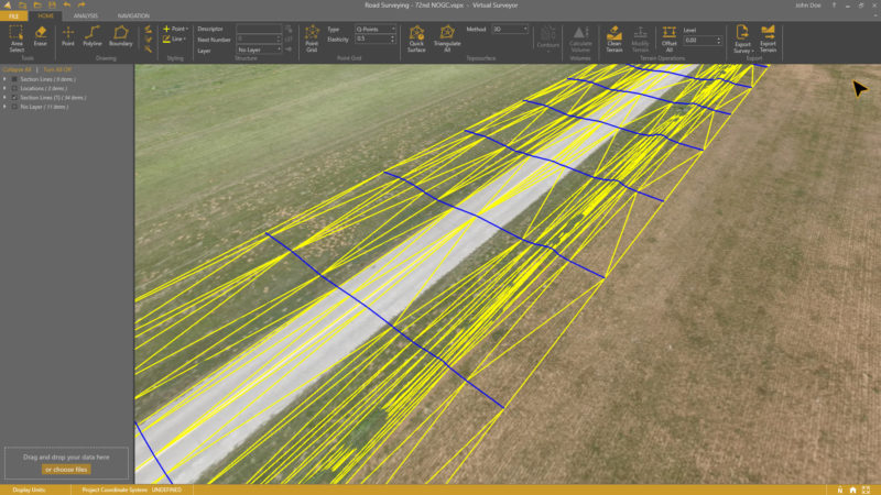
The software’s workflow enables users to move from drone data like photogrammetry to a workable, lightweight CAD model in as few steps as possible. To do this, it presents a visualization of UAV orthophotos and digital surface models and asks the surveyor to select survey points and breaklines to define the topography. This creates accurate topographic products to use for CAD input much faster than previously.
The one sticking point of the software, previous to this new release, was that users were required to input orthophotos and digital surface models—which meant some would need to process their data in a third-party application before bringing it into Virtual Surveyor. As of version 6.1, users can “drag and drop all kinds of files” into the software, including points, raster, and vector files. Users can also drop in point clouds, which the software automatically converts to DSM.
In an official release, managing director of Virtual Surveyor Tom Op ‘t Eyndt explained that users also asked for the ability to work directly from a CAD file in Virtual Surveyor. Developers added this functionality to accommodate users who work with drone data most often, but sometimes need to create surface or contours from a traditional survey.
Version 6.1 also offers users the ability to change coordinate systems after the project processing has begin, automatically generate section lines from road surfaces, and add topographic or cadastral data to the project for annotating or drawing boundaries.
Current subscribers will se the update automatically. For more information about the application, including pricing, see Virtual Surveyor’s website here.


