The construction industry has been lagging behind many other sectors in their adoption of technology, which historically has led to projects finishing behind schedule and over budget. In recent years, though, we've seen more tools which promote better vizualization and important gains in cross-stakeholder collaboration, leading to better results Many solutions have popped up over the last handful of years for these purposes, including Pix4D's Pix4Dcloud.
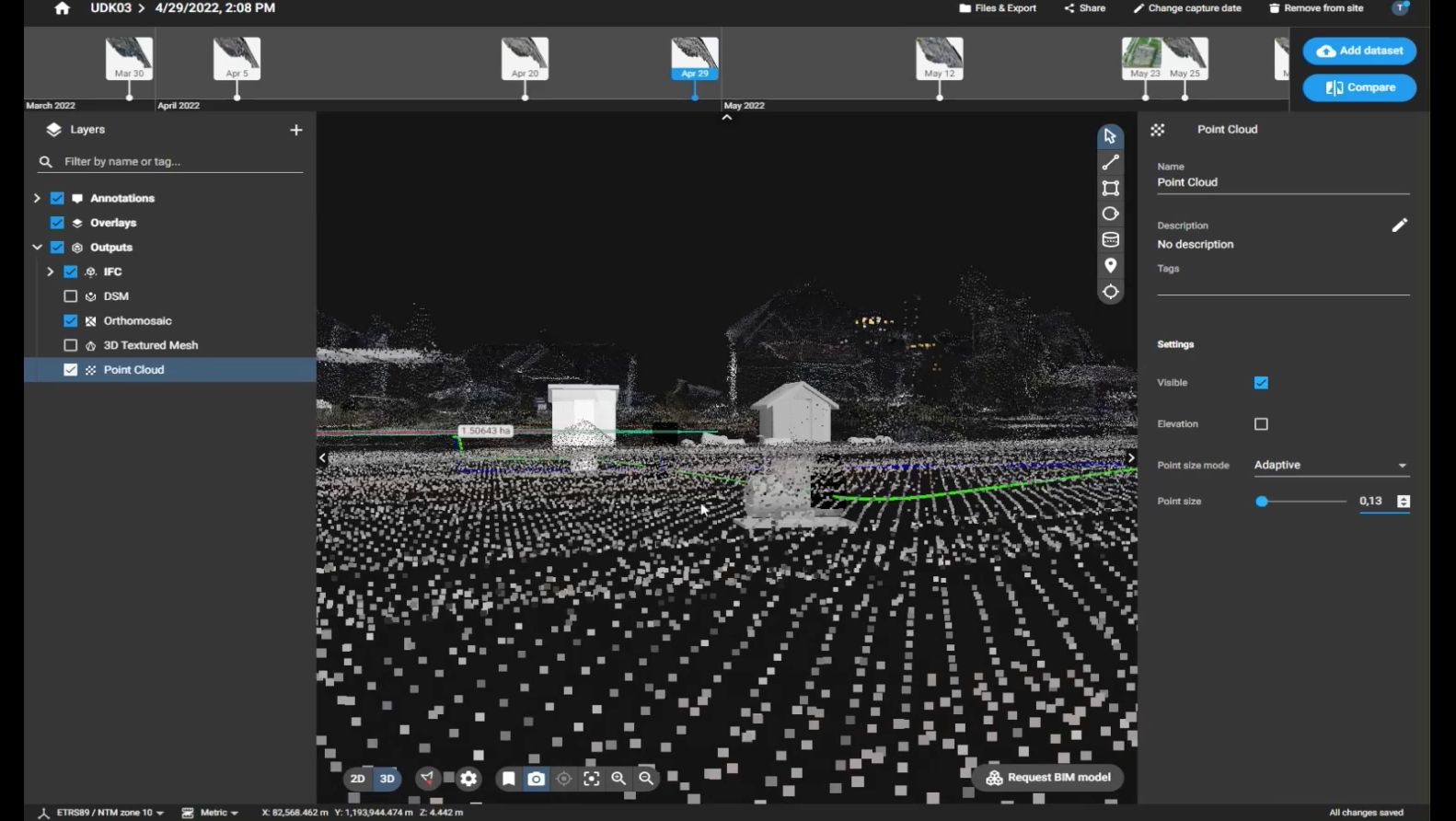
Pix4D, a Switzerland-based software company, offers a bevy of products that can be used throughout a drone-mapping project, such as with Deutsche Bahn in Germany. One of those tools is Pix4Dcloud, for which they just recently announced a handful of updates and new features that will be added to the program. At its base, Pix4Dcloud is an online, cloud-based platform that allows for site tracking and documentation sharing remotely, something that has taken a greater focus since the start of the pandemic. Providing a platform for scanning data to be uploaded and processed, users can analyze a worksite at any given point in the project and also compare as-built images with as-designed models. Users have tiers to choose from, with the Pix4Dcloud and Pix4Dcloud Advanced tiers for the product.
Among the new features and additions announced in August, the headliner is the new integration between Pix4Dcloud and Trimble Connect, a collaboration tool for multiple stakeholders across a construction project. With Trimble Connect, all stakeholders across a project can access the cloud-based data they need from any location and any device, a key improvement in collaboration for the construction industry. Given their more than 20 million users across 185 countries, per Trimble’s website, this integration is likely to be a big deal for plenty of Pix4Dcloud users.
With this integration, users of Pix4Dcloud – both the regular version and Advanced – can take the outputs and reports they get from that platform and transfer it into the Trimble Connect platform, directly on the Pix4D interface. Being able to complete these transfers directly on the platform itself will streamline collaboration for users and make it much easier to ensure all stakeholders are receiving the information they need for the project to run as smoothly as possible.
That new integration is not the only update to the platform in this latest August release. In addition to the Trimble Connect integration, Pix4Dcloud Advanced now has support for IFC files, which are used in many BIM programs. Having this ability will allow those on the ground, and other managers for projects, to be able to have a better visualization from placing BIM models into the terrains with which they are working. Trygve Almquist of Isachsen notes that having these IFC files can help them “understand how to dig, place elements, or where pipelines would be.”
In addition to these two announcements, Pix4D had a few more additions to their Pix4Dcloud to announce. One is an updated 2D/3D comparison tool. Prior to this latest update, users could compare 2D data and overlaid drawings, but now there is a new ability to compare 3D outputs like point clouds, mesh models, and the aforementioned IFC files. These comparisons can also be shared across stakeholders. Pix4D also announced a new processing cluster in Montreal, Canada, adding another option for data processing and storage, as well as the ability to import and export CSV files in a project coordinate system, and the ability to download multiple outputs at once rather than just one at a time.
We are seeing the construction industry embrace these kinds of visualization and collaboration tools at a faster rate than ever in recent years. The pandemic certainly sped this adoption up, as the realities of the time necessitated more remote work, but the industry was already trending in that direction. Pix4Dcloud’s latest additions to the platform will make that collaboration easier and more fruitful for all stakeholders across projects.


