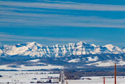
In the rugged terrain of Alberta's Eastern Slopes, a groundbreaking project is underway that promises to transform our understanding of snowpack dynamics and water resource management. Lidar data gathered by Teledyne Geospatial, an EAASI Observer, is being used to gain critical insights related to landcover, snowpack, and, most importantly, water balance on Alberta’s Eastern Slopes.
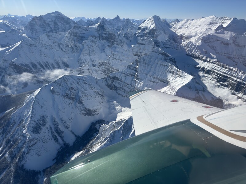
Led by Dr. Chris Hopkinson of the University of Lethbridge and sponsored by the Government of Alberta, this initiative harnesses the power of airborne lidar (Light Detection and Ranging) technology to measure snowpack with unprecedented accuracy and efficiency.
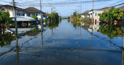
Snowpacks serve as natural water reservoirs, storing water during winter months and releasing it gradually as temperatures rise. This process is crucial for water resource management, climate change monitoring, and ecological impact assessment. Accurate measurements help predict spring and summer water availability for agriculture, hydroelectric power generation, and municipal use. They also aid in forecasting potential flooding risks during rapid snowmelt and assist water managers in planning for water allocation throughout the year.
However, measuring snow depth in mountainous terrain has traditionally been a complex and time-consuming task. Traditional methods often involve ground-based surveys, which are impractical in remote or inaccessible areas. Lidar, however, offers a more efficient and accurate solution.
"Airborne lidar has proved to be a viable method of snowpack depth mapping, sampling, and unit imputation over forested and mountain environments," explains Dr. Hopkinson.
The technique involves emitting laser pulses from an aircraft and measuring the time it takes for the light to reflect back, creating a detailed 3D model of the landscape.
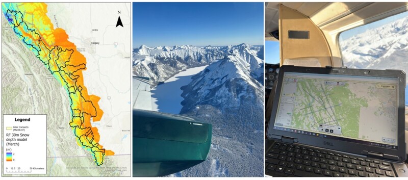
The project utilizes Optech Galaxy, an advanced lidar system capable of covering vast areas in minimal time. In just one hour, the system can survey 250 square kilometers, collecting hundreds of millions of individual measurements. This level of coverage and detail is simply unattainable with traditional ground-based methods, which might cover a mere three square kilometers in the same timeframe. This technology has been successfully deployed in various mountain ranges worldwide, including the Andes, Rockies, Alps, and Himalayas.
One of the key innovations in this project is the use of advanced lidar technology. Traditional fixed-field-of-view sensors often struggle with variable terrain, producing inconsistent data and requiring more flight lines in mountainous areas. However, the system employed in this project is capable of adjusting its scanner field of view, adapting to the changing landscape below. This results in a constant swath width over the ground, even in areas with significant elevation changes. The outcome is more consistent point density across the survey area, leading to uniform data quality. Such technology showcases why aircraft-based lidar remains the preferred choice for large-scale, high-resolution surveying in complex terrains like Alberta's Eastern Slopes.
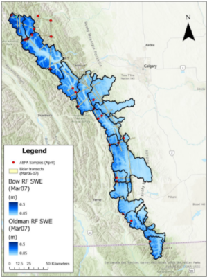
The project's methodology involves two critical flights: one in the fall when the ground is bare, and another in spring at peak snow season. By comparing these datasets, researchers can accurately calculate snow depth. Additionally, the lidar data provides information on the "gap fraction" - the amount of exposed ground - which is crucial for understanding snow distribution patterns.
But the true power of this approach lies in its ability to provide continuous snow depth measurements across diverse landscapes. By combining lidar data with terrain information, land cover data, and satellite imagery, researchers can calculate sub-basin-scale snow water equivalent (SWE). This metric is crucial for assessing water availability and guiding management strategies, particularly in light of Alberta's recent drought conditions.
Malek Singer, Airborne Product Manager, Teledyne Geospatial, commented: “The adage You cannot manage what you do not measure, cannot be truer in this innovative application. Downstream communities in Canada and around the world rely on snowpacks as a crucial source of water. We are proud to support Dr. Hopkinson and the Government of Alberta in this endeavor and are committed to developing more efficient data-collection tools like the Galaxy and Galaxy Onboard.
The technology's applications extend far beyond academic research. The insights gained from this project will inform resource monitoring, flow forecasting, and drought predictions. For Alberta's government, this means the ability to develop more sustainable water management practices, preserve ecosystems, support wildlife habitats, and ensure a resilient water supply for future generations.
This approach represents a significant leap forward from traditional snow measurement techniques. Ground-based surveys, while valuable, are limited in their scope and can be dangerous in remote or unstable areas. Satellite imagery, while offering broad coverage, often lacks the resolution needed for detailed snow depth analysis. Airborne lidar bridges this gap, offering both extensive coverage and high-resolution data.
While drones have become increasingly popular for various applications, they may not be the most practical or efficient tool for measuring snow depth over large areas in mountainous terrain. Drones often have shorter flight times, are more susceptible to adverse weather conditions, and have limited payload capacities compared to fixed-wing aircraft. Additionally, operating drones in mountainous terrain can pose safety risks due to factors such as terrain complexity and potential collisions. These limitations make crewed aircraft equipped with lidar systems a more reliable and efficient solution for large-scale snow depth measurement in such environments.
In conclusion, the airborne lidar snowpack measurement project in Alberta's Eastern Slopes represents a significant advancement in environmental monitoring and water resource management. By providing detailed, large-scale data on snow depth and distribution, it equips decision-makers with the information they need to make informed choices about water use and conservation. As we face the challenges of climate change and increasing water scarcity, innovations like these will be crucial in ensuring the sustainable management of our most precious resource.
★★★