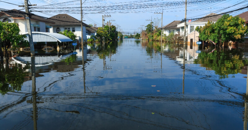
Hammond, Louisiana | December 6, 2024 - Gulf52 announces the integration of advanced lidar technology into water damage restoration services. This innovation focuses on accurate volume estimation to measure water saturation levels in structures, offering improved methods for assessing damage and planning remediation efforts. The use of lidar allows for precise data collection, enabling restoration projects to be executed with increased efficiency and accuracy.
Flooding remains a significant challenge for communities in Louisiana and Mississippi, where severe weather events often lead to extensive water damage in residential, commercial, and industrial properties. Determining the extent of water saturation is a critical step in the restoration process. Traditional methods often rely on manual measurements, which can be time-consuming and less precise. lidar technology, by contrast, provides highly detailed three-dimensional models of affected structures, ensuring that every aspect of the damage is accounted for.
“Understanding the full extent of water saturation is essential for effective remediation,” said Earl Carr, Jr., president of Gulf52, based in Hammond, Louisiana. “Lidar technology offers the ability to measure not only the visible impact of water damage but also areas that might otherwise go unnoticed. This ensures that restoration efforts are targeted, efficient, and comprehensive.”
How Lidar Enhances Volume Estimation
Lidar, which stands for Light Detection and Ranging, uses laser pulses to create precise, three-dimensional representations of physical environments. When applied to water damage restoration, the technology measures structural changes caused by water saturation, including warped materials, shifted foundations, and compromised walls. This data allows restoration professionals to estimate the volume of water intrusion and the extent of the damage with unmatched precision.
One of the key advantages of lidar is its ability to access hard-to-reach areas. Basements, crawl spaces, and wall cavities are often hotspots for water accumulation, yet they are challenging to measure using conventional tools. Lidar penetrates these spaces to create accurate models, providing a complete picture of water damage and ensuring that no area is overlooked during restoration.
Additionally, lidar’s accuracy helps in calculating the volume of materials affected by water, such as flooring, insulation, and drywall. This information is critical for planning material removal, drying, and reconstruction. The detailed models generated by lidar also allow for better collaboration between restoration teams and property owners, ensuring clear communication and efficient project timelines.
Applications in Flood-Prone Areas
Communities across the Gulf Coast face frequent flooding due to hurricanes, storm surges, and heavy rainfall. Lidar technology provides a significant advantage in these regions by addressing the unique challenges posed by recurring water damage.
In residential properties, lidar assists in assessing the impact of water on living spaces and structural elements. For commercial buildings, which often contain critical equipment and inventory, lidar ensures that restoration plans prioritize areas where water saturation poses the greatest risk. Industrial properties, with their large-scale operations, benefit from lidar’s ability to map extensive damage across wide areas quickly and accurately.
“Flood-prone regions like the Gulf Coast require tools that can adapt to the complexity of water damage,” said Carr. “Lidar provides detailed insights that help restoration professionals and property owners make informed decisions. It’s a technology that aligns with the needs of communities facing increasing flood risks.”
Implications for Insurance and Restoration
The integration of lidar into water damage restoration has implications that extend beyond the immediate benefits of precision and accuracy. For insurance purposes, lidar-generated data provides a reliable record of the extent of damage, which can simplify claims processes. The three-dimensional models offer visual evidence that supports accurate claim assessments and reduces disputes over coverage.
Furthermore, the data collected through lidar can inform future flood mitigation efforts. By identifying patterns in water intrusion and areas of structural vulnerability, property owners can implement preventive measures to reduce the risk of recurring damage. This proactive approach benefits not only individual property owners but also the broader community by reducing the overall impact of flooding events.
Supporting Efficient Restoration Efforts
Lidar technology contributes to efficient restoration by enabling teams to allocate resources effectively. Accurate volume estimation ensures that drying equipment, materials, and personnel are directed to areas where they are most needed. This minimizes project timelines and reduces costs associated with unnecessary work or material waste.
The detailed models generated by lidar also enhance collaboration between restoration teams, architects, and engineers. These stakeholders rely on accurate data to develop and execute plans for rebuilding and reinforcing structures. Lidar’s precision ensures that all parties have a shared understanding of the scope of the damage and the steps needed for recovery.
Looking Ahead
As flood risks continue to increase due to climate-related factors, the adoption of advanced technologies like lidar will play a critical role in disaster response and recovery. Gulf52’s use of lidar for volume estimation exemplifies the potential of these tools to improve outcomes for property owners and communities alike.
For more information about Gulf52’s services and the role of lidar in water damage restoration, contact the company directly or visit their website.
About Gulf52
Gulf52 specializes in disaster mitigation, restoration, and construction services for residential, commercial, and industrial properties. With over 75 years of combined experience, Gulf52 provides tailored solutions designed to address the challenges of the Gulf Coast region.
Source: Press Release


