You’d be hard-pressed to find a better answer than the Helsinki 3D+ project. This €1 million initiative was launched by the City of Helsinki to produce two up-to-date 3D city models using innovative new capture technologies. But that’s just the start, as the city is also using these models to promote smart city development, enable new commercial ventures, and start an impressive number of programs with university partners.
In other words, Helsinki 3D+ creates a rich 3D city model as efficiently as possible—and then squeeze every last benefit from it. Here’s how.
How Helsinki Generated its City Models
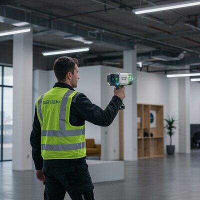
To build the model’s base, the City of Helsinki used a combination of 3D capture methods. They deployed aerial lidar to gather terrain and surface data, which they processed using Bentley’s Pointools and Terrasolid programs.
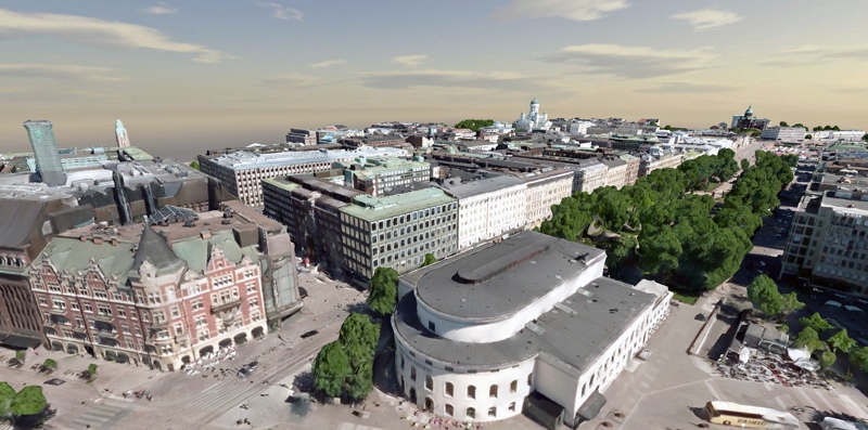
To model the city itself, Helsinki captured 50,000 oblique images with a Microsoft Osprey camera. They used myriad Bentley applications, and a farm of 10 computers running Bentley ContextCapture to process the 11 TB data set. The final product was a detailed reality mesh.
The project used 600 plus ground control points during capture to ensure clean data—as a result, the ground-pixel accuracy is 10cm, and the overall accuracy of the model is 20cm +/- 10cm.
As an added benefit, Helsinki noted that the advanced technology brought the costs of modeling much lower than expected—leaving more funds for developing innovative ways to use the 3D data.

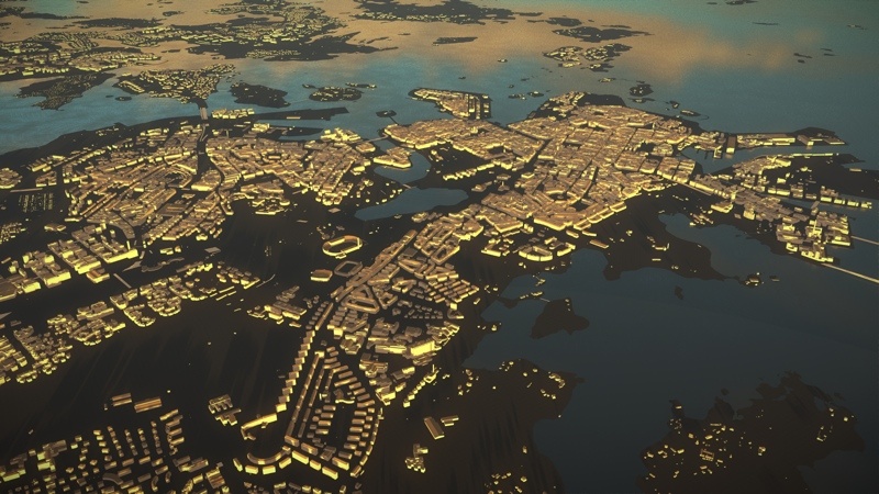
Helsinki 3D+ CityGML model
A Second Model from the Same Raw Data
Even with the reality mesh in hand, Helsinki decided to generate another model. Using the same raw data that enabled them to generate their reality mesh—the GIS data, point clouds, oblique imagery, and IFC BIM models—the city produced an intelligent CityGML model that they call their city information model.
Why did they need two models? Wasn’t the reality mesh enough? In short, the city wanted both because they weren’t sure what use cases they were going to have. This turned out to be an inspired decision.
Making the Models Useful
Having one reality mesh and one clean, rich, semantic CityGML model enabled the City of Helsinki to research a variety of applications—many more than would have been possible with one model alone.
First, Helsinki used the 3D models for presentations, leveraging Bentley’s LumenRT to help citizens of Helsinki understand and interact with new planned developments in their city. The city also used the rich 3D models to support city planning decision-making, answering questions like, “Will a new development in this space block out the sun for the building next to it?”
An Open-Data Approach
Perhaps most importantly, the city of Helsinki is enlisting the help of outside partners to make sure they get every last benefit from the 3D models. That means the city is providing the models to citizens and private companies for free use and commercial development.
It also means the city is cooperating with universities on a number of pilot programs for innovative ways to use the 3D model. In so doing, Helsinki hopes to accelerate the development of new, innovative workflows for Helsinki’s internal processes.
Currently, the city is working on no fewer than 12 pilot projects. One highlight is a City GML/Inframodel/IFC collaboration that acts as a five-dimensional project management tool for city development. In other words, it adds the dimensions of time and cost to 3D design information.
Helsinki 3D+ is also working on a citizen interaction platform for city planning. Using this platform, citizens can turn dials or press buttons to say that they want more parking, or less parking, or more parks. In response, the “serious” game shows what options best fit their requests. This data is passed to the Helsinki city planning employees, who incorporate it into their design processes.
In cooperation with the Technical University of Munich, Helsinki is refining its energy analysis methods to meet some very ambitious energy goals. Helsinki aims to be carbon-neutral by 2050 and greatly reduce its dependence on fossil fuels.
The Power of the 3D Models
That’s just the start. The city has also used the 3D models to develop a Minecraft Helsinki, 3D virtual parks, a system for modeling maintenance processes, and better urban analytics including tools for quality indicators for urban space, CO2/GHG/Emission analysis, and solar potential analyses. And it looks like there might be even more projects coming in the future.
With its two 3D models, and an innovative open-data approach, Helsinki 3D+ is showing the world what a 3D city model looks like today—and demonstrating the huge things it can help a smart city accomplish.


