
Twenty-five years after Simultaneous Localization and Mapping (SLAM) emerged, this technology has significantly improved, with many of these developments coming in the past few years due to its wide usage in the automotive industry. That said, SLAM technology still faces limitations in accuracy and where it can be used. Recently released SLAM sensors aim to address these challenges.
This article will examine some of these latest sensors, their features, how they address the issues SLAM technology is associated with, and where they are most applicable.
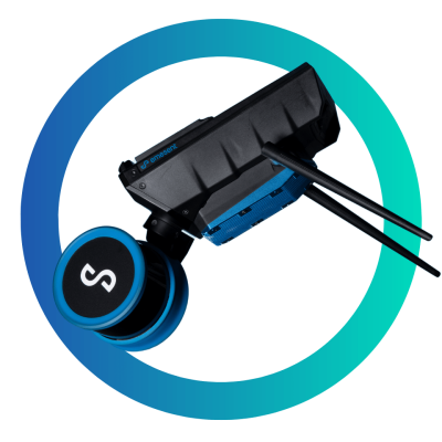
NavVis MLX
Released in September 2024, the NavVis MLX is a relatively affordable handheld SLAM scanner that delivers accurate data of smaller confined spaces. Based on their sample dataset, we don’t have to take their word for it.
To achieve higher accuracy, the handheld SLAM scanner is equipped with a 32-layer Laser Class 1 lidar sensor that can capture up to 640,000 points per second at 5 mm accuracy. It also comes with four 12 megapixel (MP) panoramic cameras that can capture 270° images when attached to a harness and 360° images when held above the user’s head.
Weighing 3.6 kg, users can hold it for a few hours or utilize to the harness for extended use, only holding it when necessary. It also measures 60x19x15 CM, making it ideal for smaller places like closets or confined places like garages. This compact and lightweight design also makes it easily portable, even as a carry-on in air travel to prevent damage.
The onboard touchscreen interface makes it easy to access and provides real-time feedback on the scanning progress, allowing adjustments on the go. For quick processing, data management, and team collaboration, the NavVis MLX is compatible with the NavVis IVION software. It is also compatible with the NavVis VLX 2 and 3, which are more suited for larger-scale scanning.
The NavVis MLX is also designed to work with GNSS and Total Station control points, allowing users to align the datasets on national and global levels. This makes it applicable for situations that need georeferencing accuracy.
What is it best used for?
The NavVis MLX fits in AEC as an ideal tool for small-scale building documentation for renovation or maintenance. It would also help create digital models of archeological or historical artifacts.
GeoCue TrueView GO
The TrueView GO, released in February, is GeoCue's first attempt at handheld mobile scanners, having previously made a wide range of other ground and aerial geospatial solutions. It comes in two versions: the 16-channel 116S and the 32-channel 132S. Featuring three strategically placed 5MP cameras and the rotating Hesai lidar sensor, the TrueView Go achieves wide coverage at a range of up to 120 meters.
GeoCue combines the real-time corrections of an RTK system with the post-processing correction capabilities of a PPK system in their multichannel GNSS system to enhance georeferencing accuracy. They also integrated Visual SLAM, which enhances accurate point registration without relying on satellite signals, achieving an overall accuracy of up to one centimeter. This SLAM and RTK integration also eliminates the need to follow looped paths, ensuring a more efficient data collection process. In areas the scanner can't reach, users can use the remote measuring capability to capture reference points and generate the 3D coordinates in real-time.
GeoCue provides the LP360 LAND Software alongside the handheld scanners to allow on-site and post-processing QA and QC. Through the provided tablet, users can track the progress of their scanning in real-time and create detailed visualizations in the office, which they can then integrate into other AEC software. Add-ons to customize workflow or achieve specific outputs are also available for the LP360 LAND software.
The TrueView GO handheld scanners weigh just under 2 kg, making them comfortable to hold for long periods. A harness is also available for more comfortable use.
What is it best used for?
The TrueViewGO’s compact design and accurate outputs make it suitable for crime scene documentation, historical preservation, and infrastructure documentation.
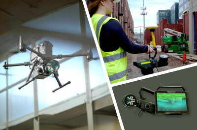
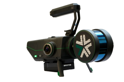
Exyn Nexys
The Exyn Nexys is a modular SLAM scanner, making it one of the most versatile SLAM sensors to be released recently, with this one coming out in 2024. It can be used as a handheld device, mounted on a backpack, a vehicle, a ground robot, or a drone, and its IP67 rating ensures it's rugged enough to be used on different platforms.
Whether users want to scan inaccessible or hazardous areas or extensive outdoor areas, they now only need one sensor. But how accurate is it, considering it houses so many different parts?
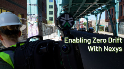
Capturing 1.92 million scan points per second, the Nexys promises to achieve an accuracy of up to one centimeter. The added level of autonomy and Zero Drift Technology also allows the Nexys to achieve this level of accuracy even in complex areas without human intervention. Users can check their sample datasets to view how effective the Nexys is at capturing data.
The Exyn Nexys also comes with hemispherical cameras, in addition to the lidar sensor, to ensure colorization. This colorization happens in real-time and is viewable through the EXYNVIEW software installed on the provided tablet. This software allows for post-processing to get the desired deliverables.
What is it best used for?
The Exyn Nexys's modularity makes it applicable in many areas, from AEC to mining to surveying.
XGRIDS Lixel L2 Pro
While companies like NavVis and GeoCue are building their first handheld SLAM scanner, XGRIDS is not new to the market. They started with the Lixel L1 in 2022, then went to the L2, and a few months ago, they released the Lixel L2 Pro. This new model combines multi-SLAM technology, RTK, and spatial AI to advance onboard processing of the collected data.
The rotating lidar scanner scans at a range of up to 300 meters at a speed of up to 640,000 points per second with the 32-channel version and 320,000 points per second with the 16-channel version. The Lixel L2 Pro achieves up to five millimeter point cloud thickness at one millimeter spacing and one million points per square meter. The onboard 48 MP camera collects high-resolution color images that are then used to colorize the points. A combination of the high-resolution camera and dense point cloud leads to some near-realistic visualizations.
The RTK automatically and accurately georeferences the points, while the onboard high-precision IMU ensures accurate data collection in indoor and complex environments. Users can use the provided extension pole for inaccessible areas or the harness for more comfortable handling.
Thanks to fast onboard processing, users can now assess the accuracy of the data being collected in real time through the Lixel GO App. Their advanced algorithms even remove human shadows in real time, minimizing post-processing work. For further processing, XGRIDS provides the LixelStudio 3.0 app, where users can clip, measure, overlay, and reduce noise, among other functions. Users can also add task-specific plugins and export results into formats like LAS or PLY for use in other software.
What is it Best Used For?
The Lixel L2 Pro's high-resolution camera and dense point cloud make it ideal for creating digital twins, BIM integration, facility management, and infrastructure inspections.
Emesent Hovermap ST-X
While the Hovermap ST-X was released in 2022, it's still an excellent SLAM sensor that works as well as the recently released models. Besides, Emesent released several updates to the Hovermap series in 2024, enhancing its features and expanding its use cases.
The ST-X is a 32-channel modular SLAM sensor with multi-return scanning ability. In single-return mode, it scans at 640,000 points per second, which is the same as more recent sensors like the XGRIDS Lixel L2 Pro. In multi-return mode, it scans up to 1.9 million points per second, making it ideal for penetrating vegetation.
The ST-X is also quite versatile. Users can mount it on a drone, backpack, or vehicle or use it as a handheld device. With a range of up to 300 Meters and an accuracy of up to 15 mm, users can use it to map outdoors, indoors, and even underground structures.
In addition to accurate data collection, the Hovermap series sensors are designed to provide pilot assistance, detect obstacles when on a drone, and allow autonomous data collection for faster turnaround times. The points collected can be viewed in real-time on the Hovermap app, while the AURA software provides post-processing flexibility.
In addition to these features, below are the upgrades that made it an even better senor:
360° imaging kit - Emesent provided a 360° imaging kit to colorize the point clouds for a more realistic representation.
RTK Modules - Users can now get RTK modules for drone and vehicle mounts and backpack mounts for handheld scanning. This ensures accurate real-time georeferencing of the points.
Data compression - Emesent introduced data compression during download, reducing download speeds by up to 80%
What is it Best Used For?
Thanks to its compact size, multi-platform compatibility, and recent upgrades, the Hovermap ST-X is applicable in underground mine inspections, forest mapping, topographic mapping, and urban mapping, among other uses.
Stonex X200 GO
Released earlier this year, the X200GO is Stonex's newest versatile SLAM sensor. It can be used as a handheld device, mounted on a backpack, vehicle, shoulder, UAV, or stationary scanner. Thanks to Stonex's X-Whizz mode, users can combine mobile and stationary data for better outputs.
As a 32-channel rotating scanner with single, double, and triple-return scanning, the X200GO can scan at up to 1.92 points per second. This, coupled with the 300-meter range, allows it to cover more ground per scan.
It also has two 12 MP panoramic cameras for coloring the points collected. An RTK module is also provided for correction, georeferencing, and onboard automatic control measurement. Instead of providing a tablet, Stonex allows users to connect their devices and install the GoApp for project management, real-time visualization, and access to the user interface. For post-processing, users can use the GoPost desktop software.
What is it Best Used For?
Like the Hovermap ST-X or the Exyn Nexys, the X200 GO is an excellent SLAM scanner for those needing one scanner for different environments.
FARO Orbis Premium Mobile Scanner
The Orbis Premium is an advanced mobile laser scanner in FARO's Orbis series. It combines a high-quality camera (Insta360) with GeoSLAM's SLAM algorithm to deliver accurate (up to 5 MM) and detailed visualizations.
The onboard 360° camera achieves up to 72 MP for flash scans using FARO’s Flash Technology and 29.5 MP resolution for indoor scans, higher than any resolution we have seen in some of the other recent sensors.
The Flash Scans are available as frequently as possible, with each scan taking only 15 seconds. They provide users with detailed colorized point clouds. The 360° camera also allows users to create a 360° image during post-processing.
With a scanning range of up to 120 meters and 640,000 points collected per second, the Orbis Premium is ideal for those prioritizing scanning speed without compromising data quality.
Users can use the Orbis Premium scanner as a handheld device, mount it on a car, attach it to a shaft for inaccessible areas, or as a stationary scanner.
The Orbis Premium scanner also comes with a data logger, which manages and stores the data collected, communicates with the FARO Stream App to show scanning progress, and ensures seamless data transfer. Users also get two processing options: FARO Sphere XG for cloud-based processing and FARO Connect for offline processing.
What is it Best Used For?
The high-resolution imagery makes the FARO Orbis Premium excellent for forensic analysis, topographic mapping, and 3D modeling.
What’s Next in SLAM?
Increased modularity, enhanced accuracy with RTK integration, and faster processing speeds are some of the trends we can see from these new sensors. Users are now getting more accurate data for use in various industries.
Faster scanners and real-time autonomous or user-guided correction have also reduced scanning time. The ability to use one scanner for stationary, mobile, and, in some cases, aerial scans also enhances accuracy and reduces operational costs.
In the future, we can expect more AI-driven automation for data collection and processing, faster processing and automated filtering to minimize post-processing, and sensor fusion for collecting different data types, such as thermal or multispectral. We can also expect to see smaller and portable SLAM handheld sensors that can do much more due to the ability to make smaller components.