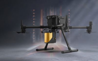
YellowScan, makers of a leading UAV LiDAR solution, have made major updates to its Mapper product. The YellowScan Mapper integrates Livox’s Horizon laser scanner into a solution benefiting from YellowScan’s experience in the industry. Looking to hit an affordable price point, the YellowScan mapper aims to attract a larger user base of professionals.
Unlike other YellowScan solutions, the YellowScan Mapper is a purely a aerial LiDAR solution that is ideally flown at 70m above ground level. It is designed to fit all DJI professional drones (M200, M210, M300, M600) and comes with an integrated camera module. YellowScan Mapper is applicable for general topography projects and is suited for archaeology, forestry and post-disaster missions. The YellowScan Mapper integrates with existing YellowScan’s software solutions, LiveStation and CloudStation, making it possible to remotely check data while the system is flying, and comprehensively post-process, visualize and export survey data.
Tristan Allouis, YellowScan’s CTO said that they sought to upgrade the system without causing a large price increase.
“We wanted to upgrade our Mapper product by applying the learning and experience we gathered over the years. The Livox Horizon scanner showed impressive performance, and allowed us to offer a quality system at a price that makes it more accessible to a wider user base.”
YellowScan will be holding a Demo Day on November 26, 2020 and January 20, 2021 – interested users can register on their website.


