For one: Without it, there’s likely no earthmine
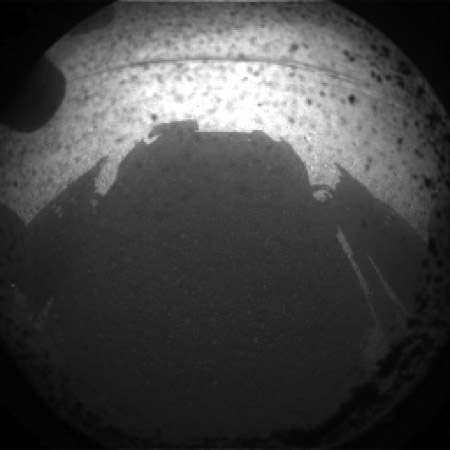
MARS – After just a few days here on planet Mars, the Mars Curiosity Rover was already sending back 3D images, red-blue anaglyphs created with the stereo pairs of hazard-avoidance cameras that the rover uses to map its surroundings and understand obstacles in 3D space.
You’re thinking: “Neat. 3D images of Mars. What does this have to do with me?”
Well, for John Ristevski, co-founder of 3D photogrammetric mobile mapping company earthmine, it has everything to do with him. Earthmine’s entire business model is based on the same technology Curiosity is using to create those 3D images. They licensed it from the Jet Propulsion Laboratory back in 2007.
“We founded the company in 2006,” Ristevski said over the phone with SPAR, “and we actively explored looking for technology. We had what we wanted to build in mind, a panoramic imaging system, so we came up with a design and searched for the technology to make it a reality. We literally stumbled across the JPL technology, just through doing research.”
Ristevski and his partners approached JPL and Cal-Tech, which handles the licensing of JPL’s technology, and after a year of testing and refining it, a successful implementation led to a licensing agreement.
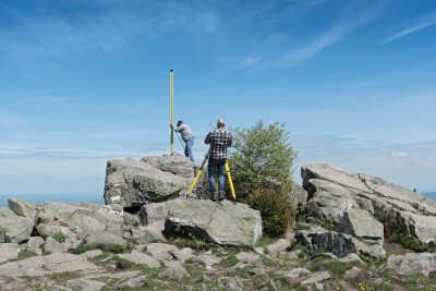
You can see in this transposition of images, that the first shot to come back from Mars isn’t unlike the images earthmine is collecting today:


“The core of the technology is still the same core we’re using,” Ristevski said, “the camera calibration piece.” From there, however, earthmine has built on it and changed it significantly, making it appropriate for the higher resolution cameras earthmine uses and to optimize it for the rapid collection of terrestrial data.
It’s possible the Curiosity even benefitted from earthmine’s involvement: “In the early days, there was a lot of back and forth,” Ristevski said. “We shared changes back to them, though I’m not sure they got implemented. But we did engage with them to help us with early problems. There was quite a lot of back and forth.”
The paired cameras coupled with the software can create point clouds of the Mars surface and be used to create panoramic images from which accurate measurements can be taken. You can argue that it’s this technology that makes navigating the Mars surface with confidence possible.
Regardless, it’s certainly true that technology developed by the Jet Propulsion Laboratory made earthmine possible. This year, the company welcomed 110 attendees to its user conference from 13 countries. “The momentum has really built up over the last six months,” Ristevski said.
And what’s good for earthmine is good for the space program. Part of the licensing agreement gives Cal Tech an equity stake in earthmine, along with other opportunities for realizing more return on the technology license. “It’s great to see that money flowing back into continued research to push these space missions further,” Ristevski said.
What other companies might come out of the Mars missions? Who can say? “I think there’s amazing stuff that JPL’s developed to address specific problems,” said Ristevski, “and I think there are lots of opportunities to license that technology and you’ll see any number of use cases where the technology has been adapted. That’s a great dual use of the technology, getting our tax payer dollars back as you license that technology and get a return on the initial investment.”


