The adoption of digital tools within the AECO industry is increasing in momentum, with digital transformation reshaping how projects are planned, executed, and managed. A core technology in this evolution is reality capture, enabling powerful workflows to create precise digital representations of physical spaces, as-built structures, construction sites, and more. By integrating detailed, 3D data with digital design tools, reality capture helps streamline project workflows, improve collaboration, and reduce costly errors.
As more firms embrace reality capture as an essential tool for their design/build workflows, the need for solutions that can bring the data together in a meaningful way has grown. In an upcoming webinar on March 27, Autodesk will demonstrate how the latest advancements in reality capture workflows—powered by tools like Autodesk ReCap Pro and Civil 3D—are now making it easier to incorporate existing conditions into digital project environments. Additionally, the webinar will showcase how Autodesk’s strategic partnership with Esri is further bridging the gap between BIM and GIS, putting AECO projects into a greater spatial context and improving project outcomes.
The success of any design and build project comes down to accuracy and efficiency and is enabled by collaboration and access to data. Capturing the data is one thing, but if teams cannot see or access the data within its context, its value can be lost. The complexities of large-scale infrastructure projects add another challenge, and some more traditional data collection methods (e.g., traditional surveys or other manual processes) are impractical at that scale.
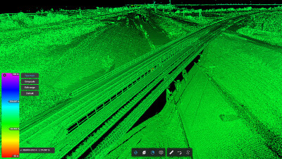
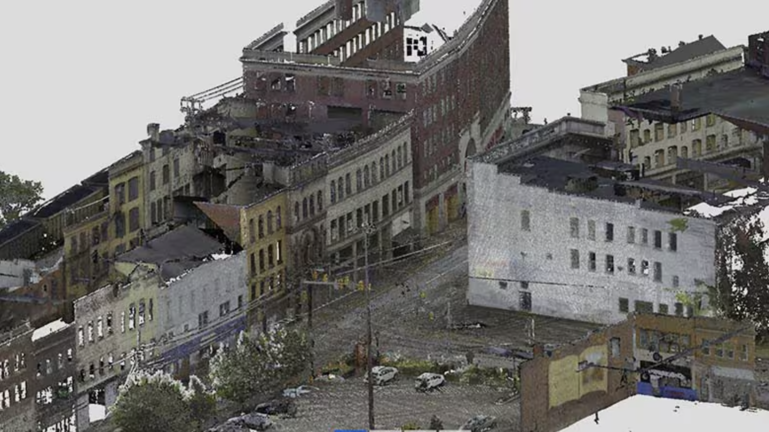
Reality capture answers these challenges by enabling more accurate as-built documentation, more quickly, through the use of high-resolution scans. These scans can be used as a foundation for a “digital twin” of the site, ensuring project teams are working with the most precise and up-to-date data and conditions.
In the planning and design stages, reality capture can also be integrated into BIM workflows, allowing teams to make more informed design decisions earlier in the process, which can prevent or lessen the need for design changes later in a build. In addition, having a single version of a model that is grounded in reality can enable better collaboration. When real-world data is easily accessible in design software, architects, engineers, and contractors can work together more efficiently, minimizing miscommunication and rework.
When reality capture efforts are repeated over time, construction teams can better track progress, identify discrepancies between designs and built components, and assess whether projects are on schedule.
A Focus on Workflows
Bridging the gap between physical and digital environments is critical for accurate project planning and design. The upcoming webinar will focus on how reality capture tools help professionals navigate the complexities of modern AECO workflows in large-scale projects. Attendees will learn how to efficiently move from reality capture to design using Autodesk ReCap Pro and Civil 3D, and best practices for handling large point cloud datasets and extracting useful design elements
Autodesk ReCap Pro simplifies the process of turning physical site data into digital models by enabling efficient scan-to-mesh to BIM to GIS workflows. It allows users to convert point cloud data into detailed 3D meshes, seamlessly integrate them into BIM workflows through Autodesk Civil 3D, and connect with GIS platforms for better spatial context. This workflow helps project teams work with more accurate site data, improving planning, design, and collaboration without the need for extensive manual processing and data capture.
The webinar will also address Autodesk’s integration with Esri, and how it can bridge the gap between designs and their geospatial context. This integration can allow project teams to incorporate GIS data directly into their design workflows. By bringing real-world spatial information into BIM and infrastructure design tools, this integration helps professionals make more informed decisions, from site selection to environmental impact analysis. With access to accurate terrain, utility networks, and land use data, teams can better assess project constraints, improve collaboration, and enhance overall planning efficiency.
By leveraging these capabilities, AECO professionals can eliminate inefficiencies, enhance accuracy, and improve project predictability—ultimately leading to better and more efficient design decisions and cost savings.
Why You Should Attend
Whether you're new to reality capture or looking to optimize your existing workflows, this webinar will offer practical insights into the latest tools and strategies shaping the future of AECO.
You'll walk away with actionable knowledge on how to:
- Improve efficiency in scan-to-BIM-to-GIS workflows
- Work seamlessly with large-scale point cloud data
- Use Autodesk ReCap Pro to accelerate model creation and project collaboration by capturing existing conditions
- Take advantage of the latest advancements in digital reality capture
This is a unique opportunity to see firsthand how Autodesk is transforming how AECO professionals interact with real-world data. Register now to stay ahead of the curve - and bring your reality capture workflows to the next level.