The AEC industry continues to adopt technology at a rapid pace following years of (often overblown) lagging in this area. There are a lot of ways this adoption has manifested, digitizing many pieces of workflows that were often done manually on paper, covering every stage of a project from design to estimates to procurement to construction and into operations. When thinking about how the geospatial industry is starting to intersect with this industry, reality capture and GIS are two of the biggest technologies being used more and more for AEC projects, particularly for large-scale projects such as those within the infrastructure sector.
Firms that work on these infrastructure projects in particular have benefited from the greater availability of and support for these types of tools, as the demand for maintenance on these projects continues to increase while the workforce fails to keep pace with said demand. It’s one thing to utilize all of these different types of technology, though. Ultimately, the key is that the data collected with reality capture tools can be seamlessly integrated into existing workflows, and key stakeholders can easily collaborate around it.
This was the topic covered in a recent webinar hosted by Geo Week News and sponsored by Autodesk. The webinar, entitled Unlock Possibilities: The Transformative Power of Reality Capture in AEC Projects, featured a presentation from Autodesk Senior Technical Marketing Manager John Sayre, and touched on how reality capture data can be used within the Autodesk ecosystem, and ultimately connected to Esri’s ArcGIS Online. The hour-long webinar is available for free, on-demand viewing by registering at the link below, and you can find a brief recap of what was covered in the presentation within this article.
Before getting into the meat of the presentation, showing off how much of this workflow looks in tangible fashion, Sayre set the stage for the discussion by showcasing how exactly Autodesk works with reality capture data. He laid out the different flow of how this data is utilized, being captured using the device of the user’s choice – whether it’s a tripod-based scanner, or a mobile mapping system that is carried on a vehicle or backpack, or anything else – before it is brought into Autodesk’s ReCap Pro. From there, the point cloud is processed, features are extracted, and it is brought into the AEC Collection, which includes products like Civil3D. Sayre also introduced how ArcGIS Online is connected to all of this before sending everything back to Civil3D, making it a truly round-trip solution.
“It’s almost round-trip,” he said. “We can go out and scan something, we can pull linear and point features from it, we can push that into Civil3D, and then push it out so that everyone can use it as existing conditions in their design.”
It’s one thing to see slides about how this workflow operates, but what really makes the capabilities sink in is a tangible demonstration, which took up the bulk of the presentation. After setting that initial context, Sayre hopped into the various software solutions to show how this workflow actually looks, using an example of mobile mapping data collected outside of Atlanta, Georgia.
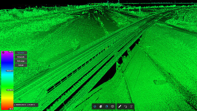
He started with the point cloud in ReCap Pro and uploaded it to the cloud, ensuring that the rest of the work could be done within a browser. This is a crucial part of this workflow, opening up greater collaboration capabilities and allowing more stakeholders to work with the massive dataset.
In terms of the actual workflow, Sayre demonstrated how users can extract linear and point features from the point cloud. Using the example of a curb and gutter, he showed how to create templates of different pieces of the asset – i.e., the top and bottom of curbs – before allowing the software to then automatically extract the rest of the linear feature. The algorithm relies on confidence levels for this process, stopping the extraction after its confidence level dips below a predetermined level.
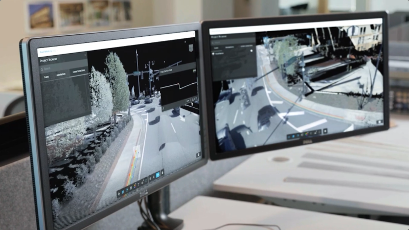
After extracting the points, he showed what happens when this data is brought into Civil3D, avoiding having to bring in the entire point cloud but instead just the points of interest. All of this can then be brought into ArcGIS Online, georeferencing these points in a cloud-based software that all stakeholders with permissions can access. All of this is under the user’s control of what is being brought into this software, ultimately saving work down the line.
“It’s under your power to figure out what all you want to pull from that point cloud. But the fact of the matter is, you don’t have to go back out and pick it up with traditional survey methods.”
Finally, toward the end of the presentation, Sayre shifted gears a bit and showed how scan data can be used within Revit for BIM workflows as well. Once again, he started with a point cloud and mesh of a building, extracting features like HVAC systems and furniture within those scans. That was then brought into Revit, updating the models there within the same coordinate system to ensure accurate representations within each software.
Professionals in AEC today are utilizing reality capture data more than ever before, but there are still questions about how to best integrate the data into current workflows and the best ways to truly take advantage of the technology. In this webinar, Sayre demonstrated tangible examples of how this works. Register using the link below for your free access to the entire presentation.