.jpg.large.1024x1024.jpg)
Sponsored by Trimble Applanix
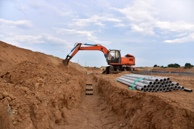
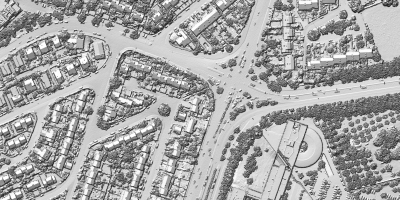
For a variety of reasons, drone-based surveying and mapping is becoming more and more commonplace all around the world as accessibility to all of the technology continues to improve. Sensors, particularly lidar systems, are becoming both cheaper and smaller, not only allowing more end users to procure the systems but also allowing sensors powerful enough to return usable data to be used as drone payloads. UAVs themselves are also becoming cheaper and better built, enabling longer flights with systems that are easier to transport. On the other end of the workflow, thanks to developments around artificial intelligence and machine learning, as well as cloud storage for data management, software is becoming easier to use for everyone across the industry.
With that being said, there are still some barriers that need to be overcome for these kinds of surveys, and really any type of survey that involves movement. Localization and positioning become a much bigger challenge for mobile scanning workflows, and for imaging-based surveys, georeferencing can be a problem. For these types of projects, users need to be able to ensure they can maintain accurate positioning and georeferencing, and this is the area in which Trimble Applanix specializes. Supporting surveying and other position-based workflows involving aerial, marine, and terrestrial workflows, they provide both the hardware and software necessary to maintain accurate georeferencing and positioning, even in GNSS-challenged environments.
Precision Positioning Hardware Solutions
Given the number of different markets Applanix serves, it’s no surprise that they offer a number of different products to serve various needs and use cases. Keeping with the theme of drone-based surveying, it’s worth starting with the Trimble APX RTX solution. This offering combines GNSS and an inertial navigation system to provide premium georeferencing for UAV mapping workflows. The chip provides a means for OEMs and payload integrators to achieve high-accuracy maps, even in complex environments. Even without using base stations, the APX RTX brings centimeter-level accuracy to projects with real-time and post-mission georeferencing.
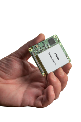
Digging in a little deeper, the APX RTX brings together three technologies from Trimble. First is Trimble Maxwell, which enables reliable and low-noise “survey-grade” accurate tracking of multi-constellation GNSS signals. Additionally, Trimble CenterPoint RTX provides over-the-air high-accuracy GNSS correction for any errors, such as satellite clocks, orbits, and atmospheric delays enabling cm level positioning without base stations. And finally, APX RTX includes Applanix IN-Fusion+ technology to blend the GNSS information with data from the inertial sensors to compute the high-accuracy real-time and post-processed position and orientation solution used for sensor georeferencing. Post-processing through Applanix POSPac UAV is included as part of the Centerpoint RTX Complete service, meaning no separate licenses are required. The APX RTX comes in four performance models, covering all types of projects with various flight altitudes, environments, and other factors.
While most of this article to this point has focused on drones in the context of surveying, positioning is also crucial in more cutting-edge applications of UAVs, such as delivery and other advanced air mobility use cases. These applications promise more convenience and efficiency for many areas of day-to-day life, but in order for something like delivery to make good on those promises, they need to work autonomously and maintain accurate localization. The Trimble PX-1 RTX solution is designed for these use cases, bringing the same centimeter-level positioning with precise, single-antenna IMU heading.
Finally, this kind of positioning and localization is also important for land-based applications, such as mobile surveying and autonomous machinery on project sites. For this, Applanix has its POS LV solution, which blends its inertial technology with an integrated design to provide accuracy in urban environments for which GNSS connectivity can be difficult. The adjacent POS LVX, meanwhile, is built for tight spaces and small vehicles. With GNSS, the solution achieves positioning up to two centimeters in X and Y, and the inertial system maintains precision during GNSS outages. Many of these applications are in complex environments, with the POS LV able to operate efficiently in extreme temperatures and generally harsh environments.
Data Processing & Georeferencing Software
As anyone in the geospatial industry can attest to, having access to powerful hardware is only half the battle. It’s, of course, important to have these on-board systems to maintain the accurate positioning, but Applanix also offers software to process the data and ensure a user’s final deliverable, in whatever application. Applanix POSPac MMS is their GNSS/INS direct georeferencing software for applications across any of the relevant environments, be it air or land, or even marine.
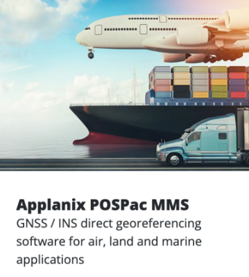
One of the main areas of value from POSPac MMS can be found its ability to streamline mobile mapping workflows, reduce processing time, and improve data quality. As noted above, it is becoming more accessible and realistic to complete powerful surveys using drone-based technologies for a variety of reasons, including positioning systems like the ones provided by Applanix. It’s still expected, though, that the final deliverable meet high standards with respect to precision. The software gives surveyors an efficient, sensor-agnostic tool to process data and ultimately produce the desired deliverable, whether it be in the field, office or via the Cloud.
Real-World Applications & Success Stories
It can always be helpful to hear directly from users about the value provided by products like the ones discussed above, and Applanix has a few customer stories they’re able to share. Take, for example, this story from L’Avion Jaune in France. Using a lidar sensor from Yellowscan as well as the Trimble APX-20 UAV, the firm was looking to survey limestone cliffs in France to monitor and manage the risk of landslides and falling debris. Ultimately, the configuration resulted in 75 hectares surveyed with four 15-minute flights, capturing lidar data precise to five centimeters in X, Y, and Z, with the data being used to implement safety and prevent plans to protect local communities, infrastructure, and wildlife.
Applanix also shared this story about a collaboration with Microdones, with the two companies coming together to delivery a turnkey solution for surveyors to deliver high-accuracy post-processed data for UAV-based projects. Recognizing the variety of barriers that can arise in these workflows, particularly around positioning within complex environments, Microdrones turned to Applanix to integrate the latter’s positioning and orientation technology within their solutions. On the Applanix side, they had to reduce the weight of their hardware without sacrificing the accuracy and performance of the units, resulting in a successful integration. Eventually, after the hardware integration was a proven success, Microdrones also began to integrate the Applanix POSPac Cloud system to continue providing accurate georeferencing data post-mission.
You can read more customer stories from Applanix here.
To learn more about how Applanix can help your positioning and orientation needs, inquire here.