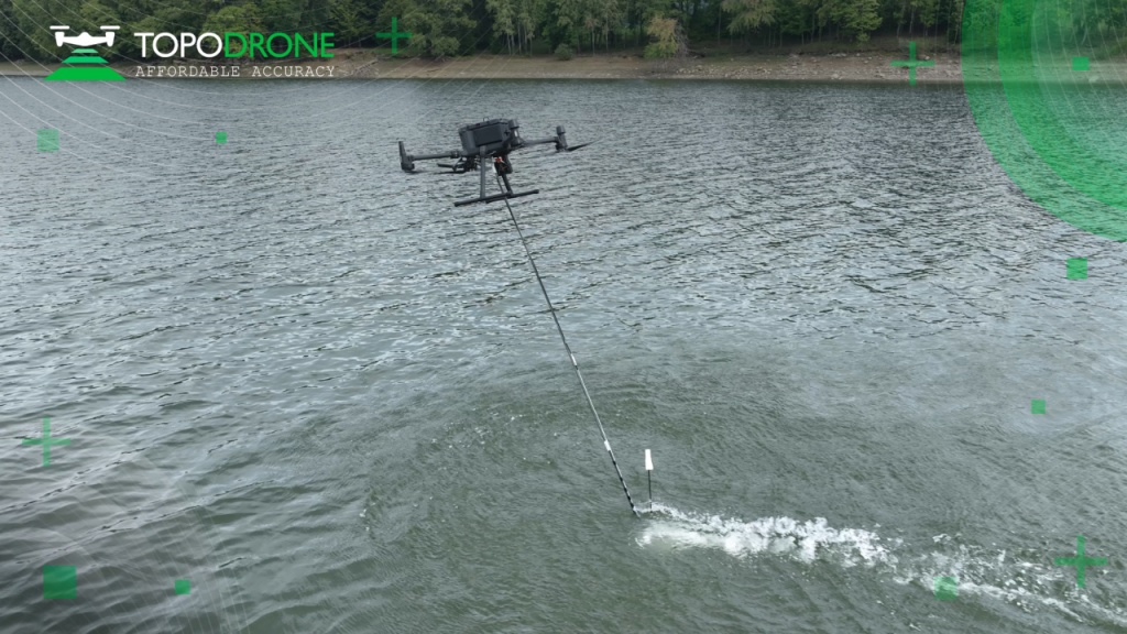
Last month the annual Intergeo conference was held in Essen, Germany, bringing together a number of top geospatial companies into one space. Many of these organizations took the opportunity to introduce new products at the event, including RIEGL with their new UAV lidar sensors. They weren’t the only company to announce new accessories to be used for UAV surveys, either. TOPODRONE, a Swiss-based company who develops lidar and UAV solutions for surveying and mapping, introduced their new bathymetry solution, the Aquamapper, at Intergeo.
The Aquamapper is a UAV-based solution for bathymetric surveying and construction, and it can be used in concert with other technology as well to form a comprehensive set of photogrammetry, lidar, and bathymetry surveying. Users of the Aquamapper can expect high survey speeds, up to 14 kilometers per hour (8.7 miles per hour), as well as centimeter level accuracy. The tool is built for quick deploy as well, with users able to use the surveying tool within 10 minutes. Additionally, the PPK-ready solution can work in hard-to-access and shallow water areas, as well as perform open sea bathymetric surveys for areas up to 100 meters in depth. TOPODRONE also lists periodic maintenance surveys of storage pools, quantity surveys and calculations of sediments as potential applications for the tool.
Although the world of surveying and mapping is most often associated with topography and mapping land-based areas, bathymetry is also a key part of many of these projects. With this new solution, TOPODRONE is entering an important and growing market. One estimate indicates that the market for hydrographic surveying reached $2.7 billion in 2021, with the expectation that it could reach $3.9 billion by 2027, a compound annual growth rate (CAGR) of nearly six percent.
Customers using TOPODRONE’s solutions for surveying throughout construction projects could find particular use for the Aquamapper, particularly given the ability to combine multiple sensors and surveying techniques within one solution. An example given by the company in their release for the new product is for a road project completed in Romania by construction firm GRAPHEIN TOPO SA. Constructing a highway in a particularly rugged area of the country, the firm leaned on solutions from TOPODRONE to complete their corridor surveys. Needing to produce accurate maps and current information for a diverse area, mapping buildings, roads, powerline networks and rivers while also collecting surrounding terrain levels. The ability to combine the different solutions offered by TOPODRONE allowed the firm to complete all areas of the project.
TOPODRONE was founded in 2014 and produces a variety of surveying and mapping solutions alongside the new Aquamapper. As an example, they recently announced a new long-range UAV surveying solution, which was created in partnership with Velodyne. The company, whose products are compatible with drones from companies like DJI and Autel Robotics, also offers lidar solutions for topographic surveys, as well as solutions for photogrammetry and camera-based capture. They also offer training sessions in addition to drone repairs.
With the Aquamapper, TOPODRONE continues to expand the offerings with which they assist their customers to complete a variety of projects. On the new solution, GRAPHEIN TOPO SA’s Andrei Sueran said, “It is a great advantage of the bathymetric equipment from TOPODRONE that it captures riverbed with centimeters level accuracy with high speed in fully automatic mode and without using any boat. It allows us to work in hard to access and shallow water areas and the same drone carrier can be used for LiDAR & Bathymetry survey. The combination of GNSS and Inertial measurement system helps to get accurate results after data post processing providing a new standard of accuracy, efficiency and flexibility."


