At Geo Week 2025, held this past February in Denver, Teledyne Geospatial announced the launch of Fathom, a coastal mapping solution that overcomes common challenges related to the cost and technical complexity of topo-bathymetric surveys. On one hand, there is a desire and market demand for topobathymetric surveys, but on the other hand, there is intimidation, fear, and concern that they will be cost-prohibitive and too complicated to produce a viable data product. Teledyne Geospatial concluded that the specific demand was for a cost-effective solution from which it is easy to produce reliable data.
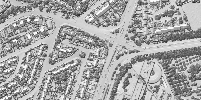
The Fathom solution has topo, bathy, and multispectral camera capabilities. The topo delivers up to two million points per second and is designed to acquire simultaneously at approximately 40 points per square meter. At a typical bathymetric altitude of 475 meters, this will provide tremendous detail on infrastructure around the coastline or the river such as roads, bridges, marinas, and energy sites such as coastal substations.
The sensor can go up to 1200 meters of altitude and deliver USGS QL1 resolution and accuracy. This is Teledyne Geospatial’s newest bathy solution design, with improved georeferencing capability that leverages an infrared laser that maps the water surface and a green laser that maps the seabed, and as a result, georeferences seabed returns with high accuracy adherence to the IHO and USGS QL0B standards.
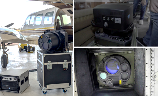
The edge computer, called Onboard, serves three functions: it is the flight management system, which is the interface used to execute flight, visualize the plane, navigate for the pilot, and organize and monitor the system health vitals. The two components are real-time processing and soon-to-launch real-time QC. With those functions, Onboard can process point clouds and surface quality indicators of the topo and bathy data, such as density gaps and coverage.
Fathom satisfies the needs of multiple applications and multiple stakeholders: it has topographic capability built-in (and not just complementary topo capability), but topo capability that can simultaneously get engineering data at approximately 40 points per meter squared for applications like infrastructure and terrain mapping and USGS QL1 at higher altitude. There is also bathymetric capability, designed for IHO Special Order, similar to USGS QL0B. The Fathom has been designed to meet these standards in required density and accuracy making it suitable for applications that need navigational charts, marine base maps, and environmental applications like monitoring coastlines and updating flood maps.
In addition to those two complete capabilities, Fathom’s potential has been maximized by building in a camera that produces photogrammetric grade imagery for all of these projects, whether they are engineering, wide area mapping, or coastline projects. Because of this triple capability, users can feel confident that in any given area, they can do more than one project, they don't have to mobilize another plane with another sensor and another crew.
Reducing operational costs
To overcome the challenges with sensor size, width, and power consumption, reductions were made in all three of these areas on Fathom while simultaneously increasing performance and capability. Teledyne Geospatial added more topo, more bathy, two cameras, and processing, but still managed to fit everything in a very small package and a standard gyro-stabilized mount.
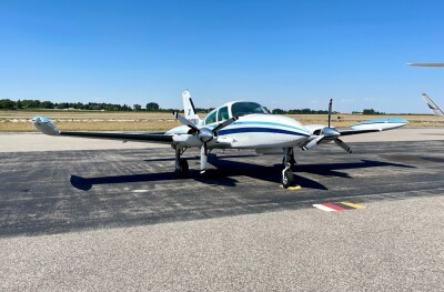
The goal was to reduce operational costs by going from a big aircraft to a smaller one and compatibility was achieved with some of the most popular aircrafts like the Cessna 208 and Cessna 206. For reference, approximately 100 kilograms (220 pounds) were shaved off with Fathom compared to CZMIL Super Nova.
As customers articulated that they didn't have bathymetry expertise or resident bathy resources, Teledyne Geospatial wanted to make bathymetric and topo bathymetric lidar easier to operate, as well as the data collection, processing, and delivery. A workflow was designed that can effectively get someone trained up to get in the air and collect a topo bathymetric project in a matter of hours.
On the processing end, to bridge the gap of experience, the company focused on simplifying the processing workflow, reducing the need for parameter tuning, and empowering the software to make informed decisions based on data characteristics, which is related to how light interacts with water and how the system records that info.
Fathom Flow post-processing software
The Fathom Flow software automates project setup and data processing. Additional tools have been provided for evaluating the validity and quality of a coastal point cloud classification from the terrain to the water surface and the intertidal zone.
Deeper bathymetric zones were also a challenge, in the case of uncertainty about the water conditions and the risk associated with that. Because of the software, Onboard, the operator is given real-time indications of the water column and the quality of the water.
This leverages Teledyne Geospatial’s deep experience in real-time processing of point clouds as witnessed on the Galaxy Onboard product currently in-market. With Fathom, this has been extended into the world of bathymetry, and the operator is provided more indication of the water column and the presence or absence of seabed returns which is ultimately the biggest deliverable of a bathymetric project.