Ouster’s Blue City traffic monitoring solution was born out of a need for an accurate traffic control monitoring solution that works 24/7. This provides municipalities a solution to collect accurate traffic data over time that provides a baseline of how things are regarding an increase in fatalities of both cyclists and pedestrians in the last decades.
Instead of using existing solutions such as cameras, lidar technology provides very accurate 3D spatial intelligence even for low and small objects like pedestrians at intersections. Laser functions independently from any external lighting or weather conditions to collect around the clock.
System components
Blue City consists of two components: a detection system including edge computing perception software and the logic to convert raw lidar data to traffic actuation. It also converts the data into formats that can be ingested into Road Side Units (RSUs) for V2X (Vehicle to Everything) applications. These are all running on the edge computer locally, so there’s no internet connection required for running this operating solution. The second component is a data analytics tool, a web-based configuration tool.
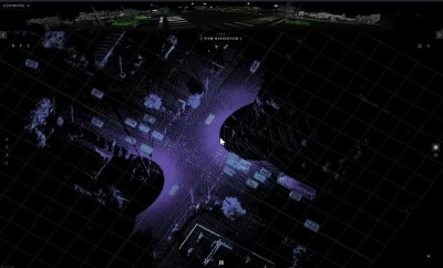
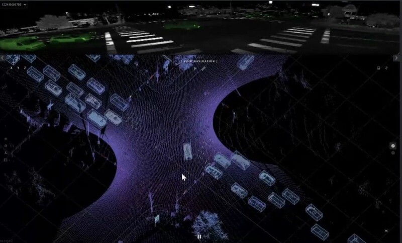
The solution enables connecting to the edge computer as long as you’re using the same VLAN (Virtual Local Area Network), which provides a 3D perspective of an area of interest, probably an intersection with one or two lidars showing a live traffic flow. The perception software detects and classifies different types of road users from the lidar data, as well as its speed, with subclassifications for different types of vehicles. Users can also create loops of instances from the traffic data visualizations and render them in Google Maps or a point cloud viewer if the first one is not up-to-date.
Extracting insights
Bue City’s data analytics platform enables to extraction of various insights, including count and speed metrics analysis of individual traffic objects, interaction analysis such as red light violations, and measuring the efficiency of signal performance at intersections for city planning.
Intersections are not the only locations where the system is deployed: in Virginia, Blue City was used for wrong-way detection in a test case where a road was closed to intentionally drive a vehicle the wrong way and evaluate the system based on false positives and false negatives, capture the event and issue a warning (flashing to catch the driver’s attention that something’s wrong).
V2X use cases
One of the important use cases of Blue City is V2X, as lidar enables extracting the speed and location of an object. Here, RSUs can broadcast such information to connect vehicles and issue warnings to drivers of such vehicles with an onboard unit if some nearby cyclists or pedestrians are not visible from the vehicle. This makes Blue City a multimodal detection system, not only for highway monitoring applications but also for more advanced use cases including V2X.
For more information on Blue City, consult this insightful webinar from Ouster on the transformative role of lidar in Intelligent Transport Systems. It features live demos of the different components of the Blue City system and more.