Sponsored by Exyn Technologies
Throughout the last decade, one of the biggest trends we’ve seen in the geospatial industry has been the growth around the mobile mapping sector. While not a new technology, there have been significant advancements recently that have resulted in something of a second wind for the technology, something we covered in a report earlier this year and a fact that was on clear display at this year’s Intergeo conference and expo. Over the course of the last 12 months, we’ve seen a number of new mobile mapping solutions, including the Nexys from Exyn Technologies.
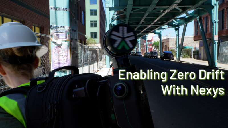
More recently, Exyn has introduced another new innovation that has the potential to take mobile mapping to the next level with their “enabling zero drift” capabilities added to the modular Nexys system. Geo Week News recently spoke with Exyn Chief Operating Officer, Ben Williams, about this new zero drift capability and how it fits in with the progression of the mobile mapping market since its inception.
As noted, mobile mapping has been around in some form for a number of years now, but there were a handful of problems that held the market back from reaching its full potential in those early years. Williams outlined a couple of those problems, telling Geo Week News that the big problems in those days revolved around accuracy.
He said, “Some of the big issues with mobile mapping were questions of accuracy, both qualifying and also utilizing the maps with lower and inconsistent accuracies. Maybe even more importantly, the data was fairly noisy and was difficult to model off of, with some of the earlier SLAM modeling techniques and that inconsistency in data led to it being interesting but not necessarily dependable for a regular industrial or commercial use case.”
A few years ago, the industry started to see improvements across the board for these systems for a couple of reasons. Perhaps chief among those was improvement with LiDAR sensors themselves, a development that came about thanks largely to the investment around the self-driving automotive industry. Once those improvements came through, innovations came around SLAM technologies and post-processing tools, opening up a bevy of use cases.

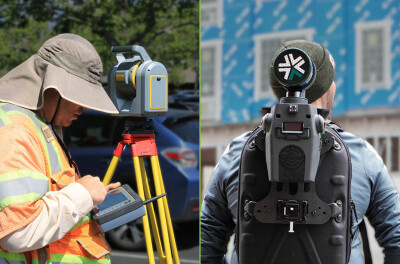
Williams said, “All of those improvements combined meant you're then able to take advantage of the reduced cost and time for capture, leading to the idea that, because each capture is cheap or fast enough, then you start to think about doing captures that would not have made sense previously. If you had a really expensive capture sequence on a tripod scanner, you only do the high-value areas, and you only do them when it’s critical. Whereas, if you're able to collect multiple sets a day for zero marginal cost, all of a sudden there is a different calculus for that data collection where you can run comparisons daily or weekly or monthly. Now with more frequent and more extensive scans, you can generate all kinds of new insights out of that.”
With those improvements in place and all of these different industries – including but not limited to spaces like mining, geospatial, AEC, and urban planning – taking advantage of the technology, new issues have emerged. That brings us to the issue of drift and Exyn’s new “enabling zero drift” software update to the Nexys. For use cases that, for example, take place over a large area (i.e., a 45-minute drive to map a road system in a city) or projects that require scans to go between indoor and outdoor environments, small errors in the localization and mapping process compound over time, which can lead to “drift” in the resulting dataset. Reducing or eliminating this drift for larger captures is critical to these datasets being useful in broader applications.
The key to solving this issue is at the core of Exyn’s latest innovation, and where Williams sees the industry moving toward next: being able to unlock corrections on multiple fronts within the mobile mapping system.
“After this whole cycle began to unlock accurate enough results to open up all of these use cases, the next step was to apply these tool sets that enable the “zero drift” collection of information,” Williams said. “That is to say, providing corrections to drift for a SLAM-based system. That's using external fiducials including Ground Control Points, GPS or GNSS corrections, and post-processing tools such as loop and closure. And where it gets super interesting is when you start to have an engine that is able to do localization, but also take into account a fusing of all these corrections, either real-time or near-real-time, that allow for a much more robust capture.”

“Any one of these inputs is helpful. Providing two means you can trade-off those inputs to select the correction factor. And then if you're able to take into account three or more, all of a sudden you greatly improved the flexibility and accuracy the mapping system - giving you confidence for a larger area map that you can trust to be usable and accurate over that area.”
Williams says that there wasn’t exactly one innovation that unlocked this ability, but instead it was a matter of all of these individual puzzle pieces of mobile mapping – the lidars, the SLAM, the post-processing – getting up to speed before being able to tackle these kinds of larger-scale problems. For Exyn, they ultimately decided the best path forward was to generalize their architecture and make sure they can account for a wide variety of localization and correction data..
“We’ll take whatever sensor data we can get, and if we have some sort of a figure of merit, like a quality factor to that localization, we can provide a correction to our localization and our map more generally. So the idea basically was like, let's make our software able to take in lots of different sources, and we weigh each against each other and try to localize or correct any drift that way. And I think that is the obvious way in retrospect.”
This is the direction he sees the industry ultimately moving, saying, “This is an approach that allows you to then take in any GPS source, any GNSS source, any lidar odometry, any visual odometry, any high-grade IMU or time-of-flight sensor, any of those things can provide factors and corrections, and help you maintain low or no drift captures.”
The Enabling Zero Drift capability is a simple software update for Nexys users to take advantage of. Those interested can learn more about the technology here or can reach out to Exyn directly here.


