

After exploring how crewed aerial mapping contributes to measuring snowpacks, urban planning, and even mapping lava in volcanic eruptions, the European Association of Aerial Surveying Industry (EAASI) now presents how Airborne Lidar Bathymetry (ALB) technologies are transforming underwater ecosystem mapping in Italy.
This latest use case highlights the collaboration between two EAASI member companies: Fugro and CGR SpA (Compagnia Generale Ripreseaeree), who have partnered to deliver high-resolution bathymetric data as part of Italy's ambitious Marine Ecosystem Restoration (MER) project.
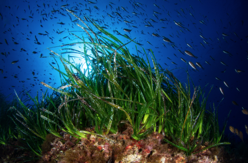
Aerial survey specialists are deploying cutting-edge ALB technology to map vital seagrass meadows along the country's extensive coastline. This innovative approach demonstrates how crewed aerial mapping can complement other technologies to monitor marine environments with unprecedented efficiency and precision.
ALB Technology: A Game-Changer for Maritime Mapping
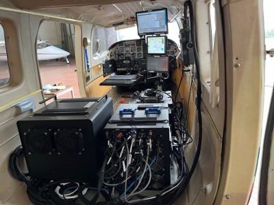
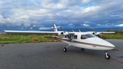
The operation began at CGR's maintenance base in Parma, where the aircraft was prepared for this specialized mapping mission. CGR, as the aviation partner for the project, provided the aerial platform on which Fugro's international team of experts from the United States, France, and Germany installed a sophisticated array of sensors. The integrated system includes:
- RAMMS lidar sensor for bathymetric surveying from Fugro
- Phase One cameras collecting RGB-NIR imagery
- Strapdown gravimetric sensor for simultaneous gravity measurement
The RAMMS (Rapid Airborne Multibeam Mapping System) 2.0 dual-laser bathymetric lidar system deployed in this project operates at 60 Hz acquisition speed, collecting detailed data on seabed topography and water column properties to depths of up to three times the Secchi depth (a standard measure of water transparency).
Beyond its technical capabilities, the system offers environmental advantages with a lower carbon footprint than vessel-based surveys, while its integration with machine learning algorithms enables preliminary data processing within four hours of flight completion—significantly accelerating the availability of actionable environmental data.
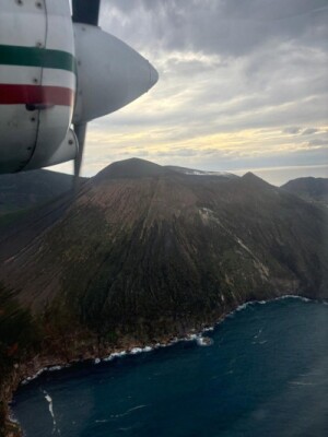
Following initial calibration flights, operations relocated to Reggio Calabria as a temporary base. Recent survey activities have covered Sicily, Calabria, and the Aeolian Islands, with plans to continue along the Italian coast through 2025, with upcoming operational bases in Palermo and Sardinia.
One of the most impressive aspects of this initiative is the simultaneous coordination of aerial, naval, and ground surveys conducted by Fugro teams. This integrated approach optimizes data collection across the surveyed regions, particularly in complex areas like the Aeolian Islands, significantly improving the accuracy and comprehensiveness of marine ecosystem mapping.
Despite their ecological importance, these meadows face mounting threats from industrial and agricultural pollution, bottom trawling, unregulated boat anchoring, and changing water temperatures due to global warming. The high-resolution mapping enabled by ALB technology allows scientists to monitor the distribution and health of these critical habitats with unprecedented detail, identifying at-risk areas and informing targeted conservation measures.
The Broader Context: Italy's PNRR MER Project
The initiative exemplifies how modern aerial surveying technologies continue to evolve beyond traditional applications, offering innovative solutions for monitoring and protecting vulnerable ecosystems. As environmental challenges become increasingly complex, the specialized capabilities of crewed aerial surveying companies provide essential tools for gathering the comprehensive data needed to inform effective conservation strategies.