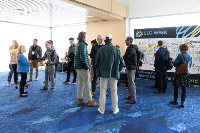
Every day at Geo Week News, we publish the most important press releases from the industry to keep those within the industry up-to-date with all of the news they need to know. Of course, we know it can be difficult to keep up with everything coming in, so we’re going to look back at the week that was in the news every Friday to recap the biggest happenings of the last five days. Today, we have a pair of industry leaders announcing new bathymetric lidar solutions, new partnerships around UAV-based surveying, companies promoting their presence at next week’s Geo Week, and more.
New Bathymetric Surveying Scanners
This week was a major one for any professional involved in coastal mapping and other airborne bathymetric work, with two of the leaders in the industry each announcing their new scanner this week. That includes Leica Geosystems, part of Hexagon, who announced their new CoastalMapper solution. Their airborne lidar solution builds off of previous generations of scanners and includes a brand new lidar bathymetric lidar component as well as a topographic lidar scanner and two high-resolution cameras. The company says that all together, the scanner can improve surveying efficiency by as much as 250 percent.
That was only one of the coastal mapping solutions announced for airborne surveying this week, with Teledyne Geospatial launching their own. This week, they announced the launch of their Fathom coastal mapping solution, which they indicate is the result of recent trends around sensor miniaturization. Teledyne calls out the ability to integrate topo and bathy lidar, low operational costs, quick turnaround, and accurate data as the key benefits for Fathom.
Bathymetric surveying has often been an expensive and complicated process, needing special lidar to collect this data from the air or, more commonly, using expensive processes using boat-based sonar to map coastlines. Recent years have seen rapid improvement around lidar sensors, and we are seeing in real-time how that is being implemented in new products for the sector. Given the global concerns around coastlines and other marine spaces due to climate change, having this efficient ability to map these areas and track changes is as vital as ever.
UAV Surveying-Based Partnerships
This week also saw two separate partnerships announced around UAV surveying. First up, we saw Pix4D and Freefly Systems announce a new partnership for what they are calling an “all-in-one solution for aerial capture and data processing.” The partnership gives users access to Freefly Systems’ drone technology along with the photogrammetry software from Pix4D.
Similarly, this week also saw the announcement of a partnership between GeoCue and Clogworks Technologies Limited. Here, the partnership brings together the former’s TrueView lidar and LP360 software with the latter’s Dark Matter range of multi-rotor UAVs. Surveyors are currently in an environment where there are many solutions for both hardware and software, but it’s not always easy to bring these various solutions together. Expect to see more of these kinds of partnerships moving forward as the industry shifts toward streamlined, less complex workflows.
Geo Week 2025
Geo Week 2025 is coming up in Denver next week, with many of the leading companies from across the geospatial, 3D, and AEC industries coming together to show off their newest innovations and services. Below are a few announcements from companies exhibiting at this year’s event.
Other News
Topcon Positioning Systems announced this week the launch of their new HiPer XR, the company's latest GNSS receiver. They note in their release of the news that the solution is designed to benefit users like construction professionals, surveyors, GIS professionals, archeologists, and more.
This week also saw an acquisition in the Earth Observation space, with geodata specialist firm Fugro announcing their acquisition of EOMAP. The latter, whose work has been covered by Geo Week News, utilizes satellite-based methods for bathymetric work.
- Later this year, towards the end of April, the World Geospatial Industry Council (WGIC) will be holding its inaugural event, World Horizons 2025. The event will take place April 27-29 in Denver, Colorado, and will “explore the intersection of geospatial technologies, allied industries, and global business ecosystems driving innovation.”


