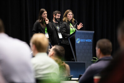
As is the case every year at Geo Week, the first morning of the 2025 edition of the event featured our product previews, giving companies from around the industry a way to showcase their latest offerings. This year’s previews included 22 presentations, which took place across two rooms Monday morning. At Geo Week News, we will be briefly covering what each company had to say through three different articles over the next three days, starting today with a look at products relating to UAV-based and other aerial mapping in the presentations.
GeoCue
Chad Dillard made a presentation for GeoCue’s TrueView product line, highlighting the company’s newest offerings for UAV-based lidar systems, the TrueView 1 and TrueView 1 Lite. As Dillard explained in his 15-minute talk, these new offerings are designed to be budget-friendly entry points into the UAV mapping space. The two systems are similar, with the regular edition including more options for cameras and IMUs. The TrueView 1 Lite comes with a financing option, allowing new users to pay a small down payment and then pay off the rest over the course of 11 months, giving users an opportunity to complete a couple of projects and receive some of that ROI before paying in full.
RIEGL
In one of their two presentations for this year’s product previews, RIEGL was represented by My-Linh Truong to talk about the company’s UAV mapping portfolio. She quickly ran through the entire portfolio for the packed crowd and then focused on the newest addition to the lineup, their VUX-100. This new sensor is similar to the VUX-120, but includes a nadir scanning pattern, providing a full 160-degree field of view. In addition to introducing the VUX-100, Truong also talked about RIEGL’s RiLOC-E and RiLOC-F, their IMUs for their uncrewed sensors.
Trimble Applanix
Representing Trimble Applanix, product manager Srdjan Sobol discussed the company’s RTX line of GNSS-inertial OEM solutions for UAV mapping. These boards offer high-quality, direct georeferencing for UAV mapping sensors, helping to achieve centimeter-level accuracy regardless of where your flight is taking place. Sobol discussed the four different boards within the series – the APX-15, APX-20, APX-30, and APX-50 – sharing with the crowd the differences for each board and what they can offer to their drone mapping operations.
Spexi
In one of the more unique presentations, Graham Anderson introduced much of the audience to Spexi, a platform that can benefit both drone pilots and anyone who requires high-resolution, recent imagery of an area. He explained how the platform works, with areas being divided into individual hexagonal spaces – known as Spexigons – which can be claimed by local drone pilots. These pilots can follow the map provided by Spexi, collect the imagery, and get paid. Then, organizations that require this data can purchase the imagery from Spexi. In his words, the platform is meant to be “Google Street View from the sky.”
Teledyne Geospatial
Teledyne Geospatial returned to Geo Week to highlight several new products, including Galaxy Network Surveyor. Tailored for data collection around utilities and other valuable and vulnerable assets, Network Surveyor features Galaxy Edge, Teledyne’s oblique imagery, real-time processing system. It also integrates with Pointerra3D to accelerate the digitization of utility grids. Teledyne also presented its EchoONE, a laser scanner designed for land surveying, vegetation, asset management, and transportation applications. When matched with a drone, the lightweight 1.2Kg scanner enables longer flights, while increasing accuracy and speed.
RIEGL
Longtime Geo Week participant RIEGL used their other Product Preview platform to describe the newest additions to its topo and topo-bathymetric product lines. Employing multi-directional scanning or “crossfire” geometry, the VQ-1560 III-S airborne lidar scanning system was created for high point density and ultra-wide area mapping. The system provides optimal coverage for superior data sets. Another airborne system is RIEGL’s VQ-840 GE. This lightweight system is ideal for drone-based missions, such as surveying underwater topography. The VQ-840 GE has recently shown its value in operations ranging from mapping lithium ponds in South America to collecting waterway data in the Northwestern US.
Vexcel Imaging
Vexcel Imaging’s Director Sales for North America Jerry Skaw described his company’s new solutions for high resolution data imaging. Based on Bayer pattern sensors, the Ultra Cam Marlin uses Adaptive Motion Compensation (AMC) to improve precision in high-end aerial imaging. Similarly, the company’s new Ultra Cam Dragon 4.1 is an aerial mapping system that features three operating modes – camera, lidar, and hybrid. The Dragon 4 was designed, Skaw said, to “excel in challenging environments” and bring efficiency and accuracy to projects in fields such as forestry and precision agriculture.
DJI Enterprise
Kyle Miller from DJI Enterprise took the stage at the Product Preview session to detail the many features of his company’s new Matrice 4E drone. Ideal for mapping professionals and for those engaged in inspections work, the new Matrice 4E comes with an upgraded controller, a new spotlight, better speakers, and low-noise propellers. The drone also offers flight safety improvements, Miller said, that enable “faster precision imaging, easier inspections, and effortless 3D capture.” During the session, Miller also described DJI’s new D-RTK3 multifunctional station. The small, adaptable, and sturdy station can extend the range of operations using drones like the Matrice 4E and enable more secure and accurate aerial surveying operations.
Leica Geosystem, part of Hexagon
Speaking during the Product Preview session, Leica Geosystems’ Layton Hobbs and Anders Ekelund discussed their new mapping and bathymetric systems. Hopps described the Leica Terrain Mapper 3, an airborne lidar sensor that offers circle scan, skew scan, and ellipse scan options to improve data collection in both dense urban areas and steep terrains. Turning to data collection of waterways, Ekelund detailed the benefits and features of the Leica Coastal Mapper. Calling it “the most efficient sensor for bathymetric data collection,” Ekelund said the system employs four sensors for higher survey efficiency. This higher efficiency, he explained, translates to increased value for operators because it reduces flight times and decreases the carbon footprint.