Real-time visualization helps with installation of wye sled subsea structure
HOUSTON – Fugro Chance has clients in the offshore drilling industry who make all kinds of difficult requests for surveying services underwater in the Gulf of Mexico. Fugro really pushed the envelope with a case in early May, though.
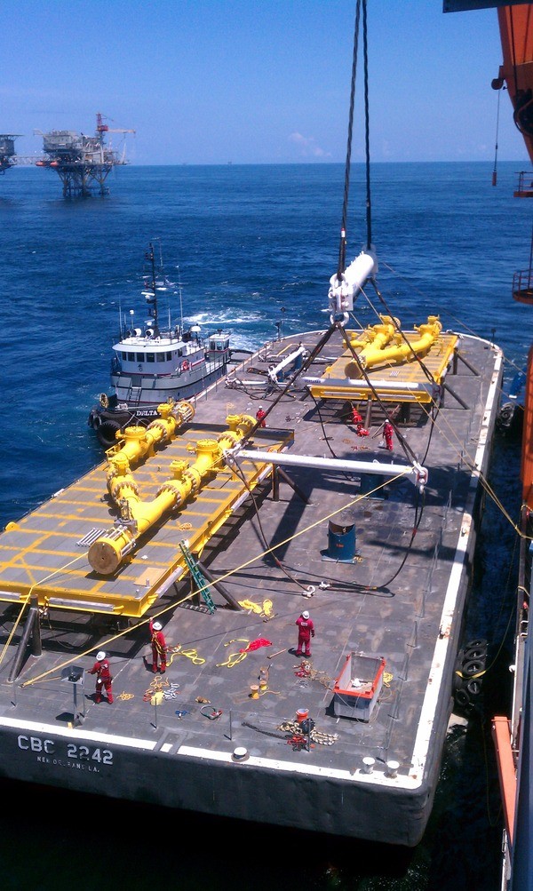
Essentially, the client needed help with the installation of something called a wye sled, which is a sort of steel mudmat that supports a collection of underwater valves and pipe connections. To install it, however, they needed to first dredge out underneath pipeline and remove a bunch of concrete coating. This stirs up the bottom of the ocean and makes it virtually impossible to see anything.
To complicate matters, the sled needed to be installed adjacent to an existing live pipeline. What happens if this big piece of steel bumps into the live pipeline because the crane operator doesn’t know exactly where to put it? Can you say Deepwater Horizon?

Or, as Tony Gray, manager of data management, Marine Construction Survey, for Fugro Chance, put it in a recent conversation with SPAR: “Whenever you’re installing a very heavy piece of equipment adjacent to an existing pipeline that is live, there is, I would say, a tremendous amount of risk.” However, because of tremendous cost of operating offshore, the client didn’t want to have to wait around until the dust settled.
What to do?
Gray and system engineer Jesus Zertuche decided to take a pass at using CodaOctopus’ Echoscope 3D Sonar, which uses a phased array of more than 16,000 sonar beams to create a live 3D underwater image. “We basically showed them what the possibilities were through a visualization using the device,” Gray said. But, “as far as doing any trials? This was such a fast-tracked schedule, we all had to do something of a leap of faith. Certainly, we knew enough about it that it made sense and we were able to do some pre-project planning on a very fast track, but the alternative was nothing, so it was that kind of situation.”
“This allowed [the client]to actually in real time make decisions,” Zertuche said. “They could say, ‘take the crane up a little, move it over.’ In terms of using other technologies, you’ve got the post-processing where the sea state can change.” The live look ability was extremely important, as Zertuche could sit with the clients in the survey room, watching the operations live on a big screen TV, and provide rotated views, views they requested, almost as though they were working with a bank of surveillance cameras.
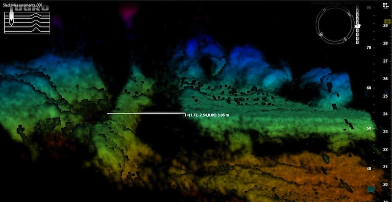
Of course, it wasn’t actually as good as video. Here’s an example of the image produced:
After everything was installed, Zertuche took some measurements from the data and compared them to known distances and Fugro Chance was satisfied with the solution’s performance. “Jesus could consistently get within a half a meter of what we were certain the relationship was,” Gray said.
Half a meter? “In this particular situation, we weren’t building a watch,” Gray laughed, “and once you get down to doing the metrology of doing point to point tie in of spool pieces, this isn’t the tool that would do that for you. You’d need a much tighter solution. But for this, yes, half a meter was plenty good … I’m not sure what they would have done if we didn’t have it. It certainly would have been a much, much, much slower process. If this didn’t work, we’re back to as high a risk as an oil company could take in a situation like this.”
In the future, Gray and Zertuche envision quite a few other applications for the technology, and both agreed it’s something they could integrate with other 3D data capture technologies (also of note: The Coast Guard is in the middle of testing the device). “I could definitely see getting the legs of a platform, subsea, from an Echoscope, and then from the water surface on up, using lidar, or some other kind of laser scanner, to get a full and complete picture of a platform,” said Gray.


