Forsite is excited to announce we are now part of the Barr GeoSpatial Solutions “BGS” group of companies. BGS is a leading provider of analytics and remote sensing to help manage and protect natural resources and critical infrastructure across North America. Other companies in the BGS group include Northwest Management Inc. (NMI) (Moscow, Idaho), Airborne Imaging (Calgary) and Barr Air Patrol (Houston).
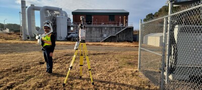
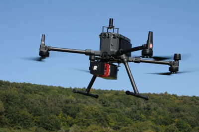
Forsite, a leading provider of forestry solutions in Canada including digital tree inventories, forest land management, fire modeling, and vegetation management for utilities, is excited to join the Barr group of companies. BGS’s advanced fleet of over 25 sensors and 50 aircraft, coupled with state-of-the-art aerial LiDAR, imaging, surveillance, and Al technologies, delivers invaluable data through sophisticated processing and analytics. Being part of BGS will provide Forsite the resources and market access to allow the expansion of our technology product offerings across North America and around the world.
The combination of Forsite (Canada) and Northwest Management Inc. (USA) – both leaders in forestland and environmental management with specific expertise in Al based LiDAR forest inventory tools (ForestView® and Digital Inventory®), fire management, and forest analyses – coupled with BGS’ expertise in LiDAR acquisition and data processing, allows us to partner with our clients to develop innovative solutions for their diverse environmental needs. Additionally, integrating Forsite’s forestry operations group with Northwest Management Inc. will allow us to further support forest inventory data collection and forest land management across Canada and the US.
John Drew, President of Forsite, commented, “Our longstanding working relationship with Airborne Imaging, a BGS company, coupled with our ambition to expand into the US and international markets, made joining the BGS group of companies a natural progression for Forsite. This partnership not only broadens our reach but also enhances our capabilities with cutting-edge geospatial technologies. We are thrilled by the possibilities this collaboration brings and look forward to delivering even greater value to our clients.”
Edward Feuerstein, CEO of Barr GeoSpatial Solutions, commented, “Forsite and NMl’s experience creating value added products from geospatial data, combined with their leading position in the Canadian and US forestry markets makes them a highly synergistic addition to the BGS group of companies. This will enable us to offer clients a comprehensive suite of services, from aerial data collection to on-the-ground forest land management, and our single-tree Digital Inventory® products. We look forward to working together to bring their geospatial based vegetation management solutions, forest land management and fire modeling capabilities to clients across all our end markets including right-of-way vegetation management for the utility and oil and gas industries.”
Our combined team represents over 400 employees across North America, all sharing a deep commitment to environmental protection. Forsite’s ownership group is enthusiastic about this partnership and have taken on equity positions in the larger entity. Forsite will continue to operate independently, with its current management team remaining in their roles, poised to expand into new geographies with the support of the BGS family. Together, under the BGS umbrella, we provide true end-to-end solutions and unparalleled value, solidifying our commitment to excellence in forest management and geospatial services.
About Barr Geospatial Solutions
BGS provides a range of capabilities and solutions leveraging Al, remote sensing and inspections from aerial and ground based assets including: comprehensive forest management, single tree digital inventories, vegetation management, fire modeling, geohazard monitoring, carbon capture modeling, aerial LiDAR acquisition, digital twins, ground control, data processing, high resolution oblique and nadir imagery (including our Talon360 imagery), methane leak detection, video, hyperspectral, aerial inspections and a suite of apps and data viewing tools for clients.
Source: BGS