The problem a lot of you have with the Kinect as a 3D data capture device isn’t just that it’s a toy – most of you are open-minded enough to see utility in any device that might help you do your job – but that most of the applications that have been dreamed up for it thus far are toy-like as well. They’re cool hacks that create neat animations of computer nerds in their computer chairs, and they hint at real possibilities (like the virtual reality demonstration Kenji Takeda gave at SPAR Europe), but they’re still mostly just doing that: hinting at possibilities.
So it’s great to see some researchers venturing out into the field with the Kinect to do some “real” science. Wired points us to Ken Mankoff, a Ph.D. student at UC-Santa Cruz who’s using the Kinect to study glaciers and how they’re degrading.
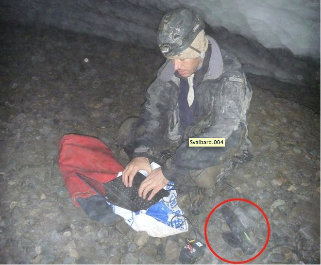
Using the little toy, originally meant as a motion-sensing device for the Xbox 360 videogame console, Mankoff scanned the cave floor in 3-D. During the summer, water from lakes on the glacier’s surface had gushed through the channel he was sitting in. The Kinect was going to provide a better understanding of its size and roughness, which could help researchers predict how the ice above would flow toward the sea.
Of course, the article then goes on to tell us that the Kinect can record “very accurate 3D data.” I guess that depends on what you feel is “very accurate,” no? If you’re doing a volume calculation of a cave, maybe very accurate could mean a couple of inches. Seems like that would be fine if you’re just interested in a ballpark square foot number.
And then there’s this:
Though a Kinect can only see between three and 16 feet ahead, it has the enormous advantage of costing $120, compared to between $10,000 and $200,000 for a LIDAR setup.
Most arguments for the Kinect keep coming back to that: Its democratization of 3D data collection. That kind of price point is going to drive a lot of students in its direction, plus, as is noted later in the article, their familiarity with the device in general (though I guess I’d question the relationship between a student who rocked out to Dance, Dance Revolution on the XBox and a researcher who’s hacking the device and figuring out how to use the data it collects to create 3D models and take measurements. Seems like that’s just as complicated, if not more so, than setting up a scanner and collecting data that way).
So, I’d like to get a look at Mankoff’s data, that’s for sure. Is it really something he can work with and share with others? Is it as real-time as it appears? If so, I can see how that would be mighty attractive.


