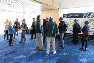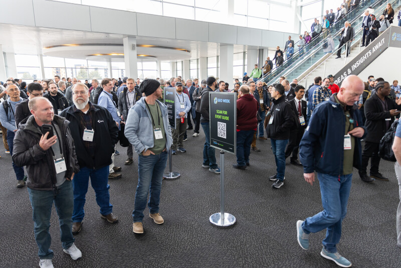
Last week, professionals from the geospatial, infrastructure, and AEC industries – and beyond – came together in Denver, Colorado for the 2025 edition of Geo Week. The three-day conference and exhibition was buzzing throughout, boasting over 3000 attendees and over 200 of the leading companies on the exhibit floor, to go with a packed conference program that included thought leaders looking at trends and professionals sharing their most fascinating case studies.
As one would expect, Geo Week News was in attendance and tried covering the three days from all angles possible. While it’s not feasible that everything was covered, we were able to capture many aspects of the event, including keynotes, other conference sessions, and conversations with exhibitors. Our coverage of Geo Week will continue over the next couple of weeks as we get to some of the things that we were unable to cover live, during the event. That said, as we get back to life at the office following the show, we wanted to put everything we’ve done to this point in one place. So, below you can find all of our coverage to date from Geo Week 2025.
Keynotes and Plenaries
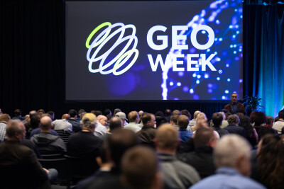
As is the case every year at Geo Week, all three days started with either a keynote or plenary discussion. This year, the two keynotes showed off very different use cases – one highlighting the digital transformation of one of the world’s busiest airports, and the other looking at the response to a tragic incident – that shared common themes, including collaboration across various technologies and disciplines. Then, the day three plenary once again featured speakers from the United States Geological Survey (USGS) providing updates on 3DEP.
Day One Keynote: No Missed Connections: How DFW Airport Connects Tech with Stakeholder Needs
Day Two Keynote: Geo Week Keynote Covers Importance of Collaboration in Response to Francis Scott Key Bridge Collapse
Day Three Plenary: USGS Representatives Present Updates on 3DEP
Product Previews
Another Geo Week tradition is that, even before that day-one keynote, attendees have the opportunity to see presentations from many of the leading companies from throughout the industry. In the product previews, two rooms are filled with 15-minute presentations taking place over the course of roughly three hours, with Geo Week exhibitors setting the stage for what will be seen at their respective booths throughout the week with their presentations. Geo Week News covers these presentations in a three-part series, all of which you can find below.
Product Previews, Part One: UAVs and Aerial Mapping
Product Previews, Part Two: Digital Twins and 3D Software
Product Previews, Part Three: Point Cloud Software and More
Conference Sessions
Geo Week includes three days of wall-to-wall conference programming covering a number of topics and formats, as noted above. As such, even with multiple members of our editorial staff, it is impossible to cover everything. We do have a few more write-ups coming about a few of the sessions from this year’s conference, but below is a sample of what has been covered so far, including sessions touching on AI, the modernized NSRS, construction technology, and more.
Industry Organizations Come Together to Discuss Modernization of the NSRS
How To Overcome the Challenges of Large Airborne Mapping Projects
Does the Combination of LLMs and Geospatial Info Represent a New Frontier for Mapping?
Emerging Technology Session Explores the Impact of AR, VR, and AI on Construction
Mad Nadir Mapping, NOVI, and Tersus GNSS Win Pitch the Press Competition at Geo Week
Exhibitor Conversations
In addition to attending and covering some of these conference sessions, the Geo Week editorial team spent the three days walking the exhibit hall floor and spoke to some of the companies showcasing their products and showcases. Here is a sampling of those conversations.
Rapida: How High-Resolution and AI Can Be Leveraged to Streamline Infrastructure Inspection and Maintenance
- Resilio: Geo Week Technology Spotlight: Resilio allows teams and firms to take their data to the next level
Global eTraining: Global eTraining Provides Customizable Training Courses for AEC Professionals
Leica Geosystems, Part of Hexagon: Leica Geosystems Shows Off New CoastalMapper Bathymetric Lidar System at Geo Week 2025