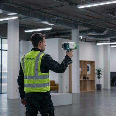
Augmented reality (AR) is quickly gaining ground as a solution for visualizing location data in the field, whether for navigation or managing underground infrastructure. Meemim, a Canadian startup company specializing in collaboration software launched two new AR products in January: vGIS, a new augmented reality platform and its first associated product, vGIS Utilities.
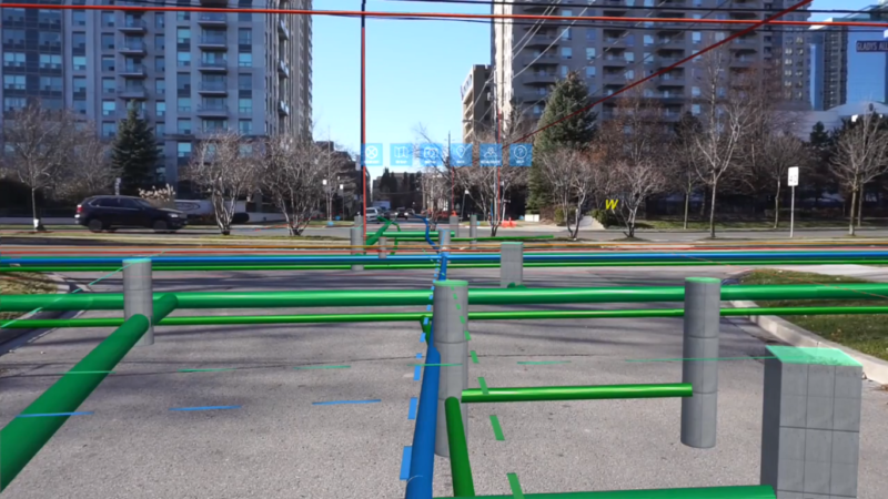
The idea of a solution that enabled field workers to see “through the ground” came from Len Bundra, who is IT/GIS director for the Toms River Municipal Utilities Authority (TRMUA) in Toms River, New Jersey. To realize this idea, Meemin combined GIS, AR, and cloud technology in cooperation with industry partners Esri and Microsoft. The result is an app that creates a common operational picture for utility field workers, and offers 3D location data by projecting holograms over physical surroundings by using AR technology.
 The vGIS app uses a shared interface for multiple users (like a multi-player game) that shows an above-ground 3D model of underground—right where they are located below street level. The app, which uses Unity for rendering, imports GIS features from ArcGIS, as well as other types location data—such as 3D building models from SketchUp or CityEngine, and LiDAR scans—making for a more immersive experience.
In addition to offering bi-directional integration with Esri´s ArcGIS, vGIS will be compatible with an upcoming Esri AR/VR runtime engine, making the use of Unity as a rendering environment a temporary measure.
Meemim uses business partner Microsoft´s Azure cloud environment for all geospatial data processing, as well as a short spatial calibration process, as well as output to field workers. Users of the app can select, pan ,and zoom in to features as with any other data visualization tool. Several short YouTube clips show how the app works in practice and how utility features are color-coded so they can be distinguished from each other easily.
The first product built with vGIS technology is vGIS Utilities. This solution is targeted at municipalities, townships, counties, and service providers such as public utilities and locator service providers. Toronto Water, a large utility serving over three million people, is currently using vGIS to help manage underground infrastructure.
vGIS enables such cleanup, because it captures discrepancies between GIS data and actual infrastructure. After issues have been identified, a record correction report is submitted quickly.
Although no other product releases are scheduled at the moment using vGIS, it´s likely more releases will follow soon. Meemim is currently patenting the spatial calibration method, and believes that more sectors will benefit from the advantages of using AR to validate their existing GIS data and monitor their assets.


