July 2017 saw the second release of ArcGIS Indoors, a template web application that combines varies a set of tools, using CAD data as input. Users can now create their own 3D campus maps, transportation networks and perform finding and routing within buildings through a web app.
Esri has been working on a template app that eases working with CAD data in a GIS application. By using this app, now called ArcGIS Indoors, it’s easier to get CAD data into a GIS environment, enabling users to perform routing and finding within buildings. The app is available in two versions. One, as a live preview that can be accessed using a web browser, and two, as a download that grants access to a set of ArcGIS Pro tasks for creating the 3D data models and streaming the app that offers search and routing functionality.
Campus viewer preview
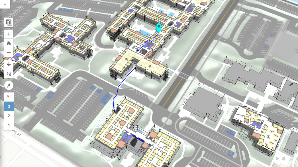
A live preview of the app shows the end result of the app: A 3D model displayed in a web browser with added search and navigation functionality.
The 3D model linked above shows the main buildings on the Esri Campus in Redlands, California. Two different view levels are available, one showing the building facades and another their interior floor plans. Different map layers show the floor levels (these can be turned on or off). You can navigate through the model using the menu on the left side or using a mouse, and the performance is quite smooth and fast.
As for the routing functionality, the application provides a way to find people or places that are located on the campus by using a search widget. After you type a search request in the search bar on the top-left part of the map, you can locate individuals or office numbers, and use the program to generate a 3D route between any two locations in the 3D scene. When doing routing, you can toggle route restrictions regarding elevators or stairs. Finally, the program reports a final summary of the total travel time and distance.
App download and configuration
A download of the app for creating these maps is available at ArcGIS.com. The program provides a set of ArcGIS Pro tasks and the application code for the browser-based Campus Viewer application.
With this download, users can replicate a series of workflows for creating and publishing their own campus models. The steps are: Create a campus basemap, the building interiors, campus map, and web scene. These form the basis for creating a routable campus network. Finally, publish the campus scene and locator layers.
The most interesting part here is the process of converting the CAD data to GIS data, and creating the indoor network for routing. CAD-GIS conversion uses a Python macro, and generates one of two available output data models for an indoor dataset. Available tool outputs are buildings, floors, and space polygons plus floorplan lines. A Z-value can be added to the 2D data with the Indoor CAD to GIS tool in ArcGIS Pro, enabling output in 3D, in addition to 2D.
These interior floorplan layers serve as input for creating a routable 3D indoor network dataset. For each floor, a dense “fishnet” lattice is first calculated, then entry points and transitions (stairs or elevators) are added, and the final network is created by pre-generating all route permutations on each floor. The final 3D layers can be published in ArcGIS Online or on ArcGIS Portal.


