The past year has been a tumultuous one in a lot of ways, including in the development and harnessing of technology. When we look back at 2023, there will be many aspects that will immediately come to define the year, and technology will be near the top of that list. In particular, the ways that artificial intelligence entered the mainstream conversation, particularly with large language models like ChatGPT, will be a core piece of the year that was.
Registration is Open for Geo Week 2024!
February 11-13, 2024 | Colorado Convention Center | Denver, CO, USA
Looking specifically at the world of geospatial, 3D technology, the AEC industry, and where all of those spaces intersect, it's also been a busy year. AI has also touched all of these areas in different ways, and will almost certainly continue to do so, while innovations in both hardware and software have shifted how the world will move forward both sustainably and commercially.
Now, with 2023 coming to a close, the Geo Week News staff has been looking ahead to the coming year and trying to figure out the technologies and innovations we believe will define 2024. The following trends are the ones that we are most excited to cover - both here and at February's Geo Week conference in Denver - moving forward to see how it will shift not only the industries we cover, but all of society.
1. Adoption of the Universal Scene Description (USD)
It wasn’t long ago that the metaverse was the big buzzword in the technology space, with companies and visionaries alike predicting a world enveloped by a 3D internet experience. While much of that momentum has dissipated over the last 12 months, there is a movement around the Universal Scene Description (USD) that could help drive things forward yet again. Originally created by Pixar, USD is a framework for interchange of 3D graphics and has been described by some as “the HTML of the metaverse.”
Earlier in 2023, five companies founded the Alliance for OpenUSD, a group whose mission is to promote USD and help make it the standard for the developing 3D ecosystem, and a group who recently unveiled their roadmap to become an international standard in the next two years. There are still a lot of barriers for any sort of widespread metaverse that some were envisioning a couple years ago, but we are undoubtedly moving towards a 3D future. That includes social use cases, but also industrial with digital twins and large-scale planning ecosystems. As these spaces grow, the need for USD will grow right alongside, and this year seems like the inflection point where it will enter the mainstream consciousness.
2. More accessible Earth observation data
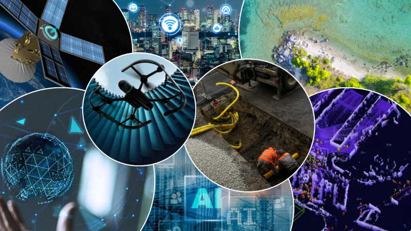
On any list of industries that are predicted to grow over the next few years, you’ll see space high on the list. Production of satellites and other crucial hardware is becoming more sophisticated, and launches are becoming easier to acquire. As a result, more organizations and companies than ever have access to high-quality Earth observation data. We’re already starting to see this become a central part of the geospatial industry, with this sector taking center stage at Intergeo this past October.
Looking around the industry, we’re seeing companies provide more access to this data than ever before, and easier than ever before. Satellogic has been working to democratize this data, giving multiple options for governments and companies alike to acquire the data they need. SkyFi has brought this data into an easy-to-use mobile platform. Even larger companies like Planet and Maxar are providing new platforms to provide specific information to more organizations. This data is crucial for understanding our world, particularly as climate change continues to be a central concern around the planet, so this trend in particular is important for all of us.
3. AR/VR’s presence in enterprise settings
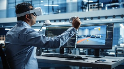
Just like the idea of the metaverse taking a step back in 2023, in some ways the same can be said for the space around augmented and virtual reality. This isn’t too surprising since there is significant overlap between the two concepts, as any “metaverse” will largely take place in virtual reality settings. And also keeping in line with a theoretical metaverse, right now there is seemingly more momentum around AR and VR in enterprise settings – both in the office and in the field – than for social activities.
Take, for example, the recent unveiling by Autodesk of their new Workshop XR product, which is their biggest foray to date into the mixed reality space. The announcement was made in November at the company’s Autodesk University conference, where mixed reality workflows were littered throughout both the conference and the exhibit floor. In the field, improving technology is making it easier and more fruitful than ever to use tablets to project models over the real world using AR, while the office is seeing the benefits more and more of collaboration in virtual reality as headsets become more powerful and more accessible. This coming year could be the time when this technology goes from niche to a staple.
4. Improving technology for bathymetric workflows
Some of these trends the Geo Week News staff sees as particularly intriguing in the coming year involve new tools taking hold, like USD mentioned above. In other instances, such as with bathymetric work, we’re talking about established workflows that are seeing broad improvements. This past year has been a big one in bathymetric work, and things are trending towards 2024 bringing even more innovation in the space.
The best driver of improvement and innovation is always going to be need, and right now there is an acknowledgement of our need for a better understanding of our coastlines. Climate change affects all regions of the world, but coastlines in particular are in peril and it’s crucial that we maintain a clear understanding of how these areas are being shaped. That means better technology for topobathymetric scans, whether that be better integrations for these surveys, or improvements in areas like satellite-derived bathymetry.
5. Internet of Things sensors becoming a staple
In developing these trends, some of it comes from what the Geo Week News staff has observed going to events and reading about the industry throughout the year, and some comes from conversations with industry insiders about trending technology. In our conversations over the last month with professionals from different industries and companies, the prevalence of Internet of Things (IoT) sensors was something that came up across the board, including in a conversation with Procore’s Sasha Reed.
This is an example of technology that has been previously established, but not everyone had taken advantage of this technology. Based on conversations with industry insiders, in particular these IoT sensors are expected to become more prevalent on job sites in the construction industry. There are a number of different reasons for this, but a lot of it comes down to better understanding of the technology, more development to develop sensors to give the information job sites need, and perhaps most crucially the constant evolution of cellular networks and WiFi.
6. Reality Capture enabled by UAVs
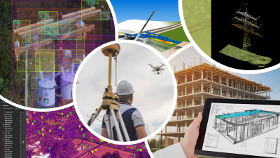
Much like in bathymetry described above, reality capture workflows with UAVs is not exactly a new space, but it is one where improvements are continuing to come down the pipeline. Using drones and other UAVs for reality capture and other surveying workflows accomplishes a couple of different objectives, opening up scanning opportunities that did not otherwise exist, and/or allowing areas to be captured much more safely than sending a human out.
The first step in the development of this space was simply about making it possible, but now we’re seeing innovation in many different areas that should continue in the year ahead. Some of that is with full devices specifically for these workflows, like the Leica BLK2FLY, which this year gained autonomous indoor scanning capabilities. Drones in general are becoming stronger, sensors are becoming smaller without sacrificing power, and software is making the processing work much simpler for end users. Put it all together, and you can expect to see more reality capture, particularly on worksites, being done safely using UAVs.
7. Growing understanding of our subsurface assets
For any construction project taking place in a city, one of the most important parts of the process is getting a full understanding of the infrastructure existing under the surface. Traditionally, this has been much easier said than done, as workers generally have had to rely upon records from when these assets were first placed underground, sometimes over a century ago. As such, these records aren’t always accurate, leading to dangerous and costly strikes.
With more and more people moving to cities in the coming years, that will lead to more construction in these populated areas, which in turn means more digging. That will require more detailed understanding of the underground, and tools to do so will become more in demand. We recently saw the release of a new product for mapping data from ground penetrating radar, and we’ve seen companies who specialize in this work take big steps forward. This generally hasn’t been a major part of a surveyor’s workload, but there are some in the industry who look at this as a place for surveyors to grow their business.
8. Lidar for crowd monitoring
We live in an era where people expect maximum efficiency and convenience when they go out to public places, whether it be someplace like an amusement park or a transportation center. Technology in so much of our life has developed this way, so it’s become the expectation everywhere. The good news is we do have the technology to track large crowds and then apply artificial intelligence to garner insights based on that data. The bad news is that we also value our privacy, something that flies in the face of much of this technology.
Lidar has the potential to achieve both of these goals, tracking crowds and providing data on movement, while also maintaining privacy and eliminating AI bias. Generally speaking, crowd and people tracking hasn’t been the most common use of lidar, but as a versatile technology it is being more widely recognized as a tool to do just that. Over the second half of this year we’ve seen two separate examples of airports using lidar to track crowds and create more efficient buildings, and we’re expecting to see even more of that as AI continues to improve and lidar sensors become more accessible.
9. AI being harnessed to address workforce challenges
As mentioned at the top of this article, looking at the overall technology world – and really even outside of just the tech space – the defining aspect of 2023 has been the development of artificial intelligence tools. Every industry has their own relationship with AI, but looking specifically at AEC it has been a way to counteract workforce challenges that have plagued the industry for years. Those challenges don’t figure to go away any time soon, as some estimates indicate that nearly a quarter of the construction industry is 55 or older.
Finding a way to attract new talent continues to be crucial for the industry, but AI can help on a few different fronts. For one, it can help to make up for a lack of work, particularly in the office, as it takes over more tedious work to free up workers’ time for more complex and important work. AI can also open up more attractive workflows for young people who are expecting technology to be part of their work. Finally, and perhaps most importantly, some companies are even taking the years of knowledge from their older workers to help develop in-house LLMs which can be used to pass on that crucial experience to the next generation.


