Sponsored by Worldsensing
While geospatial technology has long been a well-known value add for a wide array of established industries around the world, there has been a proliferation of new tools in recent years. The barrier to entry for a lot of these tools – like laser scanners and total stations, among others – has been lowered in terms of both cost and ease of use, allowing for more in fields like infrastructure and other well-established spaces to take advantage. That is a trend that is only expected to pick up speed in the near future. Clearly, this is a positive to be able to collect all of this data from scanners and other geospatial technologies, but in order to get the most out of it, organizations need to look for other supports to supplement this data collection and gain the most valuable insights. This is where Worldsensing comes in, with the company providing this key support through their Internet of Things (IoT) remote technology.
Worldsensing has been a leader in wirelessly collecting, transmitting and managing data from instrumentation and monitoring sensors and systems. Since founded in 2008, the Barcelona-based infrastructure monitoring experts have now served customers in more than 70 countries by having deployed over 3.000 monitoring networks. The company works with a network of global partners, to help improve safety in spaces like mining, construction, rail, and structural health. That focus on digitizing civil infrastructure drives its flagship solution: Their IoT monitoring solution to allow for joint geotechnical and geospatial monitoring.
Providing an eye on crucial projects
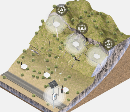
The civil infrastructure in which Worldsensing specializes are often complex and in difficult-to-access areas, meaning as much extra information as possible is going to lead to sharper insights and better decision making. The IoT remote monitoring technology acts as a “magnifying glass” for the geospatial data being collected. By collecting this joint data mentioned above, users obtain not just crucial backup data but also a fuller and more reliable assessment of the status of projects. Worldsensing’s solutions provide all of this key information with a variety of LoRa (Long-Range) IoT edge devices which collect data and then transmit it to gateways which can be up to 15 km away (with line-of-sight). All data, deployed networks and devices can then be managed in the company's Connectivity Management Tool to ensure that the crucial data is easily accessible and able to be integrated with third-party software for easy analysis.
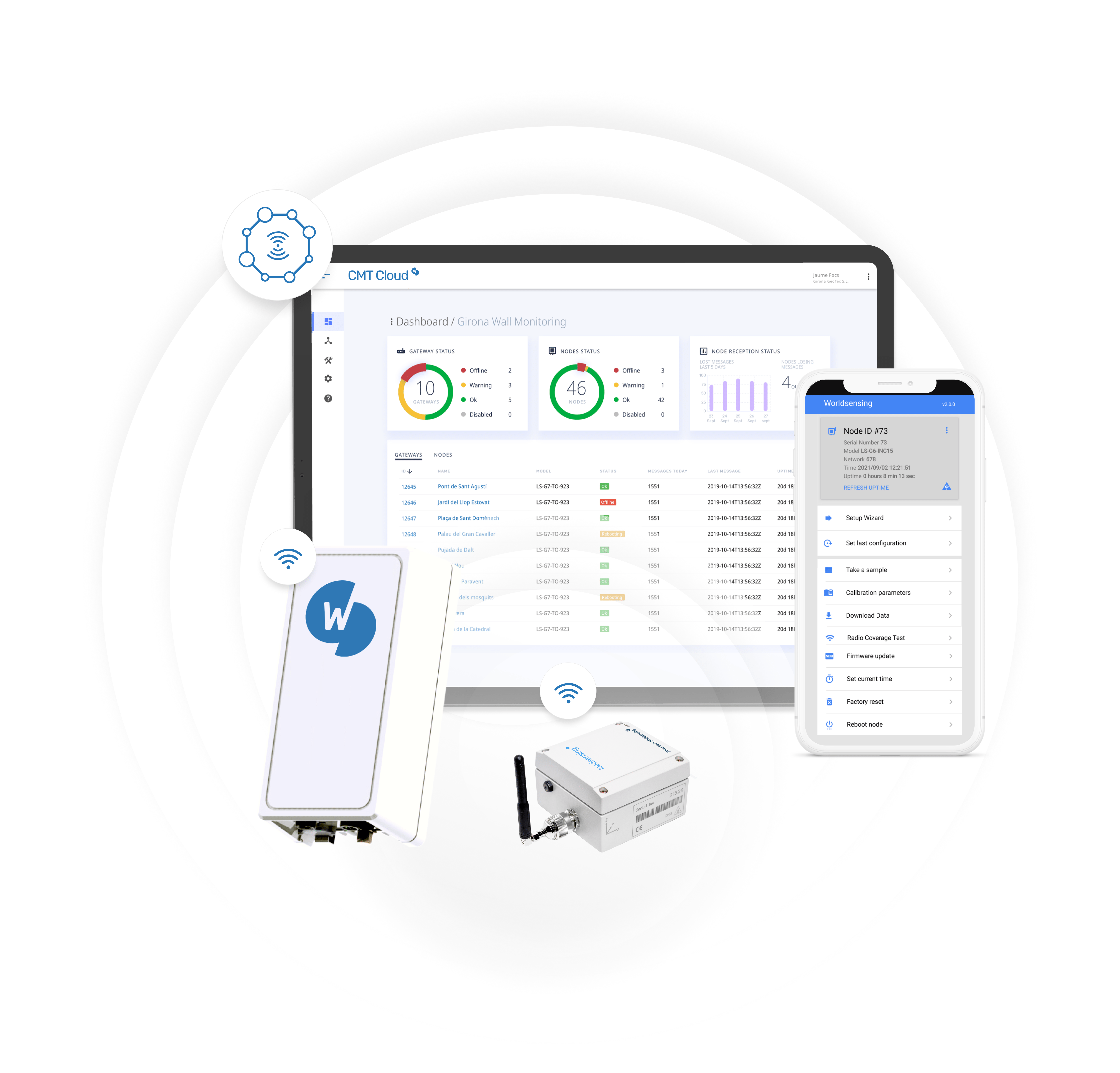
It is these three important pillars – the edge devices and gateways to collect sensor data along with the Connectivity Management Tool (CMT) – on which the Worldsensing solution is built. Starting with the edge devices, the company offers a variety of devices with wireless tilt and laser tilt sensors as well as data loggers, all of which can be integrated with existing sensors that are needed for any given project. All of the products offered in this category rank among the best in class for sensor compatibility, usability, long-range communication, and low-power consumption, allowing users to monitor things like static deflections, distance variation between piers, pressure, temperature, tension force, and plenty more around the infrastructure.

Keeping systems connected
Along with the edge devices, Worldsensing also offers strong connectivity solutions for both on-prem monitoring as well as cloud-based, 24/7 monitoring of the in-field deployments. The CMT Cloud is the ideal offering for those who want to manage projects remotely and access data from multiple gateways in one project site through a single access. Management of multiple projects sites and different access privileges will also be available soon. Users have 24/7 access to their cloud data, and gateway redundancy ensures data security and availability even in cases of cut connectivity or lack of coverage thanks to backups in the cloud. The software provides users with real-time status and mapping of all data loggers and gateways in the network. Meanwhile, CMT Edge is ideal for projects who need remote network monitoring but prefer to keep their data on-premise.
All of this collected data can then be fed into third-party software for key insight collection and data visualization. Worldsensing is partnered with some of the leading software providers in the space – companies like Trimble, among others – to ensure that users can manage the data how they see fit and how most makes sense for any specific project.
With all of these solutions, those charged with monitoring civil infrastructure can receive the extra insights they need to move past some common barriers, including those that arise from working in hard-to-access areas. Worldsensing’s monitoring solution runs on a low-power, wide-area IoT network, providing that top-of-line range, battery use, and ease of adapting for a growing list of monitoring needs. Those working in spaces like mines, bridges, tunnels, and other low-accessibility areas can now receive crucial and reliable data to cut down on risk that is inherent in many of those spaces. With the wireless configuration of the solution, the need for manual monitoring and expensive cabling is eliminated, leading to significant cost savings for users along with improved sustainability and safety.
Addressing critical future challenges
All of this is only going to grow in importance as time goes along, too. The continued effects of climate change are going to make extreme weather events more common, which in turn will put strain on much of our aging infrastructure. Already, over the last decade 55 critical infrastructures have collapsed, and by 2025 estimates indicate climate change will have caused a $250 billion loss in assets. The merging of these issues of climate change and aging infrastructure is going to require attention, and Worldsensing’s 24/7 monitoring system provides just that.
To learn more about Worldsensing’s IoT remote monitoring solutions and how they can be leveraged along with other geospatial techniques, be sure to register for their Geo Week News webinar on November 17, 2022, at 11:00 am ET. Representatives from Worldsensing and Trimble will be giving an introduction to IoT remote monitoring technology, and how users can complement geospatial technologies like total stations with continuous and real-time data.


