If there is one truth about the surveying and reality capture technology industry today, it is that the tools, methods and techniques for reality capture have expanded dramatically. The practices of surveying, mapping and modeling are evolving beyond relying only on terrestrial scanners, to include mobile lidar, advanced camera technology, uncrewed aerial vehicles (UAVs), sensors mounted on robots, and more. When using only one of these methods or individual tools, the data is relatively straightforward to process, and can sometimes be accomplished within the sensor maker’s own software. However, to realize the full potential of these tools, the data needs to be brought together. Uniting this disparate data collected from different tools - from point clouds to CAD models and meshes - can often be much more difficult than collecting it.
So, how do we get from the capture of data to a set of useful and actionable information? A platform built on providing its users with seamless data workflows, 3DUserNetVISION is the missing piece for accelerating the use of data from different sensors. In addition to bringing together and merging data sets accurately and quickly, the platform is purpose-built to make sharing, collaborating and managing data intuitive and useful. Instead of manual work and disorganized project files that need to be managed separately, 3DUserNetVISION allows the benefits of the collected datasets to be realized together - allowing users to pick the right tools for the right situation, and have access to their entire dataset.
Bringing the best of both worlds together
“In terms of capability, 3DUserNetVISION offers a more complete pipeline for our clients’ workflows. All the way from acquisition to data usability. It is ideal because you have the entire process covered.” -Matteo Sgrenzaroli, Gexcel
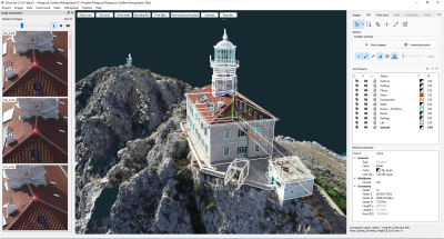
In mid-2021, 3DUserNet launched VISION, a platform for integrating, annotation, sharing and streaming survey outputs (in both 2D and 3D). 3DUserNetVISION allows users to view collected data, manage and bring in datasets from various captures or existing models and meshes. For georeferenced data, a map panel puts the datasets in context of their location.
The data can be turned into deliverables that can be shared, whether those deliverables are 360 panoramas, point clouds, high-resolution textured meshes, models or linework - or a combination. Annotations and documents can also be linked to surveys, making it easier to keep project files organized and at hand.
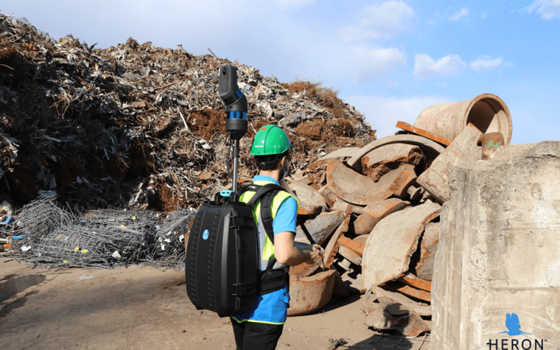
For Matteo Sgrenzaroli, R&D Project Manager at Gexcel, 3DUserNetVISION has proven invaluable for integrating scans from their HERON system with other types of data collection. HERON is a SLAM-based lidar scanner that is utilized while walking, either held by hand or mounted within a backpack. HERON’s small and compact nature makes it more versatile than some traditional tripod scanners, and it can be a strong complement to a project that spans multiple different environments. To get the most out of HERON, many of Gexcel’s clients have sought to combine its data with other datasets - which has now been made possible by 3DUserNetVISION.
“With 3DUserNetVISION, if you have already acquired data with a static scanner or drone and you go out another time with a HERON, you can localize yourself and detect the differences. HERON produces a point cloud, of course, but 3DUserNet has the capability to visualize and share point clouds coming from different sensors,” said Sgrenzaroli.
“It is not a closed platform or one where you need to work only with one instrument - it’s a platform where you can handle different sensor data, CAD model, images and that is due to the compatibility and collaboration made possible with 3DUserNetVISION.”
One of Gexcel’s clients was recently tasked with capturing a massive rail yard where trains are repaired and maintained. The client had recently acquired data of the rail yard with a drone. To capture the indoor areas, the client decided on a different approach.
“They choose to map the entire indoor area with HERON. They then needed a platform where they could share everything - from the point clouds coming from drones, to those coming from HERON, even to CAD models, and images. This is where 3DUserNet came in,” said Sgrenzaroli
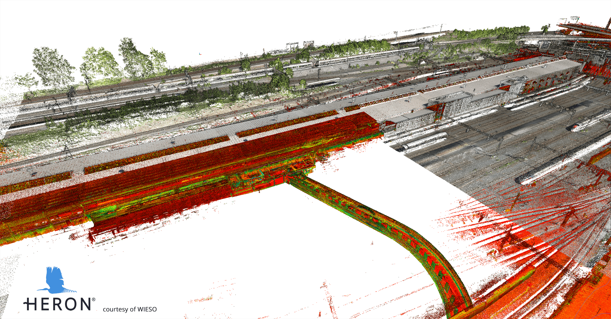
As the popularity of using drones in surveys continues to grow, so too will the need to bring these different data collection methods together.
“A lot of users now have drones,” says Sgrenzaroli , “But the drones have some limitations - you can not always fly where you need to. So sometimes walking through a place is easier than flying all over the location.”
“Most of us come from the experience of processing terrestrial laser scanners - we know all the advantages, we know the limitations. Now, we do not want to stay with just one instrument. If you have the capability to offer the best with what you have and add the best from what others can offer and you have a good merging platform - that’s a benefit for everyone.”
New data opportunities
“The ability to access our data and their data - to archive it, to interact with it, to share it - in a really quick way, is crucial,” -John Dillon-Leetch, Port of London Authority
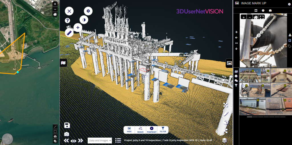
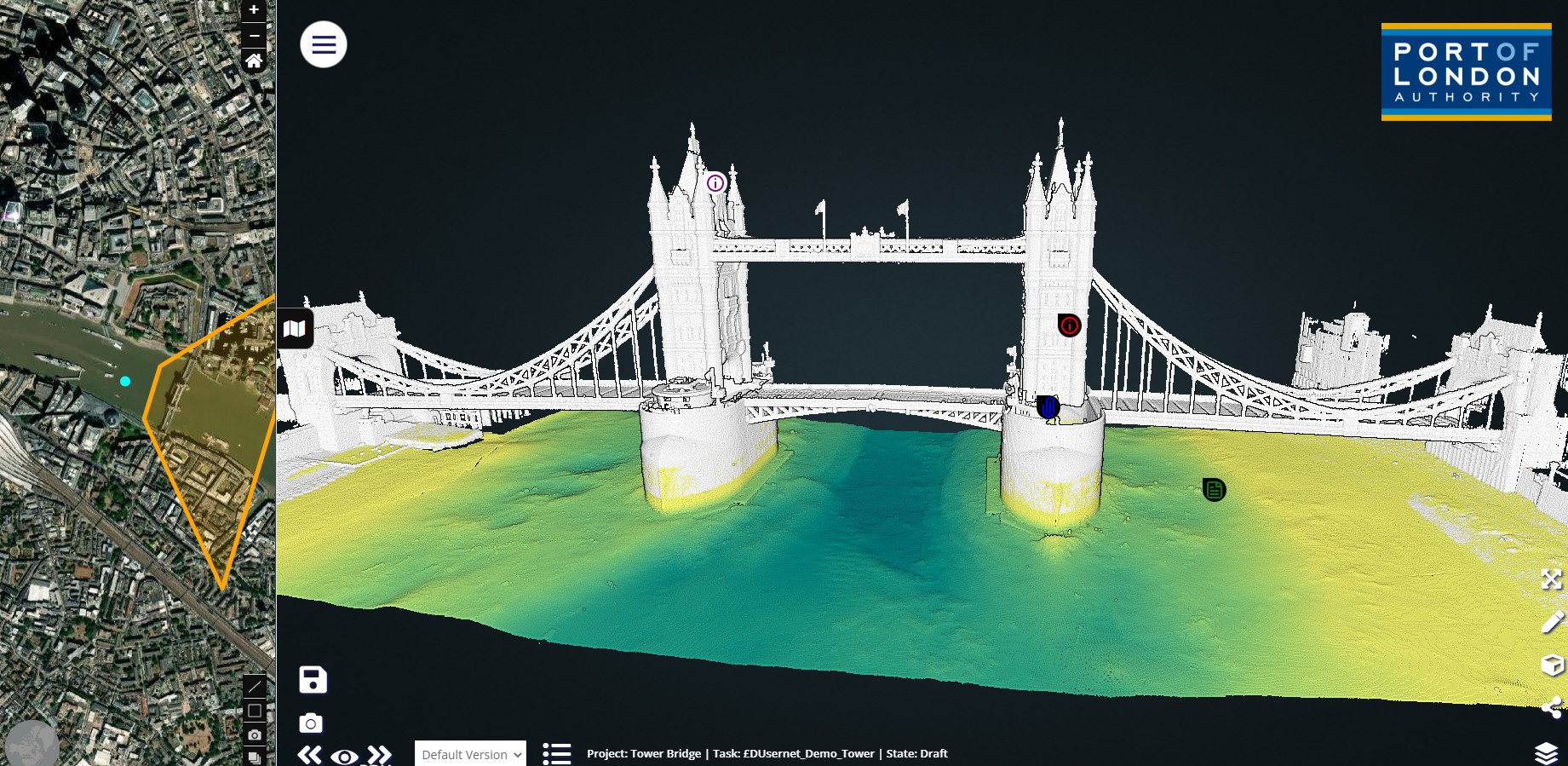
The Port of London Authority (PLA) has the largest port hydrographic department in the United Kingdom, who support the safe navigation into the busiest port in the country covering 400 sq miles. With responsibilities that range from providing navigation data used to navigate the largest container ships in the world in and out of the port, or providing the critical key mapping data of bridges, terminals and other infrastructure or mapping and monitoring condition or movement of assets and shoreline, the Port of London Authority is no stranger to collecting different data types for distinct purposes. They collect bathymetric data of the riverbed using multi-beam sonar systems and lidar and photogrammetric derived intertidal and structural data utilizing vessel-based scanners and aerial drone-based Lidar and camera systems as well as leveraging satellite altimetry, bathymetry and lidar to map over 300 miles of coastline.
Producing this rich dataset is one thing, but getting clients, stakeholders and even the public to utilize the data is another challenge altogether. John Dillon-Leetch, Port Hydrographer at The Port of London Authority has been looking for ways to move beyond the expert-centric internal datasets to more useful deliverables to their outside stakeholders.
“Most of our clients are asset managers or marine terminal managers, they’re not engineers but they’re managing very large budgets relating to engineering and maintenance. They really value that we can engage them with their data and give them tools to engage with it, including for project management.”
Using 3DUserNetVISION, data can quickly be shared via a link, eliminating the need for long email threads, attachments or outdated static documents, which can lead to confusion. In addition, the data can be organized and embedded in a friendly and easy-to-navigate interface including video, photography, drawings, reports as well as high-resolution and high-density point cloud or 3D mesh data.
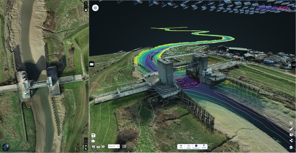
“3DUserNetVISION has given us a very user-friendly environment to share and access information, and something that can also be used as a repository. I think that big data handling is key for people.”
Working with large-scale contractors, including National Grid, is also streamlined, says Dillon-Leetch.
“They have their own 3DUserNetVISION license, and they are creating their own embedded data repository. We’ve put in all the data we’ve acquired for them since 2008, and put in some of their own in-house data on marine assets, and have now trained their marine and engineering teams to access and use the portal.”
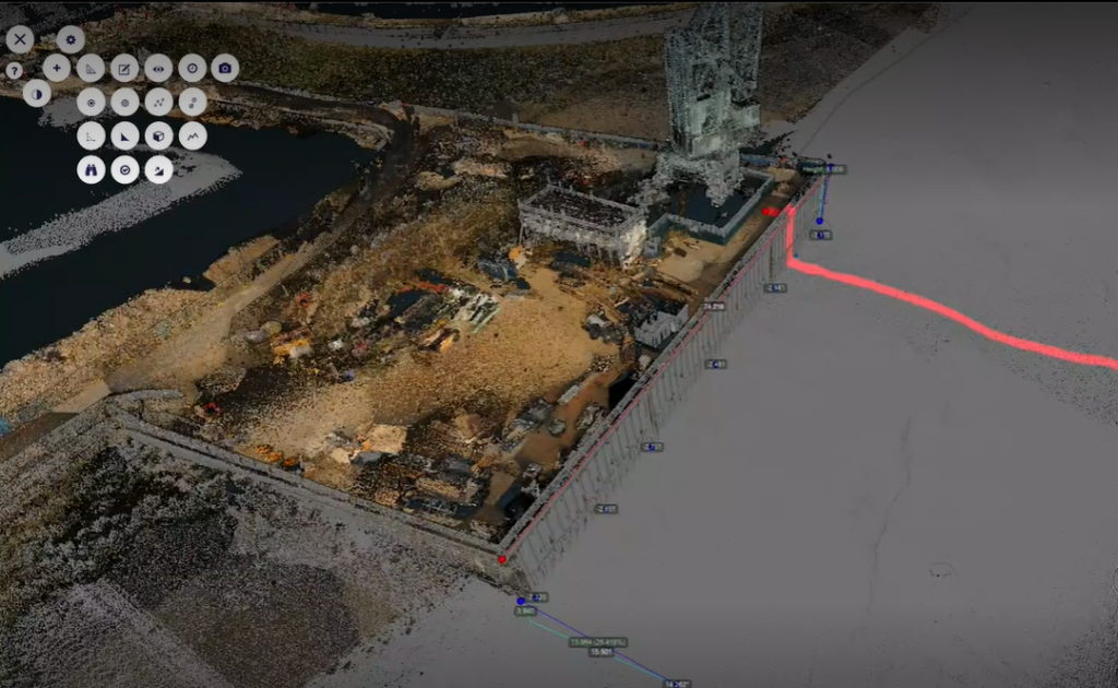
In “only a few clicks” users can now pull up a plethora of data collected above and below water for ports, bridges and more. Because the data is streamed, it means that the data viewing, even from home wireless internet connections is possible, and quick.
“I’m amazed at how quick this is,” added Dillon-Leetch.
Customizing control
Working in locations with key strategic infrastructure assets whether bridges key import/export terminals, and ports themselves can come with a security risk, so controlling data access to specific users is important when choosing a data management and sharing platform. Whether it is the threat of security or proprietary company information, these risks can be top of mind for project managers.
“When we work with National Grid, we’ve gotten requests when they’re putting a tender out, and they request certain documents for a tender pack for the bidders. We can create a unique link for download for only a week or so and they can then send out that link in their tender information,” said Dillon-Leetch.
3DUserNetVISION allows for the fine tuning of what data is shared, and for how long, with options to have a link expire or to provide limited access to the data. Permissions to download the data can be managed as well, meaning that some users will be allowed to view the data but not have access to the original files.
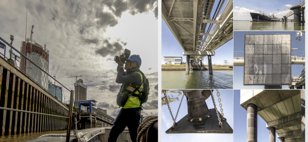
“From a safety management point of view, the software makes it easy to pinpoint where you want to look. At one asset, we captured over 1800 photographs (120 Gbs ) of every square inch of that asset recording down to serial number identification in some places either manually on the structure or we’ve done it from a vessel, under the jetty above the jetty, etc.. Loading the georeferenced images into the 3DUsernetVISION environment enables us to run a pinpoint filter tool in seconds by placing the cursor on a location and every photo captured of that particular spot is immediately loaded up and visible and you can then inspect it, share or tag for a task or feature i.e check, maintain, paint, etc and then send it to your maintenance or engineering teams for further triage or works instructions .”
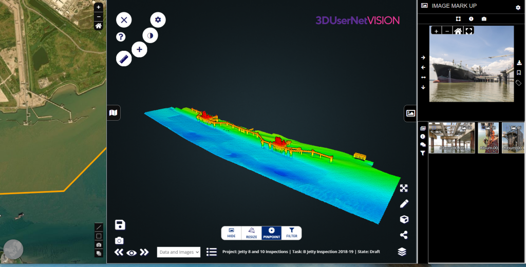
“So you could, for instance, choose a couple of layers of data and photographs, and share them with your project team who are doing the works on a fender or a tens of thousands or million dollar maintenance or replacement works scope - but because they’ve got the data to hand to inform, estimate, plan and brief the works. That sort of functionality is hugely beneficial to a client who has multiple people and contractors working on things and saves time, cost and reduced risk .”
To learn more about 3DUserNetVISION, visit https://www.3dusernet.com/VISIONWEB/


