Velodyne LiDAR has announced a partnership with SLAM innovators Dibotics this week, citing a focus on the growing drone-mapping and mobile-robotics markets.
Under the terms of the agreement, Dibotics will consult with Velodyne customers who apply SLAM algorithms in their workflows, and Velodyne will work with Dibotics to improve the operation of it SLAM technology when used in concert with Velodyne’s LiDAR sensors.
What is SLAM and Why is it Important?
SLAM (simultaneous localization and mapping) algorithms provide a way for a sensor to map its environment while, simultaneously, locating itself within that map. All of this work is performed on the fly—no previous location information is required. Because of this, SLAM algorithms are ideal for applications where GPS or navigation infrastructure are unavailable.
These algorithms offer huge potential for mapping using autonomous UAVs and vehicles. They promise a future where you can simply send your SLAM-equipped, automated UAV into the field, and it will find its own way through the environment while creating a detailed 3D map in the process.
What is Dibotics?
Dibotics was founded in Paris in 2015, and their innovation is the development and validation of a SLAM technology that is sensor-agnostic. According to the company’s website, it SLAM algorithms works with laser scanners, 3D cameras, sonar, radar sensors, and more. Dibotics also says that its solutions need only a single-sensor to provide real-time positioning over long distances “without drift,” real-time 3D mapping of the environment, and field navigation. “No odometry, IMU, or multi-sensor fusion are needed.”
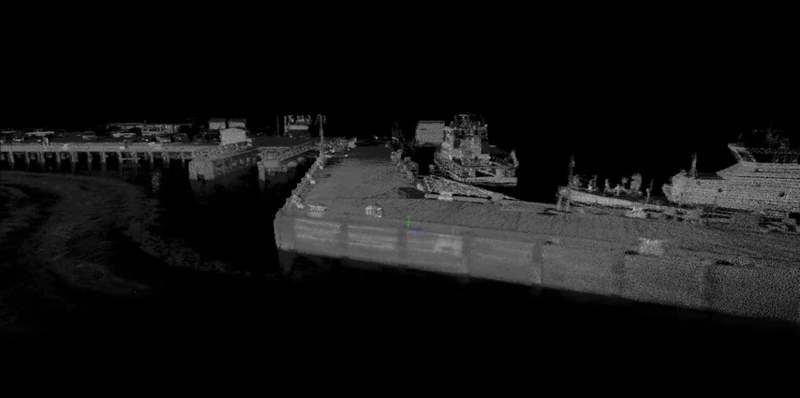
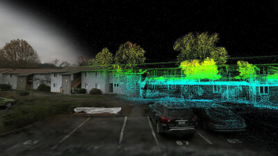
Field-tested applications of Velodyne 3D LiDAR sensors and Dibotics algorithms include 3D mapping from a moving power boat, SLAM from a VLP-16 mounted on an all-terrain vehicle driving through a field, and airborne mapping from an autonomous UAV.
In a prepared statement, Dibotics CEO Raul Bravo said, “we’re eager to work closely with Velodyne LiDAR to deliver the best solutions to emerging markets like real-time drone mapping and mobile robotics applications. We have applied our technology to a wide range of application fields in several industry segments all over the world, to achieve fully autonomous function, perception-enriched tele-operation or 3D modelization. This partnership represents the next step in our evolution, and in the maturation of the technology.”


