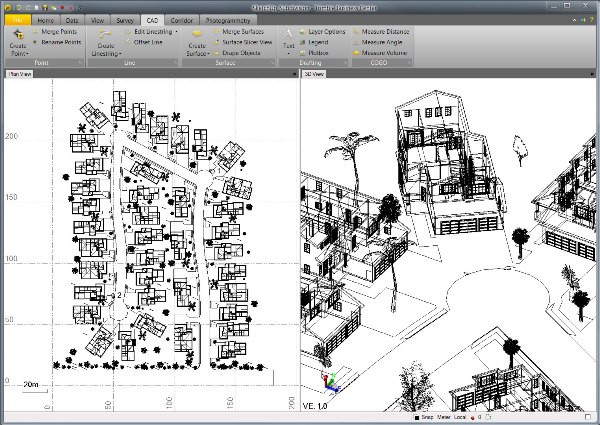
New functionality integrates SketchUp file support in Trimble Business Center software
Trimble Navigation Ltd. on Monday introduced the integration of SketchUp file import and export capabilities in its Trimble Business Center office software to provide survey and engineering workflow with processing and modeling capabilities.
Acquired by Trimble from Google in 2012, SketchUp Pro is used by architects and engineers to create 3D models for visualization of structures.
Trimble Business Center is office software that integrates with Trimble’s field products to give surveyors, engineers, and geospatial professionals the ability to edit, process and adjust data in producing deliverables.
The software allows surveyors to calculate points based on 3D SketchUp Pro models generated by engineers and architects and transfer those points into Trimble Access field software for field work.
Trimble Business Center’s exporter functionality routes survey data back into SketchUp to give survey and engineering companies and architects with a timely and accurate portrayal of the land layout as they begin design work.
“The new workflow capabilities that this data interoperability path can provide are exciting. It can enable increased collaboration between surveyors and construction design professionals, who can now make compelling new 3D visualizations of projects that include realistic representations of buildings and other such structures in real-world geospatial context,” said Christopher Keating, business area director for SketchUp. ”In addition, precise survey data can now be efficiently communicated from the field to the office, providing faster and more efficient design work in SketchUp 2013 for new construction projects of all types.”
Trimble Business Center v2.9 and v3.0 with SketchUp file support are now available through Trimble’s Survey Distribution Channel.
Sunnyvale, Calif.-based, publicly traded (Nasdaq: TRMB) Trimble, with $2 billion in 2012 revenue, uses positioning technologies – GPS, lasers and optics – to focus on applications requiring position or location, including surveying, construction, agriculture, fleet and asset management, public safety and mapping.


