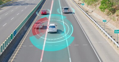
HERE Technologies, Orange and Toyota participated in a pilot study that combined multiple precise positioning technologies to test if it’s possible for an autonomous vehicle to respond to its environment in real-time. More specifically, a possible scenario was chosen where an autonomous vehicle would have to make way for an emergency vehicle and warn other cars nearby of the approaching vehicle to avoid collisions. Knowing which lane the car is in turned to be key for the pilot, as well as being able to respond to the environment in real-time to make way for an approaching vehicle and avoid possible obstacles nearby.
While GNSS technology helps to accurately position a vehicle on the road, this is complicated when there’s no direct signal, for example inside a tunnel. For this project, higher accuracies were required to make sure which lane the car was in. This required centimeter-level accuracy, whereas GNSS accuracies are not that accurate. To get a real-time, centimeter-accurate position of the vehicle under different circumstances, a different solution was needed.
High-definition GNSS Positioning
This proved to be a combination of multiple technologies: HD (high-definition) GNSS positioning coupled with vehicle dead reckoning (VDR) running on a remote platform at the edge. HERE HD GNSS positioning is a positioning service that provides sub-meter level positioning accuracy for automotive, mobile devices and chipsets. Dead reckoning refers to the process of calculating the current position of a moving object by using a previously determined position, or fix, and incorporating estimates of speed, heading, and elapsed time.
The combination was a test to see if the required centimeter-accuracy position of the vehicle under different circumstances could be achieved. Additionally, (low-latency) 5G wireless cellular technology and edge computing enabled testing the feasibility of the system in terms of processing onboard sensor data in real-time (in the cloud), and returning the corrected position of the vehicle. Edge computing is a combination of data storage, management, and analysis, allowing real-time data processing used in the automotive industry to respond in real-time to its environment.
Warning vehicles nearby
A successful pilot on a test track in France proved that the vehicle could be precisely positioned using Toyota sensor data and the corrected position signal from HERE. Additionally, the Orange vehicle-to-everything platform helps to warn vehicles nearby to avoid any possible collisions when a high-speed emergency vehicle is approaching. The pilot will provide some of the building blocks that Toyota will use to further develop its connected and autonomous vehicles.
The results of the pilot were presented in a paper during the ION GNSS conference in Denver last September.
Resources: This technology gets your car in the right lane — with centimeter-level accuracy


