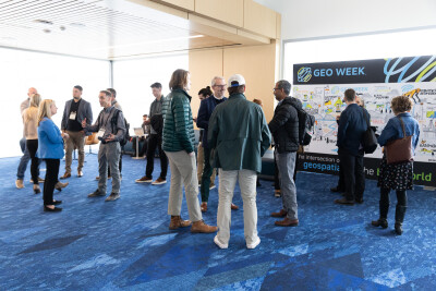
The geospatial industry is undergoing a transformative period, characterized by rapid technological advancement, expanding applications, and critical workforce challenges. What are some of the issues on the horizon? And what can the geospatial industry to do prepare for those opportunities and challenges? While these are not unfamiliar topics in conversations throughout the Geo Week event, they were a particular focus of a Geo Week plenary panel, The Future of Geospatial: Navigating Innovation, Challenges, and Emerging Opportunities, featuring Ronda Schrenk (US Geospatial Intelligence Foundation), Dan Bellissemo (GIS Surveyors, Inc.), Eric Bergholz (Laserscanning Europe) and Thomas Haun (Turner Mining Group). These futurists and industry veterans shared their opinions on where the industry might be going.
More Accessible Technology
It is clear that the industry is experiencing a significant technological revolution, and there are some key technological advances that are pushing that growth. Scanners and sensors are becoming more accessible and hardware is becoming easier to use for non-experts, with a proliferation of scanning technologies that now require minimal training. AI and machine learning are increasingly integrated into workflows, though experts emphasize the continued importance of human oversight and expertise. The trend is moving towards more sophisticated data collection, with a focus on multiple sensor types and improved interoperability.
Bergholz highlighted the dramatic changes in technology accessibility. "In the early stage, we spent entire days just copying data," he recalled. "Now, you have very small devices you can take in an airplane, with scanners that can be operated by craftsmen, not just engineers."
It seems, as well, that the industry is not just focused on how to collect data – but about making sense of that data and creating meaningful insights across multiple disciplines.
Workforce Challenges and Opportunities
Perhaps the most pressing concern (echoed in other sessions and discussions as well) is the industry's looming workforce shortages. Technical education programs are declining, creating a skills gap that needs immediate attention. In response, industry leaders are advocating for proactive solutions, such as engaging students at the high school level, developing comprehensive training programs, broadening recruitment beyond traditional engineering backgrounds, and emphasizing the exciting and innovative aspects of geospatial technologies to attract new talent.
The most pressing concern remains workforce development, with the panel offering nuanced insights into attracting and training new talent.
Bellissimo advocated for looking beyond traditional educational paths: "I've found that people who were in the military for four years doing mapping are perfect for this. You don't necessarily need a degree. Kids coming out of trade schools who have done surveying are incredible at processing data because they understand the foundations."
Bergholz shared the European model of dual study programs, where students combine university studies with practical work in companies. "This helps us catch talented people earlier," he explained.
Haun also asked the industry to think creatively about talent recruitment, "My challenge to this room would be to look for the creatives. Engineers like linear processes, but when you can tap into talent pools with different backgrounds, you might find some white space for innovation."
Schrenk also pointed out a trend she’d seen in her work. "Many geography students are transfers. They start in an engineering degree, take a GIS class, and suddenly go, 'Wow, this is what I'm all about. This is my purpose.'"
Reaching students at an earlier point in the career path was something that several panelists mentioned, including Belissimo.
"We need to start before college, before high school. Talk about our work, go to grade schools. Show kids the cool stuff we do, and they'll get excited. I challenge all of you to reach out in your neighborhoods and volunteer."
Future Predictions
The geospatial industry stands at an exciting crossroads. With technological barriers falling, new applications emerging, and a growing recognition of the field's importance, the future looks promising. However, success will depend on the industry's ability to attract talent, embrace innovation, and continue pushing technological boundaries.
To wrap the panel, each panelist was asked their predictions on where the industry is headed, and there was a lot to be excited about.
"What's on the horizon is using multiple sensors at the same time, and better interoperability. We're moving towards a global geospatial community with many types of sensors." -Ronda Schrenk
"The lidar industry is predicted to grow 200-300% over the next 10 years. Be prepared to pivot into other industries because we're using our technology to solve problems we didn't think about five years ago." -Dan Bellissimo
"I'm excited about two things: non-traditional players entering this space and the disruption around crowdsourcing and democratization of technology. There's an ease of access to capturing data that we did not have before." - Thomas Haun
"I feel we're entering a time where technological development is going much faster. We had 10 years of slower software and sensor development, but now we'll see dramatic changes. The time to reach the next step is accelerating." -Eric Bergholz
These predictions paint a picture of an industry on the brink of revolutionary change - more interconnected, more accessible, and more powerful than ever before.


