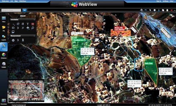
BAE Systems says GXP WebView fills need for imagery in intel reporting products
Global defense and aerospace firm, BAE Systems, said Monday its new low-cost, web-based imagery viewing and manipulation system helps intelligence analysts use geospatial data without paying for a geospatial imagery specialist.
It’s called the GXP WebView Pixel Server – a lightweight, HTML 5-based electronic light table that converts images, regardless of format or location, into a standards-based data stream viewable in a web browser, allowing analysts to view, annotate, and publish geospatial imagery into situational awareness tools and intelligence reports.
GXP WebView is a component of BAE’s GXP Xplorer software for image analysis, geospatial production, mapping, 3D visualization, photogrammetry, and data management.
The software allows all-source analysts to perform geospatial, temporal and advanced metadata searches with a single query and access images, terrain, features, GeoPDF images and maps, PowerPoint files, videos, text documents, and other data sources.
The San Diego, Calif.-based firm said the GXP (Geospatial eXploitation Products) software scales from a mobile device, to a laptop, to an enterprise server configuration with web browser access.
“GXP WebView delivers on a long-standing requirement for the intelligence community to rapidly add imagery into intelligence reporting and situational awareness products,” said Dan London, vice president of sales, marketing, and customer support for BAE’s Geospatial eXploitation Products division.


