Just last week, at Geo Week News we covered how technology is being used to evaluate urban heat island conditions. In this case, we looked at AI algorithms created by Gramener taking in multiple datasets, including from satellite imagery, to better understand the factors that lead to harmful urban heat islands in cities from different corners of the world. These heat islands are an increasingly large problem as summers become hotter and hotter, particularly off the heels of last summer being the warmest on record.
That example was one about how a private company is assisting the work of local governments, but as we know those local governments are doing plenty on their own to trying and find solutions for combating these issues, generally using a variety of technological tools. Raleigh, North Carolina often finds itself on the forefront of using tools like GIS and others – and recently was awarded a “Smart 20 Award” for much of this work. Geo Week News recently spoke via video interview with Jim Alberque, the city’s GIS and emerging technologies manager, about how they’re using Esri’s GIS technology and other tools to combat the issues of urban heat island and other challenges facing the city.
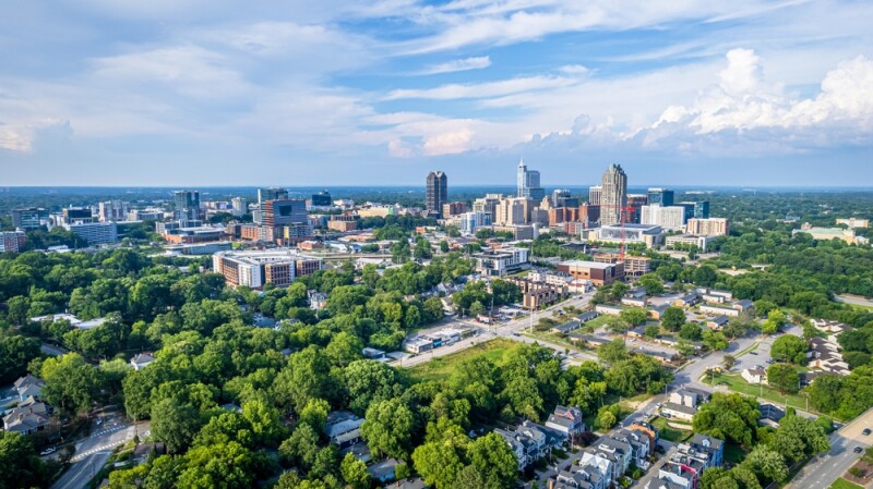
Before that, however, it’s worth zooming out a bit and looking at the city of Raleigh itself. Like most every city around the world, they have long been working to deal with the effects of climate change, and Alberque estimates it’s been about 12 years since they established their Office of Sustainability. Along with these climate concerns, they are also dealing with extreme growth, having recently been named among the 25 fastest growing cities in the United States.

As noted, they were awarded last month for their use of technology, and that’s something that Alberque immediately noticed. Prior to joining the city office 10 years ago, he was working for the city of Boston, Massachusetts – another city who utilizes emerging technologies – and Raleigh’s openness to technology was readily apparent.
“What I found was that the program was so far ahead from where I thought it was. GIS in the city of Raleigh is a core technology. I feel really lucky that [the GIS office] is included in a lot of conversations, because the staff is generally educated around what it is and its value.”
In terms of this work, there are a couple of different “tracks” that the city has taken to address these heat island concerns, as well as some other issues including accommodating the aforementioned rapid growth. One is with the help of MITRE, a national organization which spun out of MIT and assists local governments with technical and engineering work. This project involved MITRE collecting a variety of complex weather data, which was then fed into the government’s digital twin, allowing Alberque’s office as well as others in the city to incorporate the data into their models for their work.
More specifically around heat, the city received a grant from NOAA in 2021 to advance this work. “We had this opportunity through this NOAA grant to start to collect data and start to quantify what this heat island actually means on the ground to the citizens of Raleigh,” Alberque told Geo Week News. “Once we started to share that data internally, we worked with our sustainability office around how we can leverage this data, not just to tell a story about what happened in 2021 when we did this data collection, but instead to drive mitigation steps and investment and engagement and all of those sorts of things.”
So far, there are a couple of citywide projects that have resulted from this work to try and combat these effects of heat islands. One is a tree equity program, similar to a New York-based project we covered last year.
“This is trying to look at where trees are planted, where there's opportunities to plant trees, and then looking through the lens of where people experience the most significant impacts of heat island is a lens we're using to evaluate that,” Alberque said.

In addition to this, they also started a new pilot program around pavement reflection in 2020. Under this pilot project, as part of their regular resurfacing work on some roads around the city, they are applying titanium dioxide to streets. The compound, which among other use cases is often included in sunscreen, has qualities that allow for absorbing noxious gasses and is highly reflective. According to data from the city, streets that had titanium dioxide applied saw a startling 376 percent improvement in reflectivity compared to untreated streets.
Even with Raleigh’s relative advancement in this kind of work in comparison to some other cities around the country, Alberque sees ways to improve their projects around heat islands. One of the biggest ways is around the data collected as part of the NOAA grant. While extremely valuable, those were one-time collections, with volunteers collecting data from various points around the city in three different times throughout the day – morning, afternoon, and night. He’d like to see a more dynamic model.
“That NOAA project was great. It was a little bit intensive from both a device and resource perspective, but we need this data. What if we started to look at investing in sensors to start giving us real-time information to feed our models to generate the surface temperature so it’s not a point-in-time collection and it’s this dynamic model around heat island stuff.”
Still, even with where the city is today, this digital twin model is crucial for the entire government. It’s extremely helpful for unlocking new strategies around mitigating heat, as exemplified above, but also for various projects around other offices.
“The idea is we're trying to encourage people to drive their programs, whether it be investment planning or engagement, through this lens. Maybe this isn't the only lens, but this is one of the lenses that we're encouraging people to look at.”


