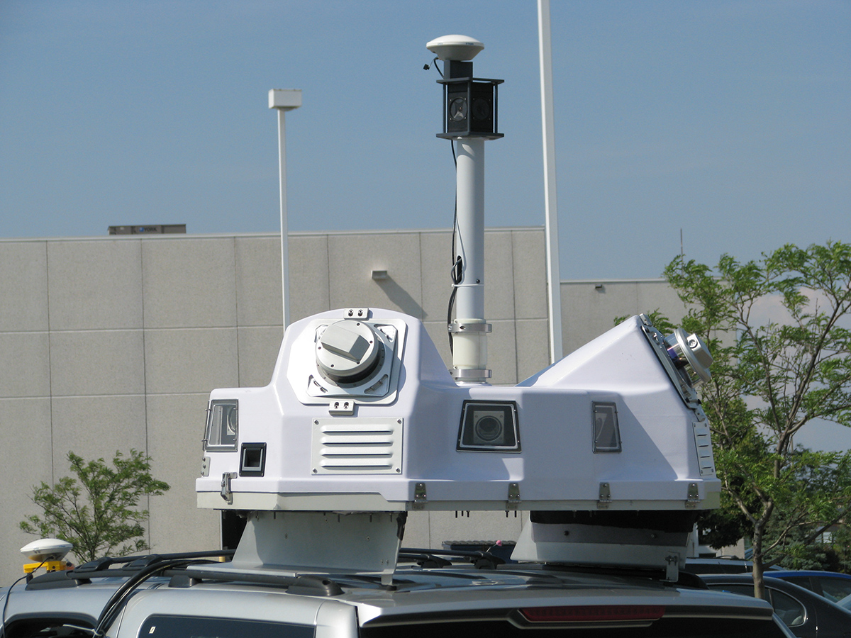
Toronto, Canada, April 14, 2014 — Optech, the world leader in the development, manufacture and support of high-accuracy lidar 3D survey systems and productivity-enhancing workflow software, is pleased to announce delivery of a Lynx SG1 Mobile Mapper™ to Psomas. One of the top-ranked engineering and survey firms in the United States, Psomas provides services in the transportation, water, energy and site development markets. This acquisition fits the Psomas commitment to using advanced technologies to deliver the utmost engineering data accuracy while maintaining a focus on safety.
The vehicle-mounted Lynx SG1, which creates survey-grade engineering models at highway speeds using its two 360° lidar scanners and high-resolution Ladybug® camera, was delivered for use by Psomas survey group teams in Southern California. Optech Services personnel trained the Psomas team to operate the Lynx and leverage the advanced rectification algorithms and power of the highly automated Optech LMS Lidar Mapping Suite workflow, maximizing their ability to consistently deliver highly accurate data to their clients.
“Our initial surveys have produced point clouds with significantly better accuracy than what we have seen previously,” said Jeremy Evans, Technical Director of Land Surveying and Mapping at Psomas. “We are particularly impressed with the power and flexibility of the Optech LMS processing software — a real game changer.”
“We are pleased to supply Psomas with the latest in mobile mapping technology,” said Elizabeth Carswell, Optech Vice President of Sales. “With the Lynx and LMS, Psomas can produce georeferenced 3D models and imagery of roadways and adjacent features with unparalleled accuracy at high speed, reducing risk to survey personnel and avoiding costly lane closures.”
About Psomas
Dedicated to balancing the natural and built environment, Psomas provides sustainably-engineered solutions to public and private clients. As a full-service consulting, engineering, environmental, construction management, and survey firm, we help our clients create value and deliver complex projects. Providing services in the transportation, water, site development, federal, and energy markets, Psomas’ staff of over 475 employees provides services from offices throughout California, in Arizona, and Utah. www.Psomas.com
About Optech
Optech is the world leader in high-accuracy lidar 3D survey systems, integrated cameras, and productivity-enhancing workflows. With operations and staff worldwide, Optech offers both standalone and fully integrated lidar and camera solutions in airborne mapping, airborne lidar bathymetry, mobile mapping, terrestrial laser scanning, mine cavity monitoring, and industrial process control, as well as space-proven sensors. Accuracy and productivity matter!


