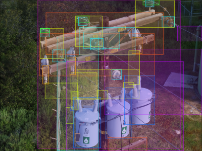
Subiaco, Western Australia | December 19, 2024 - Pointerra, a global leader in 3D geospatial technology, is excited to announce a suite of enhancements to its Pointerra3D platform at Geo Week 2025. These enhancements are aimed at streamlining workflows, improving collaboration, and driving innovation across industries including mining, construction, utilities, and asset management. Constant improvements in Pointerra3D are the reason our platform has become the cornerstone for utility resilience investments, and why we are delivering double-digit ROI percentages to our customers compared to traditional workflows. Visit us at Booth #846 to learn how we can deliver the same for your organization.
1. Photogrammetry for Orthophotos and 3D Reconstructions
Expanding beyond point clouds, Pointerra3D now includes photogrammetry capabilities. Launching in 2025, users will be able to upload raw aerial imagery and produce orthophotos, reality meshes, and photogrammetric point clouds directly within the platform. This feature bridges the workflow gap between image capture and analysis, offering a scalable, cloud-based solution for both laser scanning and photogrammetry workflows.
2. Enhanced 3D Vector Streaming and Industry Integration*
Pointerra3D now supports large-scale 3D vector datasets, unlocking the ability to render and analyze massive projects in a unified view. The addition of Bentley DGN and Autodesk DWG format compatibility enables seamless integration with industry-standard tools, empowering customers to collaborate across complex projects without limitations.
3. Unified Viewer Layout for 3D, 360 Imagery, and Photos
As customers integrate diverse geospatial data types for better decision-making, Pointerra3D introduces a new multi-viewer layout. This upgrade allows simultaneous analysis of point clouds, 360° imagery, and photo sets within a single web browser session. The result? Faster collaboration, enhanced accuracy, and seamless accessibility from anywhere in the world.
Unified Video Support with GPS Trajectory Tracking
The platform now includes GPS geotagged video support, allowing users to overlay video data with existing 3D and imagery datasets. This integration enhances inspection workflows and provides a holistic view of assets for operational teams.
4. Advanced Mining and Construction Analytics
Pointerra's commitment to the mining and construction sectors continues with new volumetric and surface conformance analytics. These tools enable operators to conduct detailed safety and operational assessments, such as longwall mining conformance analysis, ensuring enhanced safety and efficiency in high-risk environments.
5. Revolutionizing BIM Attribute Display and Filtering in Web Environments
In 2024, Pointerra tackled one of the industry's most complex challenges: supporting multi-layered 3D models in a web-based viewer. This advancement allows every individual component of a Building Information Model (BIM) and its unique attributes to be visualized, analyzed, and filtered in isolation.
This capability places Pointerra3D among a select few geospatial platforms with such functionality, enabling component-level clash analytics and integration with asset management systems. By coupling this feature with its market-leading point cloud capabilities, Pointerra3D is poised to become the definitive platform for 3D data technologies.
6. Spatial Referencing Engine and Vegetation Analytics
Pointerra3D’s updated spatial referencing engine supports the latest transformations and coordinate systems, ensuring alignment with global standards. Additionally, the platform introduces advanced tree segmentation analytics, enabling organizations to assess vegetation risks and manage carbon offset programs effectively.
7. Enhanced Security and Master Model Workflows
Responding to heightened cybersecurity demands, Pointerra3D now supports two-factor authentication for shared links, ensuring secure data sharing. A new master model workflow simplifies data management for dynamic sites, allowing teams to maintain up-to-date site-wide models effortlessly.
From the CEO
“Our Q4 2024 upgrades represent a significant leap forward for Pointerra3D. By addressing critical industry challenges and expanding our platform's capabilities, we’re breaking down data silos, significantly shrinking once fragmented workflows and empowering businesses to make data-driven decisions with confidence,” said Brian Mayfield, CEO of Pointerra US Inc.
These enhancements reinforce Pointerra's vision of unifying diverse geospatial datasets into actionable insights and establishing Pointerra3D as the premier platform for 3D digital twin technology.
For more information, visit pointerra.com or drop by booth #846 throughout Geo Week 2025.
Source: Press Release


