


The geospatial industry, while always important, is arguably becoming more important than it’s ever been – or at least within modern memories. Our technology today, from consumer to industrial, is continuously tied to our location, and being able to keep that connection consistent, professionals with geodetic knowledge are necessary, to say nothing of the need for surveyors in infrastructure and other types of projects. However, despite that importance, like many other sectors worldwide, this industry is dealing with a shortage of skilled and trained workers. Today, we are seeing more surveyors retiring or on track to retire in the near future than workers projected to enter the industry.
This isn’t the type of problem with one simple fix, and there needs to be a concerted effort on all fronts. Education and awareness of this career path need to be shared with school-age children, higher education in the field needs to be more robust, and employers need to find time to keep current employees trained and up-to-date with rapidly evolving technologies. That higher education piece right in the middle plays a major role, though, and is where most professionals end up deciding on their future career path.
Recently, Geo Week News spoke with Ezra Che and Chase Simpson, both assistant professors at Oregon State University in the school’s College of Engineering. Both Che and Simpson focus specifically on geomatics, and shed some light on how Oregon State tried to prepare students for a future in this field, how to reach the next generation, and more.
Oregon State currently offers a minor in geomatics, which is mainly pursued by students in the civil engineering major, that offers a lot of introductory courses in the geospatial realm, including courses on surveying, GIS, and even reality capture. The minor is still relatively new, kicking off in March 2023, with seven students graduating to this point and “another 20ish” set to graduate with the minor this June, according to Simpson. All told, they have 44 students in the minor right now, and expect another 20 to be added to that group after the upcoming graduation. Looking forward, Simpson indicates that they are “exploring the creation” of a geomatics and geospatial engineering major, though that is still in planning and exploration stages.
In talking to Simpson and Che, it’s clear that one of the issues that geomatics and the geospatial industry more broadly have in attracting young talent is that it’s simply not on these students’ radar coming into college. They note that, generally speaking, students end up falling into this field after a couple of years of studying rather than coming into college with this in mind. While that’s not entirely uncommon across all industries – 18-year-olds generally don’t have the best idea of what their future will look like – in the technical fields, that can be an impediment for students coming in looking to go into civil engineering, construction, or software development.
Simpson notes that one of the issues is trying to figure out how to change that trend. “How do we get students aware of this profession earlier? How do we get them not stumbling upon it, and they’re targeting these degrees when they go to college?”
One of the ways that Oregon State tries to create that path for its incoming students coming into the College of Engineering is by keeping the initial course load similar for all engineering students for their first year or two.
Che said, “Basically, for all of the College of Engineering students, they’re taking the same courses in the same year. We don’t have any specific courses set up in the first year, so students have that opportunity to get exposed to geomatics and geospatial science concepts.”
That’s fairly standard across all universities as they acknowledge, but it’s important to get students aware of this field when there is still not much awareness within secondary education and younger generation. To that end, Oregon State also does outreach to those younger students through college and career fairs. As Simpson noted, they do have a bit of an advantage in these settings as they are able to bring in tools like drones and laser scanners that immediately attract students to their booth.
“I think we’re starting to see this remote sensing and reality capture aspect of our profession is really gaining a lot of traction with the younger generation,” Chase told Geo Week News. “They’re able to relate to that, especially the folks that are really into video games. They’re like, Oh, this is what all those game engines and companies are doing. They’re going out and doing reality capture to create these game maps, and that connects with them. I think it’s a really big opportunity for doing outreach with those younger generations.”
Crucially, that outreach strategy does not end with speaking with the high school students. Che and Simpson noted that Oregon State also tries to do outreach to teachers and advisors from these high schools, giving them the information about the industry and program to that layer, who can then bring that back to students who are looking for their path forward.
“A lot of the teachers and advisors are like, Oh yeah, we have all of these students that are really into the outdoors and really into applied mathematics. This is a profession that they would all really enjoy.”
Zooming out and looking at this issue around workforce development and growth more broadly, Che talked about some of the disconnect between all of the different layers within this problem.
“Employers will say, Universities don’t give us enough of a workforce. And then we point and say, Hey, K-12, you don’t give us enough of a pool to pick students from. And then from the employee, Hey, the employer in our industry doesn’t pay their employees enough to keep people in the industry. All of the things are related.” Che would go on to say there needs to be more opportunities for all of these different stakeholders to talk and figure out where the gaps are.
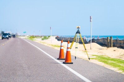
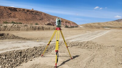
In the short-term, though, Che and Simpson says that Oregon State is trying to prepare the students who do pursue this geomatics path to be able to present themselves with the most value possible to future employers. Thanks to a partnership with Leica Geosystems, part of Hexagon, their students have access to hands-on training with reality capture equipment. This not only allows them to learn how to use the equipment, but more importantly, they are able to see examples of problems that occur with data in the field and learn how to navigate these issues before they get into the job field.
Relating to the pay gap compared to other technical fields to which these students could have access, Che also points to the coming modernization of the National Spatial Reference System as a way today’s students can argue for their value.
“The NSRS modernization is very relevant, because things will be broken. These companies can not do the same thing they’ve been doing for the last five, 10 years. Things will fall apart, and any engineering firm will have the need to keep up with this. It will change the landscape of the industry, in my opinion. I think if we can stay ahead of the curve a little bit, I think we will see a rise in demand for surveying, and then the demand should go up and pay will catch up.”
Simpson says he is seeing similar movements to what Oregon State is doing across other universities, hoping to increase the value for their students heading into the workforce, which will hopefully in turn attract more students to the field.
“I think what a lot of programs are doing is they’re revamping their curriculum to give those students that are graduating an upper hand in a negotiation to say, Hey, there’s all this change in the industry, and I was just educated on where the future is heading.”


