At this point, it’s been made abundantly clear how valuable GIS can be for making crucial decisions based on the spatial context of a situation. Whether it’s for a public official making policy choices with clear demographic information about specific areas, or private companies deciding where to build a new location, or many of the other use cases for both the public and private sectors, GIS forms the basis of so many of these crucial bits of information. As we’ve pointed out at Geo Week News many times, GIS can be an indispensable tool for making decisions for the greater good.
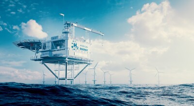
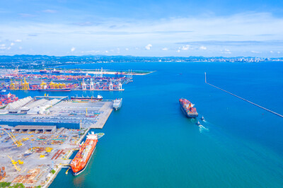
Generally speaking, these decisions have been limited to the terrestrial realm, whether it be unsettled land or urban centers and everything in between. However, recent years have seen the burgeoning of a new “blue economy,” with initiatives and business ventures increasingly relying on our coasts and into the deeper seas. Between fishing communities that have existed for centuries and newer ventures like offshore wind farms, and speculative projects like underwater data servers and subsea mining, there is more happening in our oceans than ever before, and not a whole lot of spatial context around where it is happening and how the areas are being affected.
It’s a problem that is now starting to be addressed with a recently announced joint initiative between Esri and NOAA to create a prototype for what they describe as a “one-of-a-kind, fully interoperable open data platform to provide equitable, actionable and ready-to-use ocean and coastal data for decision makers and communities.” The platform is still in development, but Geo Week News had the opportunity to speak with Dan Pisut, Senior Principal Engineer and Content Lead for the Living Atlas, about the collaboration and what they think it will add to this growing blue economy.
Pisut, who has ties to NOAA having worked for the agency prior to joining Esri, notes that an existing relationship between Esri President and Founder Jack Dangermond and NOAA’s top administrator Dr. Rick Spinrad, each of whom understood the value GIS could provide to strengthen this blue economy.
Pisut said, “A new blue economy is something that Dr. Spinrad has really been pushing for in his time as the NOAA Administrator, and that means: How do we optimize our use of resources in the ocean? Where are the competing demands for protecting species and habitats, clean energy use, shipping and coastal development? All of these things are vying for the same piece of ocean, and there’s ways in which we can spatially optimize that use and support a new blue economy.”
This is exactly the problem that NOAA and Esri hope to ultimately solve with this platform under development. At this point, Pisut says that they have been working on some prototypes to evolve some of the work NOAA has already been doing in this realm along with work Esri has done with non-government partners. One of the driving ethos of the entire project is what Pisut calls a “whole of society approach,” borrowing from the Biden Administration’s language regarding climate change, calling for collaboration between private and public sector and bringing together the work people are currently doing separately.
In this case, that means taking data from a number of different sources to ensure that they have all of the information they need to build out a maximally useful platform. That includes satellite data from open sources, as well as data from NOAA and from other Esri partners. Pisut gives a number of examples for the kinds of things they want to have measured within this platform, including bathymetric data of ocean floors, chemical properties like pH levels and temperatures of certain areas, as well as being able to track how all of that has changed over time. He also noted that they are borrowing from Uber’s H3 system, which separates the Earth into identifiable hexagon sections, bringing that concept to coastal and ocean areas.
As they are still in the process of putting out a prototype for this platform – Pisut was not able to give a timeline on the release – it’s hard to say exactly how the tool will ultimately be used. This kind of offering, which will be freely available for anyone to use, tends to be utilized for reasons that are not previously foreseen. That said, Pisut did have a few ideas of some of the topics for some of the ultimate use cases.
That includes, for example, conservation and environmental science uses, who may want to monitor habitats for specific species. Using historical data for these specific sections of the ocean, they could run projections for how that habitat could change in the next, say, 50 years. That’s work that can be done now, of course, but having more specific spatial context gives more meaning to the work.
“You could look at one area, and you could say, Where are other areas like that in other parts of the ocean?” Pisut said. “Or, if an area is described like this now, where will a similar place like that be in 50 years? By being able to bring geography into the ocean, we are able to do a lot more with it and start to find these patterns. Because otherwise, it’s just pixels and it’s really hard to find patterns and meaning with the vastness of all that ocean data.”
This data could also be used to better track shipping and fishing vessels, the latter of which are not always transparent with their tracking. By bringing in satellite data, some of these fishing fleets can be better tracked, improving sustainable fishing practices. Wind energy is also a growing industry, and by bringing in more of this contextualized geographic information it can be much easier to find suitable locations to build these offshore wind farms that will bring the least disturbance to surrounding habitats and economies.
Right now, this work is going to be centralized to the United States, with the initial scope being all areas within the United States Exclusive Economic Zone. This makes sense given NOAA’s authority within the US and Esri’s base being here. However, both have data available globally, and the ultimate goal is to extend this tool to the entire planet. The idea is a long way from reaching that point and they need to prove the concept works in the US before starting to extend, but Pisut mentioned global expansion as an “aspirational goal.”
For now, though, they want to support the growing blue economy in the United States, and believe giving people from all sectors this addition of geographic context is the way to do it.
“Our real goal is that we’re pulling all of this data together, and all of these information products together, so that other people can create initiatives off of this underlying, consistent framework,” Pisut told Geo Week News.You might need to bring in our own local information, but we’ve unleashed all of this other data. You can bring in those hexagon summaries and then put your data into that and start to do spatial analyses. It’s really starting to empower this initiative focus.”