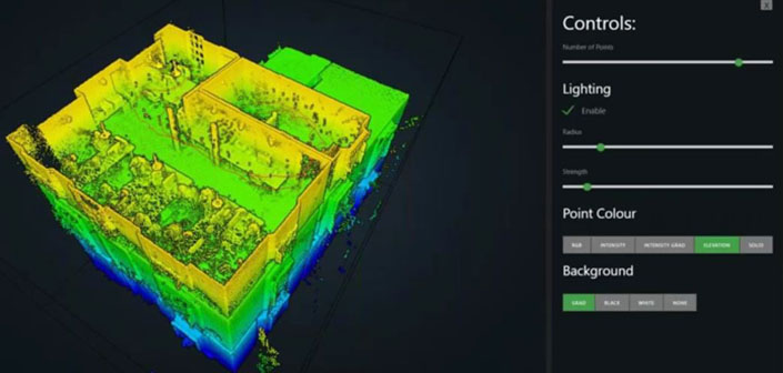
To help professionals collect rapid and high-quality results while saving time and money, UK-based GeoSLAM has been developing 3D geospatial technology solutions that provide accurate 3D mapping without the need for GPS.
Designed for the property sector, the ZEB PANO is GeoSLAM’s newest handheld, lightweight and easy-to-use SLAM scanner and panoramic camera. By featuring the company’s ‘walk-and-scan’ method of data collection used with previous scanners, the ZEB PANO provides accurate data and high-resolution photography, allowing users to create floorplans and property descriptions in no time.
Weighing 3.8Kg in total, the system features a datalogger with 90 minutes-battery, and 120GB storage; a 14 MP 360-degree panoramic camera with 19GB storage; and finally the scanner, which captures 43,000 data points per second at a maximum range of 30 meters, with an accuracy of 1 to 3 cm.
By simply walking around a room, the ZEB PANO captures the 3D data automatically and, when needed, the user can stop and trigger the panoramic camera to capture a 360º photo in 3 to 5 seconds. The camera needs to be in stationary to capture the highest-quality image possible, because “if you’re taking the 360º images while in motion, you’re going to end up with a lot of image blur, and it will be quite difficult to use and process the data”, said Michael Dutch, Global Product Manager at GeoSLAM.
According to the company’s website, the system uses the “leading SLAM algorithm”, which allows it to “automatically and accurately position panoramic photos” and create 2D and 3D property floorplans.
In order to process the collected data, GeoSLAM Hub is a software suite that transforms 3D point cloud data “into actionable information and valuable deliverables”. With a simple drag-and-drop system, the Hub syncs the scan with the panoramic images, providing users with a fully digital representation of the property within minutes. In addition, it creates hotspots for the panoramic pictures for contextual image referencing, and to provide users with “an interactive experience, allowing detailed floorplans and property descriptions to be created”. Also, the software allows users to plug into AutoDESK Revit and edit/create 3D models.
Furthermore, the ZEB PANO can work as an add-on to the ZEB REVO RT, another scanner from the company, to capture more data points and high-resolution imagery at the same time, and then merge that data using the GeoSLAM Hub.
“Working with GeoSLAM, and using the ZEB REVO RT, has already transformed the way we run our business,” said Boy van Houten, managing director of Zien24, the first adopters of the ZEB PANO. “We’re always looking for the next way to make the process of selling a house easier and quicker.”
The ZEB PANO is now available, and If you want to learn more about how to use the scanner and process the collected data, the company recently ran a webinar on those subjects.


