Right now, the National Geodetic Survey (NGS), part of the National Oceanic and Atmospheric Administration (NOAA), is undergoing a massive project that will have profound impacts on the surveying industry within the United States. For the first time since the late 1980s, the organization is working to modernize the National Spatial Reference System (NSRS), work that has, in some forms, been happening for decades but has really ramped up more recently. Now, they are starting to approach the end of this work, which is expected to be completed within the next couple of years.
At Geo Week News, we have been highlighting some of the work involved with this massive project, particularly through the lens of work being done by researchers in the Pacific Northwest, and specifically the Geospatial Center for the Arctic and Pacific (GCAP). We’ve previously looked at the modernization efforts from a high level, and more specifically about how this work will affect the world of bathymetric surveying.
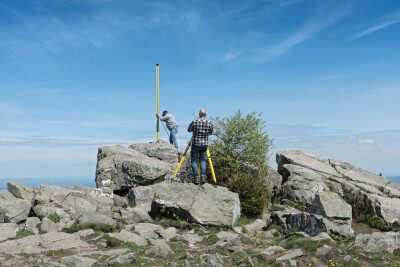
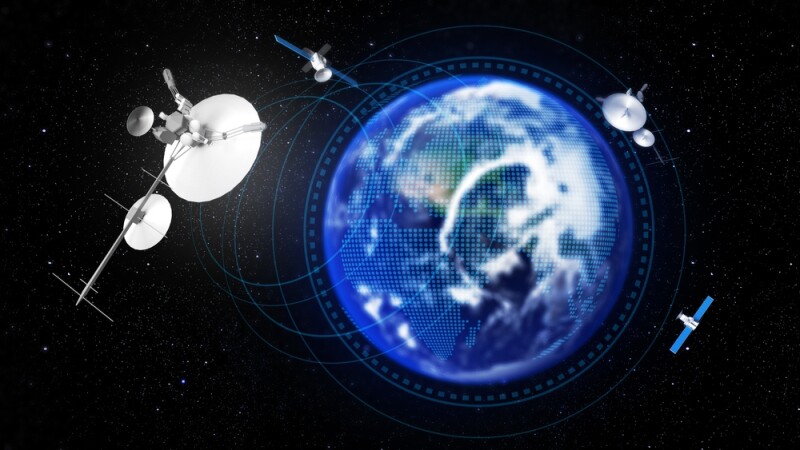
Today, we’re going to look at the modernization effort from another more specific lens, this time around GNSS. As we discussed in the first article within this series, GNSS is really at the heart of this entire effort, as satellites have transformed the way surveying can be done, a process that has only continued to grow as satellite launches become more accessible and more data is available. For this section, we spoke with Brian Weaver, an assistant professor and senior researcher with Oregon State University, Chase Simpson, a senior instructor of geomatics at Oregon State University, and Dan Gillins, Chief of Spatial Reference Systems Divisions with NGS.
Before getting into the specific work being done by the GCAP team around GNSS, it’s worth taking a brief look at the extent to which GNSS has altered surveying. In our first article from this series, NGS’s Galen Scott told Geo Week News that, shortly after the modernization effort in the 1980s is when GPS really started to become a viable, publicly available option for surveyors, and it was immediately clear that the industry would need to adjust. In some ways, this current modernization effort started at that point. Quite simply, the data from GNSS was noticeably more accurate than previous datums, and NGS has been trying to catch up since.
Gillins told Geo Week News, “GNSS has been such a disruptive technology. In my opinion, it’s changed just about everything we do at NGS.” Weaver backed that up, calling GNSS “the key to everything” in relation to modern surveying.
As we’ve outlined in some previous articles in this series, GCAP was given a series of eight “tasks” relating to this modernization effort to help achieve the objectives of a grant they received from NGS. Unsurprisingly given the importance of GNSS to the overall modernization undertaking, half of those tasks in some way fall under this umbrella. One of the big tasks, for which Weaver serves as the lead, was around the OPUS Projects, a service provided by NGS.
OPUS is at the center of much of this modernization effort, particularly when it comes to GNSS’ role in the project. OPUS, or the Online Positioning User Service, as explained by Simpson is “the method for users to access the NSRS. When NGS creates all of these tools and products for doing GNSS processing, it’s all being routed through OPUS.”
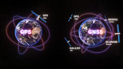
OPUS has been around since before this modernization effort really ramped up in recent years, but it’s only been taking in data from GPS satellites, not the entirety of the global GNSS systems. Right now, there are three different services within OPUS, with a static service, a rapid static service, and OPUS Projects. More recently, they’ve introduced a new version of OPUS, currently in beta, which includes multi-GNSS processing.
Gillins told Geo Week News regarding this new step for OPUS, “We’re building a new version of OPUS that can process data from BeiDou, Galileo, GLONASS, and GPS. Our expectation is that the results will be a little more accurate, you’ll be able to work in areas that have less satellite visibility than before, and you can hopefully just get more work done more efficiently.”
For GCAP’s part, in simplest terms the team is working to make sure that the new OPUS version works as intended. Weaver said, “NGS has done a lot of evaluations. Even for my master’s degree at OSU, we did a lot of evaluations with OPUS. But the OPUS version that uses MPAGES is a little bit untested. They did a lot of internal tests at NGS, but they would like to see some more concrete publications and statistically meaningful results, focusing on the hopefully improved performance with multi-GNSS processing, and also to confirm that the switch from that double difference approach to the single difference approach is working as expected.”
In addition to the work around OPUS, the other major project around GNSS with respect to the modernization effort is focusing on a service for real-time network alignment. More specifically, the GCAP team is working to create more automated processes for positioning reference stations in the real-time network.
Simpson said, “We needed to find a better way to update the positions of the reference stations in the real-time network. What we ended up doing was having a follow-on study that was really just diving into the ways that we can try to automate the process of computing new positions for these stations. Managing real-time networks can be pretty time consuming, mostly for the file management side of things where you have to compile all that data to get it into a standardized format.”
Right now, that work is largely localized to the Pacific Northwest, starting with a project for a service that can be used by the Oregon Department of Transportation. Eventually, Simpson says, they hope to grow things gradually to Washington, and then California, and gradually move east from there.
This kind of real-time network alignment service is something that is not currently offered by NGS, but it is something that they see as a value-add for the organization. In short, these RTN services are what aligns data with the NSRS, so there’s clear value from NGS’s perspective around this kind of service. Gillins said, “The idea of this real-time network alignment service or tool is it provides real-time network managers a way to help them make sure that their network is in the NSRS, and that the coordinates they’re broadcasting are correct. That way, everybody’s collecting data in the same datums and thereby referencing their work in the same system.”
These real-time network alignment services are provided by some network managers, whether it be public organizations like a DOT or National Park, or in the private sector. However, any service from NGS shouldn’t be viewed as competition, but rather a service for these network providers, according to Gillins. “We would just provide a service to them if they want to make sure that their network is in the NSRS or not.”
This work is extremely comprehensive, and as one would imagine with GCAP there is quite a bit of collaboration and overlap between these GNSS-related tasks on their docket. And it’s work that energizes the whole group, according to Simpson. “I was really excited when NGS released this geospatial modeling grant. I think it enables us to really push the work that NGS is doing, and push it on more of a national level of at least the GNSS side of positioning.”
To put it in relatively simple terms, GNSS is one of two main prongs of this modernization effort. There is the GEOID model, which Scott discussed with Geo Week News in the high-level article linked at the top of this page, and then there is GNSS. “If you try to really boil everything down into super nuts and bolts of what the modernized NSRS is, the two critical components of it are the GNSS and GEOID model,” Gillins said.