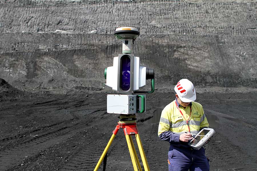
ADELAIDE, Australia – Maptek announced this week the release of its new I-Site 8810 laser scanner at the MINExpo even in Las Vegas. The scanner is an update of the I-Site 8800, already designed for long-range applications and with panoramic imaging capability, with new features that include a wireless link so that the scanner controller no longer needs to be tethered, a new interface and layout for faster set up, and battery life extended to six hours of continuous operation.
New onboard controls mean that the I-Site 8810 can be operated in the field with no other peripherals attached, according to the release, and optional onboard USB or tablet PC scan storage has been added to make data easier to handle. Also, “a fully integrated compass enables easier vehicle scanning and registration” and “a new calibration for the vehicle mount removes the impact of the vehicle on the compass, allowing uninterrupted capture of reliable data.”
Futher, “Operation is simpler with the one controller for both the scanner and GPS through an integrated GPS interface,” according to the release, “and the storage temperature has been extended to minus 40 degrees.”
One thing that hasn’t changed, is that “the Maptek I-Site 8000 series scanners are the only terrestrial laser scanners rated to IP65 for environmental protection,” according to a statement by Athy Kalatzis, global manager of Maptek I-Site laser scanning.
As for the data itself, according to the release, “Maptek’s new intelligent pulse algorithm automatically analyses the multiple waveform returns, giving the I-Site 8810 scanner an accuracy of 8mm out to 200 meters.”
For the back office, “The I-Site 8810 is teamed with I-Site Studio 4.0 software for faster processing. Dynamic scan manipulation and improved photo image registration are just a couple of features. Customised toolbars, point attributes and LAS import are all new to I-Site Studio 4.0.”


