If there’s a common thread to be found among the conference sessions at Geo Week, its that we’ve reached the era of “scaling up.” Projects are getting bigger and more ambitious, and digital twins and other geospatial technology are moving from single models to complex interconnected projects. And nowhere is this more obvious than at the opening keynote featuring the Dallas Fort Worth (DFW) International Airport. Serving 86.9 million passengers annually at a campus that is larger than the island of Manhattan and big enough to earn its own zip code, DFW airport is in a league of its own when it comes to the scale and complexity of their operations.
Presenters Adan Banda, Tarinia Shukla and Kelly Watt shared a case study of an unprecedented scale; with a central focus on the integration of technology across the DFW airport facilities and grounds. As if the sheer size of this undertaking wasn’t enough, the airport is facing a 20% growth rate in passengers, two major terminal construction projects, a new electric plant project and a litany of projects to address aging utilities. The airport also deals with rapid change and ongoing threats that require real-time information flow for decision process and collaboration. These challenges present excellent opportunities to leverage 3D visualization, AI/ML, and event-driven architecture to solve critical use cases supporting Utility Management, Terminal Operations, and Emergency Management.
Evolving Problems Require Interconnected Solutions
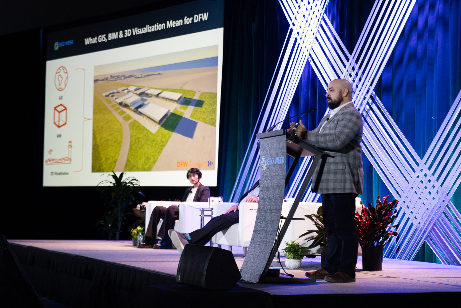
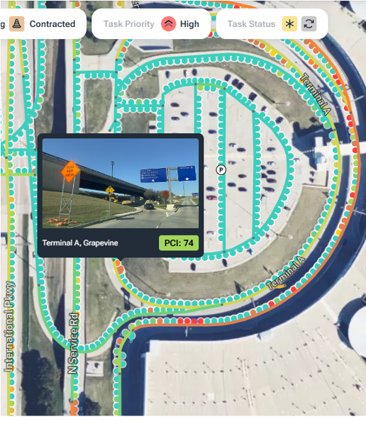
In their keynote, presenters showcased multiple use cases where integration between systems and across silos of data were crucial to their success. For the construction of on-site buildings, a combination of GIS, BIM and 3D visualization were leveraged to fine-tune designs before the building sections were pre-fabricated to be painstakingly assembled on-site. In another example of integrated technologies, vehicle cameras were paired with AI systems that could map airport roads in real time, enabling more rapid deployment and automated actions within the system to alleviate or address traffic or other incidents.
 The team has also worked to implement integrated systems that can generate alerts for Advanced Warning And Response Exchange (AWARE). By ingesting connected data from flight schedules, traffic, weather, tollbooths, parking data, FAA incidents, the AWARE system is being developed with the hopes it can become a unified data platform. These real time inputs can yield predictive analytics, and will eventually be able to prevent roadway congestion before it occurs, ultimately optimizing passenger flow through key areas.
While technologies like GIS, BIM, lidar and smart sensors are touted as solutions for these challenges, when it comes to integration and adoption of these systems, there’s a lot more to consider.
The team stressed that it is crucial to make sure that they know the use case that they need a tool for before committing to a certain piece of technology - and to make an effort to match the tools to the ultimate needs. One example where this came into play was when a SLAM lidar scanner was used in place of traditional surveys to get a 3D picture of sightlines for placement of cameras and other stationary lidar sensors. While it would have been typical to just send a survey team to do a traditional survey, when the final outcome was considered, the SLAM scanner was a better fit, because of the end goal of the data’s use.
Understanding Stakeholders' Needs Before Tackling a Problem
In addition to considering the use cases and ultimate goals of data collection or certain steps on a path to integration, the idea of involving stakeholders was stressed. At the end of the day, speakers explained, no one wants to spend the resources to create a tool that end users don’t want to use, or that solves the wrong problem. The team recommended avoiding only involving stakeholders at the end of implementation, but to take the time to truly understand their needs in the first place.
“They have to be involved with the process,” says Watt, “It has to be their idea.”
“From an IT perspective, IT is there to support,” added Watt, “But really the business problems are their business problems, and [end users] need to own the end solution. It is really, really critical they have involvement, they have the ownership and they’re guiding the process, not just showing up at meetings.”
By involving the end users, integration and digitalization teams can avoid the pitfalls of creating a dashboard or solution that doesn’t improve over previous methods. That might involve more in-person meetings, research, and having end users involved in the development process, but understanding their needs has a long term benefit.
DFW Airport’s keynote made one thing clear. Successful technology integration isn’t just about adopting the latest tools—it’s about connecting those tools to real-world needs. In an era where airports and infrastructure projects are scaling up at unprecedented rates, DFW’s approach serves as a model for balancing digitalization and integration with real-world applicability and practical use.
By prioritizing open systems, stakeholder collaboration and problem-centric approaches, the team at DFW are demonstrating how large-scale operations can bring together a variety of cutting-edge geospatial technologies (everything from GIS to real-time people-counting lidar) without losing sight of what the data collection is all for. Their commitment to integrating GIS, BIM, AI, and real-time data analytics isn’t just about efficiency—it’s about creating a smarter, safer, and more adaptable airport for the future.
Just as Geo Week highlights the growing need for interoperability and cross-disciplinary solutions, DFW’s success story reinforces the importance of breaking down silos and ensuring that technology serves real stakeholder needs.