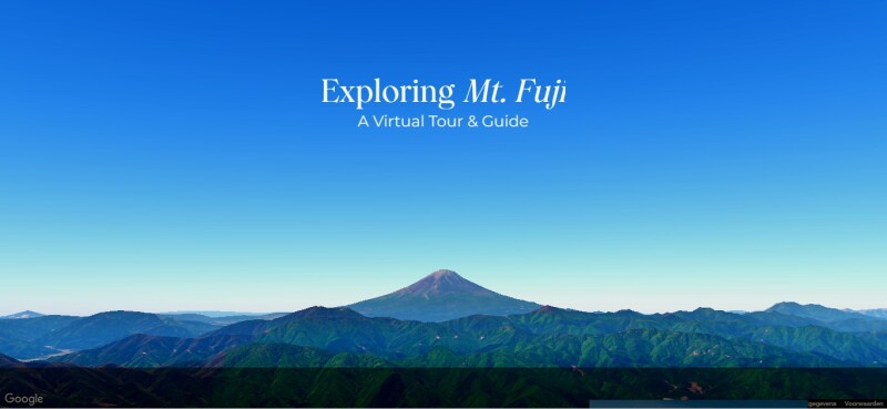
In October, Google launched the Google Maps Platform Photorealistic 3D Maps Challenge on the software competition platform Devpost. Two months later, the winners of the challenge were announced. According to Google, 1,750 participants spanning 160+ countries participated in the hackathon to build unique, immersive experiences using Photorealistic 3D Maps in Maps JavaScript API. A Google blog post provides an overview of the winning applications.
The submissions had to include one or more of the following elements: gamification, 3D map elements, user experience, and both AI and geospatial integration to enhance the functionality and capabilities of the 3D map experience. Projects were submitted in three categories: location discovery, immersive marketing, and built environment and sustainability.
Three Winning Applications
The winning submission, named Daryaft, is an interactive travel guide website for Mount Fuji that allows users to explore the mountain's trails and surroundings using a 3D map. The project video shows the different trails in 3D when the user scrolls from top to bottom on the website. Below, 3D city models show spots where to experience Mount Fuji’s beauty, such as Minato, Tokyo. The website developer, Ziya Uddin, also shares the difficulties during the development process.
The prize in the category “Best of Immersive Marketing” was won by an application called “City of Mural Arts”, which brings Philadelphia's vibrant mural art to life in a realistic cityscape enhancing the immersive experience. The website leverages Google Maps' 2D and 3D views, and offers a “gamified, interactive experience that encourages users to explore, collect, and engage with the city's public art freshly and dynamically”.
Another winning submission incorporates geospatial datasets: the Storm Vision application created by A. Duncan. Providing advanced situational awareness to users before and after a hurricane, it visualizes peak storm surge and wind fields in 3D, which makes for “a more engaging and emotionally resonating way for users to engage with this critical information and personalizes the experience so that users can explore locations that may be affected in a storm that are crucial to their way of life”, according to the website developer.
The Current Mapping API Landscape
The availability of creating immersive 3D mapping through Google’s Maps JavaScript API was announced in the summer of 2024. This capability gave Google Maps Platform developers access to a real-world canvas to build on with Google’s rendering technology. The Google Maps API is one of several options in the mapping APIs market today: Mapbox, Esri, HERE, Cesium, and others also offer mapping APIs. Each one targets specific use cases, including navigation, real estate, gaming, and more.
At the time of writing, the Photorealistic 3D Maps feature in the Google Maps JavaScript API remains in experimental release, which means that while developers can access and utilize this feature, it is still under active development and may undergo significant changes.


