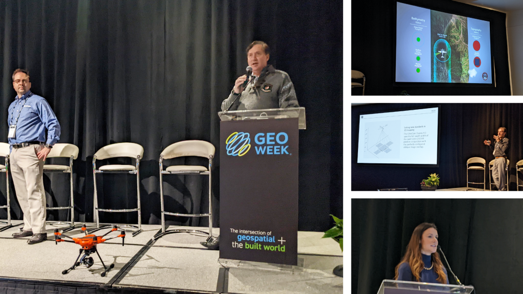
One of the highlights of Geo Week are the product preview presentations. In these rapid-fire sessions, exhibiting companies can showcase their latest wares announce their latest products, and, sometimes, introduce themselves to new audiences.
So what types of products were highlighted? Everything from scanners to subsurface utility detection to drones to algorithms… and more. While the descriptions below don’t capture every presentation, they provide a taste of the scope of the myriad solutions presented at Geo Week.
RIEGL
RIEGL provided updates around their efforts to increase efficiency and usability that directly impacts user productivity. RIEGL defines this productivity in terms of economics and flexibility. The productivity that the miniVUX series enables has been detailed in multiple places, but it is now offered at a more reduced, entry level price. Reductions in price range from 13-33%. For mobile systems, the VMY-1 is a new entry-level mobile mapping system. It was built for multi-purpose capability for low-cost mobile and UAV system usage.
Geo Week also provided RIEGL with a chance to highlight their ALS product portfolio, their topobathymetric surveying systems and RiACQUIRE, which is the RIEGL embedded web application that is accessible via any browser. All of their kinematic solutions are designed to be the choice for productivity and efficiency.
Woolpert
Woolpert, who started as local engineering and surveying company over 100 years ago, also had topobathymetry on their minds and in their talk, featuring BULLDOG, their next-generation topo-bathy sensor. The new sensor came out of a challenge of sorts. Current topobathymetric sensors have to be flown at relatively low altitudes, and the question was - how high could a sensor be designed to fly? The results are impressive, and the new sensor creates a swath 856.7 meters in diameter at 10,000 feet.
FARO
Back on dry land, FARO made an announcement that will delight its customers who have been asking for it. The Focus Swift, FARO’s mobile mapping solution, now has the capability for anchor scans and for color capture. With FARO’s new workflows, users now have the option for pausing for between five and 25 seconds to do what they are calling an “anchor scan” to get a high definition scan very quickly during mobile mapping sessions. The new color capture capability for the Swift, which will be available starting today, uses the Ricoh Theta Z1 panoramic camera, which is the same camera that the Focus has integrated with previously.
Yuneec
The opportunities that drone data can open up in the enterprise have been well documented, but what does it mean to take advantage of these opportunities when connecting the hardware to the software? The Enterprise Typhoon H520E/RTK from Yuneec is designed to operate autonomously to collect data that fuels numerous enterprise workflows. What does it mean to process all of this data though? This is where the Skyline connection for Yuneec comes in, as Skyline provides everything users need to produce, store, analyze and share high quality 2S & 3D geospatial content. The companies have partners to work with various engineering firms, local governments, and utility companies. Their software measures in full 3D to enable precise measurements and change detection.
Blue Marble Geographics
Blue Marble Geographics is a Maine-based company whose software is focused on allowing users to access raw point clouds for a variety of purposes that make sense for them. At Geo Week, Global Mapper Pro and Global Mapper were highlighted in a big way, which power users with numerous new and enhanced data processing and analysis tools. Released back in September, Global Mapper Pro allows users to isolate certain point clouds based on their spectral graph partitioning. Once exported, these point clouds can be utilized as something users specifically need for their project or workflow. Details about their advanced workflows were also fully explored. Global Mapper Pro is ultimately designed to allow users to use these 3D and digital assets themselves rather than having to outsource or rely on 3rd parties.
Vexcel
Vexcel showcased their UltraCam and aerial cameras solutions at Geo Week. The Ultra Eagle is the flagship model with 26,460 pixels across that captures the smallest details with an ultra-large footprint. It was the first camera to feature user-exchangeable lens system, accommodating different altitudes. The Ultracam Osprey enables new perspectives on 3D aerial mapping. It uses the full swath width of the nadir cone in conjunction with the perfectly configured oblique image overlap. Highlighting what’s new, Vexcel recently introduced Adaptive Motion Compensation (AMC) exclusively for 4th generation UltraCam aerial sensors. The Ultracam Condor can capture large regions in record time thanks to 48,462 pixels across the flight strip, which makes it ideal for wide-area mapping projects.
Z+F
Z+F USA highlighted what’s new at Geo Week as part of their product preview. The Z+F Profiler 9020 provides users with cleaner, more detailed data when compared to previous products. The improved range noise is notable to users while also being less susceptible to overexposure. A new feature called the AxisInspectuion Tool will allow users to correct their scans for optimized results. The 5016A is a new feature that stands for “advanced.” It’s been about five years since the 5016 has been released and these advancements represent an increase in the data acquisition rate, new IMU tilt and improved tracking.


