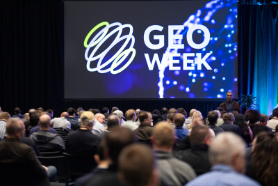
As is the case most years at Geo Week, the final day of this year’s event kicked off with a plenary featuring representatives from the United States Geological Survey (USGS) to give an update on their 3D Elevation Program, known as 3DEP. They are nearly 100 percent of the way to baseline completion, and as they pointed out throughout this plenary session they are already working on the next generation of 3DEP. The session included the following speakers, all from USGS:
Jason Stoker, Physical Scientist
Brian Hadley, Elevation Data Acquisition Lead
Walter Kloth, Commercial Partnership Lead
Cindy Thatcher, Geographer
This year’s plenary included updates from all four presenters on various aspects of the 3DEP work and got started with a few words from Stoker about how important events like this are.
“Conferences like this really help keep us going and reinvigorate us,” he told the crowd. “I get re-energized every year. When we're going through the grind of what we do day-to-day, come back and feel all the energy that you all provide here at the conference, all the enthusiasm, and getting all the questions and the appreciation. Especially at times like this, it means a lot to us to feel valued and feel work.”
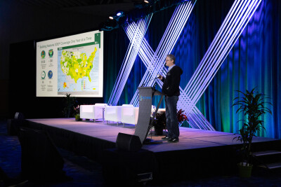
Following those open remarks, Hadley took to the podium to address the general updates for 3DEP, though he acknowledged that there wasn’t a ton about the coming year he could share in specifics as they’re still waiting on appropriations from Congress. That said, he did note that, at this point, 98.3 percent of the nation has been collected for the project, which he shared amounted to some 70 trillion points for the lidar data.
Hadley also discussed some of the various use cases that this 3D data can and has been used for, including in response to natural disasters like Hurricane Helene and the recent wildfires in California. Additionally, he looked to the future a bit, touching on some of the next-generation ideas for the project. Included in the next generation was a reduction in update frequency for the continental U.S. from eight years to five years, the incorporation of bathymetric data – more on that soon – and a slight uptick in annual costs of about $110 million but a massive uptick in benefits of nearly $7 billion.
Following Hadley’s presentation, Thatcher took the stage to talk more specifically about the hydrologic and topobathymetric work that is being incorporated into 3DEP. She talked about the importance of this work being incorporated into this overall data, noting that when the 3D Hydrological Program 3DHP is fully implemented, they estimate it will provide more than a billion dollars in benefits to federal, state, local, tribal, nonprofit, academic sectors on an annual basis.
One of the most interesting updates to come out of this presentation, and something that Thatcher described as “game-changing,” is the concept of addressing the hydrographic data.
“That enables users to link water information to specific locations on the hydro network, all in a 3D space,” she told the plenary crowd. “And so here the 3D aspect of 3DHP provides information about the exact path of the river’s flow, and allows you to summarize features and X, Y, and Z position on the stream network and have everything flow in the proper direction. Then the geospatial community can use the HydroAdd tool to attach their own data to the 3DHP network.”
For the third presentation, Stoker took to the stage again, this time talking more about the next generation of 3DEP and looking toward the future of this work. He noted that the 3D National Topography Model, or 3DNTM, is their “North Star,” with that integration of both topographic and bathymetric data into one system. One of the crucial pieces Stoker says they have been working on is integrating data in a way that makes sense.
He also talked about some of the changing focuses that the organization is starting to hone in on, saying that they are shifting from a “mapping paradigm to a monitoring paradigm.” He said that with this data now being available in three dimensions, he sees change detection becoming a critical application that they need to keep in mind. To hammer this point home, he showed some data from the recent California wildfires and how that area changed before and after the disaster.
Finally, Stoker talked about the need for a more multi-modal approach from USGS. He noted that, in order to really achieve the goals of 3DNTM, they need to start bringing in different types of data. That means, in addition to the typical surface lidar they utilize, they also need to look into satellite data for more frequent data refreshes. For finer resolution collection, they need to start bringing more UAS data into their portfolio.
“We know that other agencies have been collecting this type of data, and so we've been working on this concept of the three-nation ecosystem, which is a data mesh concept, where we can start making available partners’ data, other agencies’ data, and integrate that in a way that we can share it without the user having to go to seven different portals to find it themselves.”
The presentations then ended with a quicker talk from Kloth, who spoke about contracting. USGS relies on a lot of outside agencies to collect much of their data, and as he explained they work with multiple vendors on contracts – right now, it’s 10 contractors – that go back up for competition every five years. Right now, they are in the midst of the third year of their current contract, which means they are gearing up to start working toward their next contracts.
While he was not able to share too much about these upcoming contracts, and emphasized that he wouldn’t be able to answer specific questions from interested parties just yet, he did make a few notes about what they are looking for. Perhaps most notably, he built off of what Stoker was saying about needing a multi-modal approach, saying that they are looking for that “other” type of data in their next contracts as they look toward future goals for the organization.
There was so much more than we could put in these pages within this session, and they’ll be back next year for even more updates on 3DEP.