In the early morning of March 26, 2024, a tragic incident took place in the Baltimore Harbor when a nearly 1000-foot cargo vessel struck the Francis Scott Key Bridge, causing it to collapse. The tragedy resulted in the loss of six lives and disrupted one of the major commercial ports of the United States’ Eastern Seaboard. While the recovery and reconstruction of the area is still ongoing nearly a year later, a swift and effective response was needed to help clear the area and begin that rebuilding process.
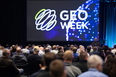
Any major incident like this is going to require expertise and action from a variety of agencies and organizations, all with different areas of expertise. The geospatial community will of course be heavily involved in any type of response like this, and that was the focus of Tuesday’s keynote presentation. Moderated by the United States Geospatial Intelligence Foundation (USGIF) CEO Ronda Schrenk, the session included commentary from the Army Geospatial Center’s (AGC) Jeremy Wasson as well as Mike Aslasken from NOAA’s National Geodetic Survey (NGS).
The keynote started off with some words from Schrenk, who set the stage for what the presenters were going to be discussing in their portions of the session. She talked about her personal connection to the incident, living not far from the area, and how the wheels started turning quickly after allision. Crucially, she mentioned how important collaboration across disciplines is for this kind of work, which set the scene perfectly for the presentations to follow.
Wasson took the stage first, and he started his talk by discussing his place in the story, which started roughly a week after the incident took place. He was in town on other business, but received a call from someone working on the response asking for the help of AGC. He immediately said yes, found a partner from AGC, and made his way to the command center that was created inside what is normally a cruise terminal.
Wasson talked a lot about that idea of collaboration, particularly in the context of what he is used to coming from the Army. In short, it was a different experience than he was used to, one that was more collaborative, without a clear leader.
“Coming out of the military, somebody’s always the boss, right? All these people are in charge? How is that productive?” Wasson wondered. “But it truly was. It was remarkable to see shared leadership; it’s a unique thing for me, and it was impressive to see.”
Wasson talked about how blown away he was by the amount of data sharing and collaboration, noting that there was often overlap between what was being collected and shared. As he pointed out, though, it’s always better to have too much data as opposed to too little.
Ultimately, Wasson’s biggest takeaway was two-fold. One, as noted above, was the amount of collaboration from different agencies and organizations working together for one common goal. It was something he hadn’t encountered before in his normal work. Likewise, the kinds of data he was utilizing were not what he was used to. Specifically, he called out some of the sonar data collected around the site being at a quality that he had never encountered.
Following Wasson’s presentation, Aslasken took the stage to discuss the incident’s response from NOAA’s perspective. He reiterated a lot of these same points, emphasizing even the cross-disciplinary collaboration that took place within NOAA and with outside agencies. He talked about the National Weather Service actually being the first entity there, and were waiting for the other entities to whom they could give their weather advice. Ultimately, they were able to bring together data from NOAA and the Coast Guard into a single place for everyone to see.
“This is probably the first time that we’re aware of, where we were able to link NOAA and Coast Guard into a shared ArcGIS environment.”
Aslasken went on to talk about how normally this is an extremely arduous process that takes a lot of effort from everyone involved. This shared environment certainly took a lot of work as well, of course, but the end result was that shared web services for everyone across the local, state, and federal responses. While this was obviously a tragic event, he said that this lesson has been taken forward for future responses, including the recent aircraft collision in Washington, D.C.
The keynote then wrapped up with a short question and answer, led by Schrenk, in which Wasson and Aslasken reiterated some of their points and talked about their biggest takeaways. For the former, it was largely that collaboration piece and seeing the value that comes from unified approaches to this kind of crisis. Aslasken, meanwhile, talked about taking these lessons from a tragic event and applying them down the road, hopefully leading to even speedier, safer, and more efficient recoveries in the future.