At ILMF 2016 and 2017, the hot topics were Geiger-mode and single-photon lidar (GML and SPL). These two related (but distinct) technologies debuted with promises of a dramatic increase in point density for aerial lidar collects, a serious uptick in wide-area mapping efficiency, and, of course, lower costs. Two years later, a few big players have had hands on the technologies and put them through their paces. Where do they stand today?
To find out more, we caught up with Dr. Qassim Abdullah, chief scientist and associate, geospatial services at Woolpert, and Dr. Jason Stoker, physical scientist and the chief elevation scientist for the National Geospatial Program at the USGS, to find out where the technology stands in a five primary areas.
- Dr. Jason Stoker, USGS
- Dr. Qassim Abdullah, Woolpert
1: Accuracy
When GML and SPL debuted on the wider market, many pointed out that the gain in data density over traditional, linear-mode lidar came at the cost of accuracy. Has that proven to be a real problem?
“The increased density is what these new sensors have been highlighting, and we have few concerns about them producing dense point clouds,” says Dr. Stoker of the USGS. “After further review, in general I believe they have the ability to meet our QL accuracies—however, as with every lidar collection we have been a part of, regardless of technology, issues of accuracy must still be reviewed on a case-by-case basis.”
In fact, Dr. Stoker explains, some key factors in achieving adequate accuracy aren’t even the sensors themselves. “A big component needed to meet our accuracies has to do with the quality of the ground-control survey, for example—something completely independent of the sensors.”

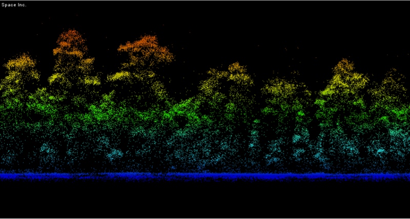
Sigma Space single-photon data of trees
2: Attribute data
In 2016, some industry experts argued that GML and SPL offered less complete attribute data than linear-mode lidar. Has that changed?
When we asked Dr. Abdullah, he zeroed in on one attribute in particular: intensity. He points out that GML was able to offer intensity data at its introduction to the market, and that SPL has since advanced to the point where it can return intensity data as well.
When we asked Dr. Stoker if these new technologies offered the right attribute data for the needs of the USGS, he had a somewhat more complex answer. “SPL, to us,” he said, “seems to be much more analogous to linear-mode lidar, compared to GML. The big difference we have seen is the increase in high and low noise points that need to be filtered out.” In other words, SPL is interoperable.
On the other hand GML data is more similar to photogrammetry or structure from motion data, says Dr. Stoker. “Many attributes we require now in our base specification on the LAS file format specification still do not really work as it relates to GML. We are working with ASPRS and OGC on new ways to cross-reference and possibly even store GML that may be more efficient than shoehorning it into LAS.”

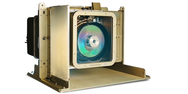
A Harris geiger-mode sensor.
3: Data processing
The high density of the data gathered by SPL and GML results in very large datasets, and that can represent a challenge: How do you approach processing? But it’s not just data volume that causes problems, explains Dr. Stoker.
For SPL, he says, “the data is very similar to linear-mode lidar, simply with more noise points,” so the question becomes, “how do we handle and or manage these noise points? There may be some signal still hiding in the noise, but is it worth storing data sets that have so many noise points? If we ask the vendor to delete them before delivery, are we losing information that we may want to mine later?”
The story is similar for GML data, which USGS receives from vendors with the noise removed in pre-processing. With that data, Dr. Stoker explains, “the challenge is that we have no insight into what was removed, or understanding of why some points appear in some areas of the dataset, but not in others.”
That means USGS has taken an iterative approach with their GML provider, who adapts the filtering to meet their needs. “Proprietary filtering algorithms can produce great results,” he says, “but we are really looking for greater understanding of where & how the data are produced, not just a black box system.”
4: Cost and availability
Dr. Abdullah says that the economics and hardware characteristics of these sensors have not changed significantly since they were introduced. That means they are still best suited for wide-area collects, and not small engineering projects.
On top of that, vendors are still limited to Harris and Sigma Space. He points out that Ford’s acquisition of Princeton Lightwave was important, “as they were the only commercial entity offering such sensors for the geospatial community. There are smaller players in the market, but they did not make it to the geospatial industry yet, it will be a while before such a gap is filled.”

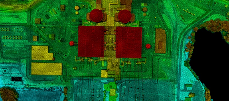
A sample of Sigma Space single photon data
5: Maturity
When a technology is introduced to the market, it takes time to mature. That happens as vendors come to understand the needs of their users, but also as users educate themselves about the proper application of the new technology. Only once both of these tasks are complete can the technology reach its full potential. So, how is it going?
Dr. Stoker says that working with vendors has helped the USGS to really understand the data, and given the vendors a chance to better understand how to serve their customers. The iterative processing he mentioned in the above point illustrates this point well.
User education is a somewhat different story. “To me, it is still a work in progress,” says Dr. Stoker. “We (USGS) have yet to publish any of the GML or SPL data we have contracted for, yet, as we are still putting the data through our rigorous QA process. I’m hoping we get data out to the community very soon so people can download it, kick the tires more and see for themselves the differences, the pros, the cons.”
Once the data gets out, he hopes we’ll start to see great improvement in the way that geospatial users apply GML and SPL, as well as developments in filtering and processing methods, especially from the academic sector. “I think we’re still just scratching the surface as to what the potential of these instruments is,” Dr. Stoker says, “and what the future may hold.”


