As we sit here in mid-August, we find ourselves square in the middle of hurricane season for the Atlantic, which runs roughly from the start of June through the end of November. Just last week, much of the East Coast of the United States was hit by Hurricane Debby, which tragically left eight dead and caused extensive flooding and damage throughout its path, running from Florida up to New York. As we publish this story, Hurricane Ernesto just knocked out power to a significant portion of Puerto Rico, and projections indicate it will gain strength as it heads toward potential landfall in Bermuda.
These kinds of storms are part of life in the Caribbean and along the East Coast in the United States, particularly in the southern half of the coast. According to scientists at NASA, climate models indicate that these storms will only become consistently stronger in the coming years due to the effects of climate change. Because of this, localities can expect to deal with more frequent and intense flooding, which in turn means the upkeep and structural integrity of infrastructure like floodwalls is critical for cities and counties in these oft-affected areas.
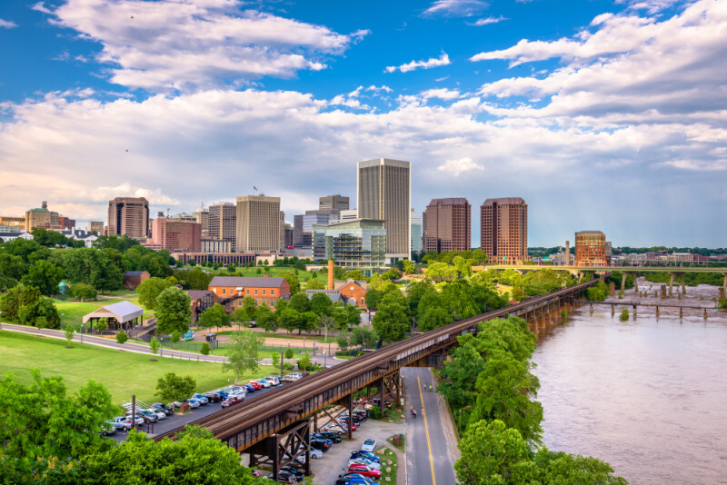
Richmond, Virginia isn’t necessarily in the heart of hurricane activity like cities in Florida or others along the coast of the Gulf of Mexico, but their position in the Southern United States does put them in that path enough for it to be a concern. In fact, they were in the path of the aforementioned Debby, at that point a tropical storm. Recently, Geo Week News spoke with GoMeasure3D’s Paul Motley and Art Pekun – the company’s COO and Application Engineer, respectively – about how they’ve tested the use of 3D scanners on Richmond’s floodwall and some of the benefits that presented themselves.
Although Richmond is not directly on the coast – the middle of the city is a little under 100 miles from the ocean – their location on the James River and that proximity to coastal communities does leave the area vulnerable to flooding. To counteract that, in 1995 the city finished construction of their floodwall. In total, the wall is about 3.28 miles long, reaching 25 feet in height, and is made from 22,000 cubic yards of concrete, 1,050 tons of reinforcing steel, and 55,000 linear feet of steel piles. In part thanks to this wall, Richmond says that their last significant flood was in 1996 due to a blizzard that winter.
For the GoMeasure3D team, their work scanning the floodwall in Richmond was not official work with the city, but rather began as a “proving out” of a new Artec 3D scanning system, the Ray II. In addition to that tripod-based long-range scanner, they also incorporated the handled Leo scanner into the work as well.
As Motley and Pekun explain, the combination of the two scanners works well for this kind of workflow. Using the Ray II, they were able to capture the entirety of the wall relatively quickly, with the handheld Leo scanner used to capture more detail of smaller areas. Some of these smaller areas were identified ahead of time – for example, they know scanning a door would be important even before scans – while they can also go back after finding potential anomalies from the larger scan.
The benefits to this kind of workflow were immediately clear to Pekun. He relays that traditional workflows for this work would generally take a couple of days by taking pictures and physical measurements, but with this scanning workflow they were able to complete their scanning of the entire wall in just a few hours. That speed is the biggest component about what using this combination of scanners adds to the job, but Motley also relays that their civil engineering customers also look to this workflow to reduce human error. Pekun also points to the ability to “repeat measures as accurately as possible” as another benefit.
In terms of the results, Motley didn’t find anything particularly notable – which, as he pointed out, is probably a good thing for a floodwall – but Pekun did make one note. He was “surprised by how quickly I could take a flat plane, like a CAD object, and fit it to a part of the wall and then inspect it by clicking a button.”
As noted above, potentially dangerous storm surges are already becoming more common in areas affected by hurricanes, and that increase in intensity is only expected to continue based on our climate models. At the same time, staff for maintenance and inspections are becoming smaller as the AEC industry ages, so municipalities need a way to ensure their infrastructure is sound with shrinking workforces. Technology is a way to fill in those gaps, and for floodwalls in particular laser scanning workflows like the one used by the GoMeasure3D team can help get more detailed information in less time as compared to more traditional methods.


