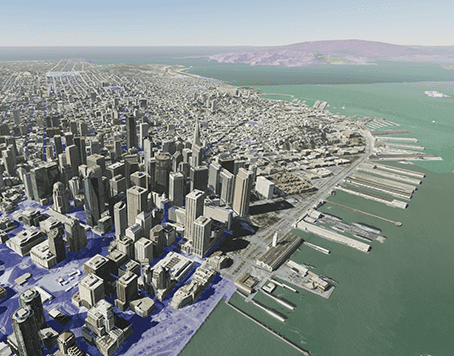
Over the last couple of decades, and more emphatically over the last five to ten years, we’ve seen a rapid development in 3D technology in the GIS world, with better quality than ever before. That, along with the growing speculation and building of the metaverse, in which geospatial professionals figure to play a central role, has created an unlikely bridge between the GIS and gaming industries, with the latter’s 3D technology increasingly being involved in the GIS world. Recently, perhaps the biggest name has announced new software development kits (SDKs) with two of the biggest names in gaming engines. That would be Esri, who recently launched an ArcGIS Maps SDK for both Unity and Unreal Engine. Both are available as a free download for users with an ArcGIS Developer or ArcGIS Online account.
While these engines were obviously built for the purposes of gaming experiences at the outset, recent years have seen a number of industries start to utilize these kinds of technologies into their own use cases. In Esri’s case, they took the task extremely seriously, saying they started the process of working on these SDKs in 2019, ensuring maximum ease of use in working with real-world data in these game engines. With these SDKs, developers can take advantage of their own data for large-scale or more local projects, and can also utilize live services from repositories such as the ArcGIS Living Atlas of the World.
Esri calls out a number of different industries and use cases that can benefit from these SDKs, too. That includes everything from AEC workers, to those in defense, public safety, natural resources, and urban planning. Generally speaking, these SDKs are ideal for users who need to monitor projects and/or run simulations. This also should theoretically lead to better collaboration, especially in this era of more remote work. Rather than having to gather at a site, for example, AEC workers can model their project in realistic and accurate 3D engines and collaborate while looking at a detailed model from remote locations. These SDKs can also be used by developers to build experiences in augmented reality (AR) and virtual reality (VR) spaces.
This kind of immersive and realistic experience with GIS data has the potential to be a game-changer for all of these different industries, and continues an exciting trend of improved 3D technology and a growing number of use cases. One of the early adopters of this new SDK with Unity has been construction firm CIMIC Group, whose General Manager of EIC Activities Simon Bowles likened this to a “flight simulator for construction.” The firm uses ArcGIS for Unity to create an interactive and dynamic digital twin of their construction site, allowing for an easy way to track large-scale projects and seeing potential clashes before they take place.
Adding in these game engine plug-ins is part of the continued development of ArcGIS from Esri, long among the leading platforms for GIS professionals. At the company’s UC 2022 conference last month, they highlighted their ongoing shift towards big data for the product, making advances not only in this visualization aspect but also looking to add more in the way of analytics and artificial intelligence. They also recently unveiled their new GeoAnalytics Engine to this end, a software library of over 100 tools that can be used to perform spatial analysis on large data sets and then move the results into ArcGIS. Esri founder and president Jack Dangermond pointed out at the conference that the amount of data is so large that it can be hard to take it out and put into a GIS, an issue solved by these tools.
It’s undoubtedly encouraging to see one of the leading companies and software packages in the industry continue to develop in this way as the technology in related spaces improve at such a rapid pace. Users are certainly going to be able to benefit in major ways from this new plug-in around Unity and Unreal Engine, along with the other initiatives around big data. And in terms of gaming companies partnering with all sorts of different industries, and the GIS world specifically, it’s likely fair to assume we’re only at the early stages of that mix.


