Performing flood simulation with GIS is nothing new. Maps and spatial data have been used for years to show where flood-risk areas are located, and what the impact is on populated and natural areas in case of flooding. The result was always a 2D map or a series of 2D maps in case of different scenarios. Auto-generated 3D animations inside ArcGIS Pro now make it possible to see the results of different flooding scenarios without having to run scientific spatial tools and models manually.
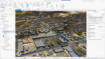
ArcGIS Pro’s new flood simulation functionality is an interesting new way of making use of 3D visualization and modeling to model, test, and visualize how water flows and accumulates based on a set of parameters. It also combines animations with 3D maps in a dynamic way, rather than running resource-intensive geoprocessing tools that manipulate spatial datasets and result in static map output. Instead, it uses 3D elevation surfaces and buildings to realistically model water flow.
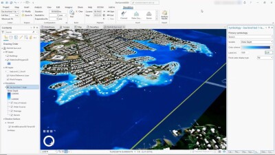
The addition of this new functionality into Pro is also very timely, as climate change forces spatial planners to deal with the effects of heavy rainfall, melting glaciers, and rising sea levels. In addition to creating different flood scenarios, the functionality allows for analysis of the results and exporting visuals of the different flooding scenarios as raster images, to be used as GIS maps for further analysis, or visuals for reports.
How it works
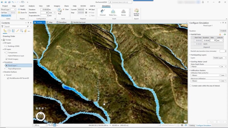
Multiple behaviors can be configured, for example how water is added through rainfall, water source points (such as rivers), and initial water depth. Second, users can configure how barriers and channels redirect water flow, and how water is removed by infiltration or evaporation.
Any user-created flood simulation scenario is stored locally and can be run as an animation of flowing water in a static 3D map. These are created by scanning each cell inside a user-defined area of interest. Next, an elevation surface raster is added based on the resolution of the scenario. This raster is sent to the GPU, where visual blue water is added to the cell based on the flooding type defined in the scenario. The updated distribution of water is rendered on top of the content in the 3D map after each calculation, resulting in a single “frame” of a longer animation.
After creating and running a scenario, the user can adjust parameters such as to create new scenarios, or by adding elements to the map that might influence existing scenarios, such as dams. Pro enables users to add raster layers to define the depth and infiltration rate before running a scenario, making the results more reliable and realistic. Additional symbology is available to visually enhance the results of a flood simulation.
Learn more
The new flood simulation functionality is available with an Advanced license of ArcGIS Pro 3.3. This web page includes a video that shows multiple new features of ArcGIS Pro, starting the new flood simulation functionality. The online documentation for flood simulation inside ArcGIS Pro is available here. It includes a page on common flood simulation workflows, such as storm modeling with rainfall rates that vary over time, modeling the controlled venting of a dam, or reviewing potential futures from a partially flooded state.