DJI released an update of its DJI Terra software, its mapping and 3D modeling software. DJI Terra converts aerial data into 2D maps, 3D models, point clouds, and terrain reconstructions. It is used by GIS and mapping professionals for topographic mapping, and in construction, agriculture, and public safety applications.
DJI Terra covers both laser scanning and photogrammetric imagery processing. For lidar, it provides support for point cloud processing, terrain classification, and DEM/DSM generation. Lidar data processing capabilities were first introduced into the software in October 2024, in version 3.9.0. Subsequent updates introduced new capabilities that build on existing capabilities.
Lidar and visible light fusion reconstruction feature
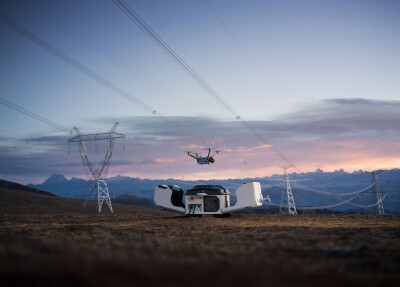
One notable recent feature is the fusion of lidar and visible light feature, which was introduced in v4.4.0 in January 2025, and combines lidar and RGB imagery for enhanced 3D reconstructions of complex hollow structures such as pylons or bridges. This new feature is introduced in a short online video.
DJI Terra also recently added support for direct PPK correction processing for the DJI Matrice 4E, which until then required third-party software. PPK enhances UAV geolocation accuracy by correcting satellite carrier phase observations using data from a nearby base station. It does not require a real-time connection between the drone and the base station: the corrections are applied after data capture by the software. This makes it ideal for BVLOS missions.
Performing subject-based photogrammetry
In addition to PPK support, DJI Terra enhances 3D reconstruction with the Matrice 4E. This drone supports DJI’s Smart 3D Capture functionality, which is a flight to route intended for “subject-based photogrammetry,” or “capturing surfaces with any slope and orientation in 3D space.” DJI Terra is now better equipped to manage the drone data captured for 3D reconstruction as it automatically makes the corrections required for reconstructing photos with different focal lengths caused by Close Photography, and outputs the 3D model.
Smoother and more accurate lidar mapping updates
The most recent DJI Terra update, Version 4.4.6, includes fixes and modifications for smoother and more accurate lidar mapping. Refined point cloud processing capabilities such as improved stability during data processing make for efficient data handling with fewer interruptions. Secondly, by addressing specific issues related to color rendering in lidar point cloud tasks, accurate analysis and presentation is ensured.
Finally, color inaccuracies as a result of using the “Smooth Point Cloud” feature now belong to the past, resulting in smoother and more visually accurate point clouds. This feature reduces the point cloud thickness to remove discrete noise, make local structures clearer, and improve the effects of ground point extraction.